liverpool L40 Postcodes
Spending a fortune on conveyancing?

Compare instant, low-cost online quotes from trusted conveyancing solicitors.
Backed by experts, our no-obligation service searches through the best conveyancing quotes on the market to save you time and money.
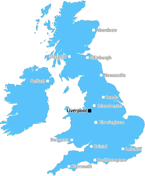
Liverpool (L40)
The L40 postcode area is located in the Liverpool postcode town region, within the county of Lancashire, and contains a total of 701 individual postcodes.
There are 44 electoral wards in the L40 postcode area, including Bootle, Liverpool, Ormskirk, Prescot which come under the local authority of the West Lancashire Council.
Combining the whole postcode region, 30% of people in L40 are classed as having an AB social grade, (i.e. 'white-collar' middle-upper class), compared to 27% across the UK.
This does not mean that the people of L40 are wealthier - or higher class - than average, but it can be an indication that the area may be prospering and desirable to live in.
The L40 postcode covers a large area in and around the Liverpool district of Merseyside. It runs at the far outer edge of the metropolitan area, taking in Liverpool Airport, Old Roan, Melling and areas around the Formby Golf Club. It is well connected to the city centre, as well as other local destinations, through regular public transport services including trains and buses.
The majority of the L40 postcode area is rural and semi-rural. It is characterised by a mix of green spaces, including grassy paddocks and woodland, as well as farmland and rural settlements made up of smaller pockets of habitation. Despite the rural feel, the area also features some modern developments and suburban locations, such as Carr Mill, Mossley Hill, and Altcar.
The L40 also encompasses some popular attractions in the area such as Martin Mere Wildfowl & Wetlands, Formby Point and Sefton Coast. This makes it an ideal destination for tourists who want to experience the best of urban and rural lifestyles. The area is also home to several galleries, theatres, arts centres, and independent shops.
Despite its rural location, the L40 postcode has seen an increase in population in recent years, as commuters flock to the area for scenic walks, daily commutes, and plenty of leisure and entertainment options. Property prices vary in the L40 postcode area, with smaller newbuilds and terraced houses costing around the mid-�100,000s and bigger detached properties in the more expensive areas hitting closer to �500,000.
In terms of education, the postcode area is served by a number of local schools and colleges, including Litherland High School, Ranworth Square School, Meols Cop High School, and Maghull High School. The Birkdale School of Technology is also situated in the L40 postcode, offering further education options.
In terms of health, L40 has a number of local hospitals and health centres, including Aintree Hospital, Fazakerley Hospital, Maghull Health Centre, and the Colquitt Street Clinic. The postcode is also served by a number of local police and fire stations.
L40 is a peaceful and desirable destination for those wanting to enjoy the best of urban and rural pursuits together. It offers a unique mix of small-town charm, modernity, and convenience for visitors and inhabitants alike.

Demographics

Lancashire

L40 is located in the county of Lancashire, in England.
Lancashire has a total population of 1,485,000, making it the 8th largest county in the UK.
Lancashire has a total area of 1187 square miles, and a population density of 482 people per square kilometre. For comparison, Greater London has a density of 5,618 people/km2.
| Outward Code | L40 |
| Postal Town | Liverpool |
| MSOA Name | West Lancashire 004 |
| LSOA Name | West Lancashire 004C |
| County | Lancashire |
| Region | Lancashire |
| Country | England |
| Local Authority | West Lancashire |
| Area Classification | Urban with Significant Rural (rural including hub towns 26-49%) |
L40 Electoral Wards
The postal region of L40, includes the local towns, villages, electoral wards and stations of:
Dig even deeper into the L40 postcode by clicking on a postcode below:
Click on an outward postal code below for more information about the area. Each 'outward' postcode give you a comprehensive list of all postcodes within the outward code area (L) and estimated address.
Click on an 'outward' code for more information. For example, the outward postcode page 'EC2M' will give you an alphabetical list covering all postcodes located in the region, from 'EC2M 1BB' through to 'EC2M 7YA'.
Chris H
Saturday, April 6, 2024
We don't have any views of L40 right now. If you live in L40 or have visited it, please help us to help others by telling others what you think of this neighbourhood.
Add your view of L40
People need your local expertise. If you live in L40 or have first-hand knowledge of the neighbourhood, please consider sharing your views. It's completely anonymous - all we ask is for your initials.
Please tell us what you like about the L40 postcode area, what you don't like, and what it's like to live or work here.
| LOCAL AMENITIES | |
| FAMILY FRIENDLY | |
| PARKING | |
| GREEN SPACES |
Local News Lancashire
Police officer hit by stolen car in hit-and-run
The officer was conducting investigations into the theft when he was hit by the car, police say.
BBC NewsMan arrested after mosque break-in
A man ran away after he was challenged by some men already inside the building, police say.
BBC NewsMosque intruder chased off after break-in
Lancashire Police say they are investigating the motive for the break-in at the mosque in Burnley.
BBC NewsCan Surrey be beaten as County Championship returns?
With the new County Championship season starting on Friday, can anyone prevent Surrey winning a third straight title?
BBC NewsLyon 'disappointed' by shortened Lancashire stint
Australia spinner Nathan Lyon is disappointed his spell at Lancashire this summer will be shortened to manage his workload.
BBC News'Arranged' gang fight causes distress for residents
Police in Burnley and Rawtenstall town centres were tackling reports of a "pre-arranged fight".
BBC NewsReform UK drops candidates over 'racist comments'
Campaign group Hope Not Hate claims it found historical derogatory tweets made two Reform candidates.
BBC NewsDay one of County Championship season hit by rain
Day one of the County Championship season sees play abandoned at Derbyshire, Durham, Lancashire and Kent without a ball bowled.
BBC NewsFrom the Postcode Area blog

Deciphering Crime Rates - a Deep Dive Into UK Postcode Analysis
Ever wondered about the crime rate in your UK postcode? You're not alone. We've dug deep into the data, uncovering trends and patterns that'll make your head spin.

Death of the High Street?
The BBC reports that despite councils' attempts to kurb them, the UK's high streets have seen a huge growth in fast food outlets. Could this mark the death knell for the Great British high street, and what can we do about it to halt its decline?

Discrimination by Postcode
You really couldn't make it up, could you? Some of the country's most vulnerable people are missing out on their weekly £25 Cold Weather Payment, just because the system that's in operation is discriminating against them because payments are based on postcode, rather than geographic location.

The Redesign is Underway
Well, the current website was absolutely in dire need of a good redesign - from the ground up. So I set out to pull it all apart and get it up and running again to become the most comprehensive guide to every postcode in the UK. And it's been a long, tough job from start to finish - and quite possibly the biggest project I've ever undertaken.
SOCIAL GRADES
According to census records, 30% of people here have a social grade of AB (highest), compared to the national average of 27%.