liverpool L30 Postcodes
Spending a fortune on conveyancing?

Compare instant, low-cost online quotes from trusted conveyancing solicitors.
Backed by experts, our no-obligation service searches through the best conveyancing quotes on the market to save you time and money.
Liverpool (L30)
The L30 postcode area is located in the Liverpool postcode town region, within the county of Merseyside, and contains a total of 591 individual postcodes.
There are 5 electoral wards in the L30 postcode area, including Bootle, Liverpool, Ormskirk, Prescot which come under the local authority of the Sefton Council.
Combining the whole postcode region, 10% of people in L30 are classed as having an AB social grade, (i.e. 'white-collar' middle-upper class), compared to 27% across the UK.
This does not mean that the people of L30 are poorer than other areas, but it may give an indication that there are areas of deprivation.
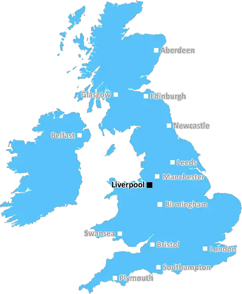
The L30 postcode is located in northern Liverpool, an area that includes the neighbourhoods of Bootle, Thornton, Belfry, and Orrell. This postcode is embedded within Sefton borough council and thus falls within the North West region of England. The L30 postcode is bordered to the north by the L29 postcode, to the east by the L20 postcode, to the south by the L21 postcode, and to the west by the L31 postcode.
As of the 2011 Census, there were 18,932 households in the L30 postcode, of which the majority are owner-occupied (64.7%). The area predominantly consists of Victorian-era terraced housing, with a preponderance of detached and semi-detached properties increasing gradually toward the south. The district is served by a number of regular local bus routes and has found its economy to be largely tied to industrial and service sectors.
The district abounds with green spaces such as Bootle Cricket and Bowls Club, Lodge Lane Recreation Centre, Wilfred Owen Park, New Cut Lane Park, and Stonebridge Playing Fields. Other popular attractions include Deb Vintage, LQ Radio and Studios, the Gladstone Theatre, Warbreck Moor Park, and the Legholme Country Park. There are also a number of shops, takeaways, and schools within the district.
Moreover, the district offers convenient access to the heart of Liverpool � which is just a 10-minute 16-mile car journey away � as well as a direct train to the city centre in just under half an hour. Liverpool John Lennon Airport is also located just over half an hour away from the district, making it a great spot for those looking to get away for a weekend break. .

Demographics

Merseyside

L30 is located in the county of Merseyside, in England.
Merseyside has a total population of 1,406,400, making it the 9th largest county in the UK.
Merseyside has a total area of 250 square miles, and a population density of 2174 people per square kilometre. For comparison, Greater London has a density of 5,618 people/km2.
| Outward Code | L30 |
| Postal Town | Liverpool |
| MSOA Name | Sefton 023 |
| LSOA Name | Sefton 023E |
| County | Merseyside |
| Region | Merseyside |
| Country | England |
| Local Authority | Sefton |
| Area Classification | Urban with Major Conurbation |
L30 Electoral Wards
The postal region of L30, includes the local towns, villages, electoral wards and stations of:
Dig even deeper into the L30 postcode by clicking on a postcode below:
Click on an outward postal code below for more information about the area. Each 'outward' postcode give you a comprehensive list of all postcodes within the outward code area (L) and estimated address.
Click on an 'outward' code for more information. For example, the outward postcode page 'EC2M' will give you an alphabetical list covering all postcodes located in the region, from 'EC2M 1BB' through to 'EC2M 7YA'.
Chris H
Sunday, April 7, 2024
We don't have any views of L30 right now. If you live in L30 or have visited it, please help us to help others by telling others what you think of this neighbourhood.
Add your view of L30
People need your local expertise. If you live in L30 or have first-hand knowledge of the neighbourhood, please consider sharing your views. It's completely anonymous - all we ask is for your initials.
Please tell us what you like about the L30 postcode area, what you don't like, and what it's like to live or work here.
| LOCAL AMENITIES | |
| FAMILY FRIENDLY | |
| PARKING | |
| GREEN SPACES |
Local News Lancashire
Critically ill boy fulfils soldier dream for a day
Noah, who is from Leyland, loves tanks and wished to be a soldier for a day.
BBC NewsSteel takes 5-25 as Surrey bowl out Lancashire
Defending champions Surrey dismiss Lancashire for 202 as Cam Steel and Dan Lawrence both return career-best bowling figures.
BBC NewsBlackpool 1-0 Cambridge United
Blackpool keep their faint League One play-off hopes alive with a narrow win over Cambridge at Bloomfield Road.
BBC NewsCampaigners call for cemetery to be protected
They are urging a bishop to keep the site as a cemetery and stop it being redeveloped.
BBC NewsMore children and young people getting MMR jab
Health bosses have warned measles 'hasn't gone away', urging people to ensure they are protected.
BBC NewsVolunteer groups at 'crisis point' over NHS referrals
Organisations in Lancashire say they are under pressure due to a rapid increase in "social prescribing".
BBC NewsEverton beat Burnley to boost survival hopes
Dominic Calvert-Lewin capitalises on an Arijanet Muric error to score his second goal in as many games and help Everton to a priceless win over fellow strugglers Burnley.
BBC NewsG4 superfan changes her name in honour of singers
Christine Christie Ansell Duncan Jai Martin changed her name in tribute to the X Factor finalists.
BBC NewsFrom the Postcode Area blog

Deciphering Crime Rates - a Deep Dive Into UK Postcode Analysis
Ever wondered about the crime rate in your UK postcode? You're not alone. We've dug deep into the data, uncovering trends and patterns that'll make your head spin.

Death of the High Street?
The BBC reports that despite councils' attempts to kurb them, the UK's high streets have seen a huge growth in fast food outlets. Could this mark the death knell for the Great British high street, and what can we do about it to halt its decline?

Discrimination by Postcode
You really couldn't make it up, could you? Some of the country's most vulnerable people are missing out on their weekly £25 Cold Weather Payment, just because the system that's in operation is discriminating against them because payments are based on postcode, rather than geographic location.

The Redesign is Underway
Well, the current website was absolutely in dire need of a good redesign - from the ground up. So I set out to pull it all apart and get it up and running again to become the most comprehensive guide to every postcode in the UK. And it's been a long, tough job from start to finish - and quite possibly the biggest project I've ever undertaken.
SOCIAL GRADES
According to census records, 10% of people here have a social grade of AB (highest), compared to the national average of 27%.