liverpool L18 Postcodes
Spending a fortune on conveyancing?

Compare instant, low-cost online quotes from trusted conveyancing solicitors.
Backed by experts, our no-obligation service searches through the best conveyancing quotes on the market to save you time and money.
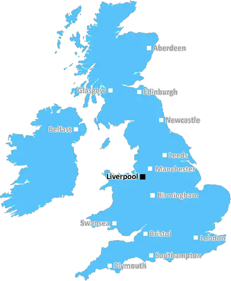
Liverpool (L18)
The L18 postcode area is located in the Liverpool postcode town region, within the county of Merseyside, and contains a total of 807 individual postcodes.
There are 2 electoral wards in the L18 postcode area, including Bootle, Liverpool, Ormskirk, Prescot which come under the local authority of the Liverpool Council.
Combining the whole postcode region, 34% of people in L18 are classed as having an AB social grade, (i.e. 'white-collar' middle-upper class), compared to 27% across the UK.
This does not mean that the people of L18 are wealthier - or higher class - than average, but it can be an indication that the area may be prospering and desirable to live in.
The L18 postcode in the Liverpool district is in the south of the city, just north of Aigburth and south of Hunts Cross in the Sefton borough of Merseyside. It is mainly residential, with many medium-sized detached houses, semi-detached and terraced homes and flats, as well as a few youth clubs and an LCFA football club. There is a range of recreational parks, gardens and green spaces, including Woolton Woods, Allerton Towers, Camp Hill, Calderstones Park and Sefton Park. It is well served by numerous bus routes, as well as a Park and Ride facility.
The area has several schools, including Woolton Primary School, Our Lady's Catholic Primary School, St Margaret's Church of England Primary School and Childwall Sports College Academy. The primary secondary schools are All Saints Catholic College, and Quarry Bank and Parr Mount high schools. Further educational options for young people include City of Liverpool College and the University of Liverpool.
Founded in 2000, the L18 Citizens Association works to improve the local area by creating community events and campaigns. These include annual L18 Xmas Food Bank Appeal, Liverpool Community Clean Up Day as well as events in the local park. Recent campaigns have included initiatives to reduce crime and anti-social behaviour as well as encouraging residents to be aware of potential environmental hazards and sign up to green energy schemes.
For shopping and leisure, there is Woolton village, which includes a variety of independent and chain shops and cafes as well as traditional pubs and restaurants. There are also a number of public houses, coffee houses and snack bars located throughout the area.
The area is served by two railway stations, Woolton and Hunts Cross, and is accessible to the rest of Liverpool by Liverpool Metro, bus and road network.
L18 postcode is a relatively quiet residential area that is well served with transport links, shops, pubs, restaurants, schools and parks. It also benefits from a number of active local campaigns and initiatives that suggest a real sense of community spirit.

Demographics

Merseyside

L18 is located in the county of Merseyside, in England.
Merseyside has a total population of 1,406,400, making it the 9th largest county in the UK.
Merseyside has a total area of 250 square miles, and a population density of 2174 people per square kilometre. For comparison, Greater London has a density of 5,618 people/km2.
| Outward Code | L18 |
| Postal Town | Liverpool |
| MSOA Name | Liverpool 041 |
| LSOA Name | Liverpool 041D |
| County | Merseyside |
| Region | Merseyside |
| Country | England |
| Local Authority | Liverpool |
| Area Classification | Urban with Major Conurbation |
L18 Electoral Wards
The postal region of L18, includes the local towns, villages, electoral wards and stations of:
Dig even deeper into the L18 postcode by clicking on a postcode below:
Click on an outward postal code below for more information about the area. Each 'outward' postcode give you a comprehensive list of all postcodes within the outward code area (L) and estimated address.
Click on an 'outward' code for more information. For example, the outward postcode page 'EC2M' will give you an alphabetical list covering all postcodes located in the region, from 'EC2M 1BB' through to 'EC2M 7YA'.
Chris H
Sunday, April 7, 2024
We don't have any views of L18 right now. If you live in L18 or have visited it, please help us to help others by telling others what you think of this neighbourhood.
Add your view of L18
People need your local expertise. If you live in L18 or have first-hand knowledge of the neighbourhood, please consider sharing your views. It's completely anonymous - all we ask is for your initials.
Please tell us what you like about the L18 postcode area, what you don't like, and what it's like to live or work here.
| LOCAL AMENITIES | |
| FAMILY FRIENDLY | |
| PARKING | |
| GREEN SPACES |
Local News Merseyside
Couple jailed for sexual abuse of under-age girl
Scott Geraghty and Chloe Dixon caused their victim "immeasurable pain and suffering", police say.
BBC NewsRare giraffe calf kicks up heels in first outing
The giraffe is captured playing with the rest of the herd on its first outing at Chester Zoo.
BBC NewsGreat-grandad, 111, is world's oldest living man
John Tinniswood, from Merseyside, took the title after the death of the previous record-holder.
BBC NewsCatalans ready for 'top of game' St Helens
Catalans Dragons are ready for a 'top of their game' St Helens side when the two teams meet live on BBC Three this Saturday night.
BBC NewsKlopp hails 'wonder goal' as Liverpool reclaim top spot
Jurgen Klopp praises Alexis Mac Allister's "wonder goal" as Liverpool overcome Sheffield United to reclaim top spot in the Premier League and maintain control of the title race.
BBC NewsHospital staff reach deal after months of strikes
Clinical support workers had voted overwhelmingly to renew their strike mandate.
BBC NewsCan Surrey be beaten as County Championship returns?
With the new County Championship season starting on Friday, can anyone prevent Surrey winning a third straight title?
BBC NewsTrain strikes: How will you be affected?
Rail workers at 16 companies are taking industrial action but tube strikes have been called off.
BBC NewsFrom the Postcode Area blog

Deciphering Crime Rates - a Deep Dive Into UK Postcode Analysis
Ever wondered about the crime rate in your UK postcode? You're not alone. We've dug deep into the data, uncovering trends and patterns that'll make your head spin.

Death of the High Street?
The BBC reports that despite councils' attempts to kurb them, the UK's high streets have seen a huge growth in fast food outlets. Could this mark the death knell for the Great British high street, and what can we do about it to halt its decline?

Discrimination by Postcode
You really couldn't make it up, could you? Some of the country's most vulnerable people are missing out on their weekly £25 Cold Weather Payment, just because the system that's in operation is discriminating against them because payments are based on postcode, rather than geographic location.

The Redesign is Underway
Well, the current website was absolutely in dire need of a good redesign - from the ground up. So I set out to pull it all apart and get it up and running again to become the most comprehensive guide to every postcode in the UK. And it's been a long, tough job from start to finish - and quite possibly the biggest project I've ever undertaken.
SOCIAL GRADES
According to census records, 34% of people here have a social grade of AB (highest), compared to the national average of 27%.