liverpool L17 Postcodes
Spending a fortune on conveyancing?

Compare instant, low-cost online quotes from trusted conveyancing solicitors.
Backed by experts, our no-obligation service searches through the best conveyancing quotes on the market to save you time and money.
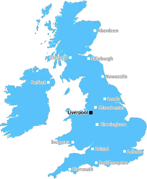
Liverpool (L17)
The L17 postcode area is located in the Liverpool postcode town region, within the county of Merseyside, and contains a total of 732 individual postcodes.
There are 7 electoral wards in the L17 postcode area, including Bootle, Liverpool, Ormskirk, Prescot which come under the local authority of the Liverpool Council.
Combining the whole postcode region, 32% of people in L17 are classed as having an AB social grade, (i.e. 'white-collar' middle-upper class), compared to 27% across the UK.
This does not mean that the people of L17 are wealthier - or higher class - than average, but it can be an indication that the area may be prospering and desirable to live in.
The L17 postcode is an area of inner-city Liverpool in Merseyside, England. It is located in the centre of the city between the metropolitan boroughs of Liverpool and Sefton, and covers the neighbourhoods of Mossley Hill, Smithdown, and Paddington.
The area consists mostly of terraced red-bricked housing, many of which were built during the Victorian era. The area has a population of around 13,900 people, and is largely occupied by young professionals, students, and families. The area is home to the famous Penny Lane, which was made famous by the Beatles.
The L17 postcode is well connected to other parts of the city, with easy access to Liverpool's main public transport system, including trains, buses, and the Merseyrail network.
One of the most important landmarks in the area is the Anglican Church, St Lawrence Parish Church.The church is renowned for its architecture and stained glass windows and has a number of interesting features such as a restored ceiling, a recently installed organ and choir stalls. The church dates back to 1848, and is a Grade II Listed Building.
The area is also home to several schools, including St Margaret's Church of England Primary School and St Mary's Primary School.
Other amenities in the area include libraries, parks, tennis courts, theatres, a bowling alley, and shops. Allerton Road is a popular shopping street in the area, and has a range of independent and chain stores.
The area is home to many cultural events, including the annual �Christmas in Mossley Hill' event, the Brazilian �Carnival da Bahia' music and dance festival, and the �Little Liverpool Festival'. The area also hosts some sporting events, including the Liverpool 5K Run.
The L17 postcode is a diverse area, with its own unique identity and an atmosphere to match. It is the perfect place for people of all ages, backgrounds and lifestyles to call home.

Demographics

Merseyside

L17 is located in the county of Merseyside, in England.
Merseyside has a total population of 1,406,400, making it the 9th largest county in the UK.
Merseyside has a total area of 250 square miles, and a population density of 2174 people per square kilometre. For comparison, Greater London has a density of 5,618 people/km2.
| Outward Code | L17 |
| Postal Town | Liverpool |
| MSOA Name | Liverpool 048 |
| LSOA Name | Liverpool 048D |
| County | Merseyside |
| Region | Merseyside |
| Country | England |
| Local Authority | Liverpool |
| Area Classification | Urban with Major Conurbation |
L17 Electoral Wards
The postal region of L17, includes the local towns, villages, electoral wards and stations of:
Dig even deeper into the L17 postcode by clicking on a postcode below:
Click on an outward postal code below for more information about the area. Each 'outward' postcode give you a comprehensive list of all postcodes within the outward code area (L) and estimated address.
Click on an 'outward' code for more information. For example, the outward postcode page 'EC2M' will give you an alphabetical list covering all postcodes located in the region, from 'EC2M 1BB' through to 'EC2M 7YA'.
Chris H
Saturday, April 6, 2024
We don't have any views of L17 right now. If you live in L17 or have visited it, please help us to help others by telling others what you think of this neighbourhood.
Add your view of L17
People need your local expertise. If you live in L17 or have first-hand knowledge of the neighbourhood, please consider sharing your views. It's completely anonymous - all we ask is for your initials.
Please tell us what you like about the L17 postcode area, what you don't like, and what it's like to live or work here.
| LOCAL AMENITIES | |
| FAMILY FRIENDLY | |
| PARKING | |
| GREEN SPACES |
Local News Merseyside
Cinema gunman may have had 'suicide by cop' motive
A gunman who fired at a cinema, shop and house will have more psychiatric tests before being sentenced.
BBC NewsCan Surrey be beaten as County Championship returns?
With the new County Championship season starting on Friday, can anyone prevent Surrey winning a third straight title?
BBC NewsPC who had sex with vulnerable mother jailed
Cheshire Police constable Jordan Masterson insisted he was the victim but a jury rejected his claims.
BBC NewsGreat-grandad, 111, is world's oldest living man
John Tinniswood, from Merseyside, took the title after the death of the previous record-holder.
BBC NewsArtistic fantasy world gets listed status
The flat, known as Ron's Place, was secretly transformed by its tenant with weird and wonderful features.
BBC News'I wish our daughter had spoken to this police force'
The parents of Gracie Spinks, who was killed by her stalker, visit a dedicated police unit.
BBC NewsCouncil boss defends leisure centre demolition
The Woodchurch leisure centre will be knocked down despite efforts by community groups to save it.
BBC NewsTrain strikes: How will you be affected?
Rail workers at 16 companies are taking industrial action but tube strikes have been called off.
BBC NewsFrom the Postcode Area blog

Deciphering Crime Rates - a Deep Dive Into UK Postcode Analysis
Ever wondered about the crime rate in your UK postcode? You're not alone. We've dug deep into the data, uncovering trends and patterns that'll make your head spin.

Death of the High Street?
The BBC reports that despite councils' attempts to kurb them, the UK's high streets have seen a huge growth in fast food outlets. Could this mark the death knell for the Great British high street, and what can we do about it to halt its decline?

Discrimination by Postcode
You really couldn't make it up, could you? Some of the country's most vulnerable people are missing out on their weekly £25 Cold Weather Payment, just because the system that's in operation is discriminating against them because payments are based on postcode, rather than geographic location.

The Redesign is Underway
Well, the current website was absolutely in dire need of a good redesign - from the ground up. So I set out to pull it all apart and get it up and running again to become the most comprehensive guide to every postcode in the UK. And it's been a long, tough job from start to finish - and quite possibly the biggest project I've ever undertaken.
SOCIAL GRADES
According to census records, 32% of people here have a social grade of AB (highest), compared to the national average of 27%.