lincoln LN7 Postcodes
Spending a fortune on conveyancing?

Compare instant, low-cost online quotes from trusted conveyancing solicitors.
Backed by experts, our no-obligation service searches through the best conveyancing quotes on the market to save you time and money.
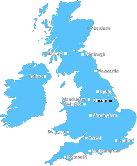
Lincoln (LN7)
The LN7 postcode area is located in the Lincoln postcode town region, within the county of Lincolnshire, and contains a total of 291 individual postcodes.
There are 36 electoral wards in the LN7 postcode area, including Alford, Horncastle, Lincoln, Louth, Mablethorpe, Market Rasen, Woodhall Spa which come under the local authority of the West Lindsey Council.
Combining the whole postcode region, 24% of people in LN7 are classed as having an AB social grade, (i.e. 'white-collar' middle-upper class), compared to 27% across the UK.
This does not mean that the people of LN7 are poorer than other areas, but it may give an indication that there are areas of deprivation.
LN7 is a postcode in the Lincoln district of the United Kingdom. It covers the eastern suburbs of Lincoln and includes nearly all of the city's outlying villages and settlements east of the A47. This area is home to a range of attractions including the National Trust's Belton House and the historic market towns of Saxilby, Bracebridge Heath, and Washingborough.
The area is mostly residential, with a mix of rural and urban living. Here you'll find a mix of traditional terraced and semi-detached houses in addition to some more modern housing developments.
Transport connections in the area are excellent, with a number of bus routes and regular train services to central Lincoln. The A15 and A47 are the two major roads that serve the LN7 postcode area, with the A15 running to Sleaford, Newark and Bourne, and the A47 running to Peterborough.
The area includes some industrial activity, with a few power stations present, as well as plenty of smaller businesses and shops. There's a large range of schools, with a number of primary schools, secondary schools, and six further education colleges.
For entertainment, there are some great local pubs and several restaurants to choose from. There are plenty of routes to explore, with the LN7 postcode offering a mix of traditional and modern landscapes to explore. The wide open spaces along with long rolling hills offer plenty of scope for leisure activities such as cycling and walking.
The area is very well-connected, with good access to larger cities and towns. This makes it an ideal base to explore the wider region, while still benefitting from a more rural environment. With so many amenities on offer and excellent transport connections, the LN7 postcode is an attractive and sought-after place to live.

Demographics

Lincolnshire

LN7 is located in the county of Lincolnshire, in England.
Lincolnshire has a total population of 1,073,300, making it the 18th largest county in the UK.
Lincolnshire has a total area of 2693 square miles, and a population density of 153 people per square kilometre. For comparison, Greater London has a density of 5,618 people/km2.
| Outward Code | LN7 |
| Postal Town | Lincoln |
| MSOA Name | West Lindsey 001 |
| LSOA Name | West Lindsey 001D |
| County | Lincolnshire |
| Region | Lincolnshire |
| Country | England |
| Local Authority | West Lindsey |
| Area Classification | Mainly Rural (rural including hub towns >=80%) |
LN7 Electoral Wards
The postal region of LN7, includes the local towns, villages, electoral wards and stations of:
Dig even deeper into the LN7 postcode by clicking on a postcode below:
Click on an outward postal code below for more information about the area. Each 'outward' postcode give you a comprehensive list of all postcodes within the outward code area (LN) and estimated address.
Click on an 'outward' code for more information. For example, the outward postcode page 'EC2M' will give you an alphabetical list covering all postcodes located in the region, from 'EC2M 1BB' through to 'EC2M 7YA'.
Chris H
Wednesday, April 10, 2024
We don't have any views of LN7 right now. If you live in LN7 or have visited it, please help us to help others by telling others what you think of this neighbourhood.
Add your view of LN7
People need your local expertise. If you live in LN7 or have first-hand knowledge of the neighbourhood, please consider sharing your views. It's completely anonymous - all we ask is for your initials.
Please tell us what you like about the LN7 postcode area, what you don't like, and what it's like to live or work here.
| LOCAL AMENITIES | |
| FAMILY FRIENDLY | |
| PARKING | |
| GREEN SPACES |
Local News Lincolnshire
Pet killed and woman hurt by loose dogs
A woman reportedly suffered hand injuries and a dog had to be euthanised due to its injuries.
BBC NewsLincolnshire Police and Crime Commissioner election candidates and how to vote
The election will take place on May 2
Lincolnshire LiveUnderwater search team brought in after missing 94-year-old man's car found in Tetney Lock
Colin's car was found in Tetney Lock on April 4
Lincolnshire LiveClaim council is 'insulting residents' intelligence' over bin changes
Warren Webster says he 'doesn't see the point in doing the council's job for them'
Lincolnshire LiveBody found in search for missing Grimsby man, 94
Police have informed the family of Colin, a man who has been missing since April 2
Lincolnshire LiveReading 1-1 Lincoln City
Play-off chasing Lincoln extend their unbeaten League One run to 16 matches but have to settle for a draw at lowly Reading.
BBC NewsCandidates vie for police commissioner role
Five hopefuls will be on the ballot for the Lincolnshire PCC post on 2 May.
BBC NewsAdam Bailey death: Woman arrested on suspicion of murder after man found dead at his home
She is the fourth to be arrested in connection with Adam Bailey's death
Lincolnshire LiveFrom the Postcode Area blog

Deciphering Crime Rates - a Deep Dive Into UK Postcode Analysis
Ever wondered about the crime rate in your UK postcode? You're not alone. We've dug deep into the data, uncovering trends and patterns that'll make your head spin.

Death of the High Street?
The BBC reports that despite councils' attempts to kurb them, the UK's high streets have seen a huge growth in fast food outlets. Could this mark the death knell for the Great British high street, and what can we do about it to halt its decline?

Discrimination by Postcode
You really couldn't make it up, could you? Some of the country's most vulnerable people are missing out on their weekly £25 Cold Weather Payment, just because the system that's in operation is discriminating against them because payments are based on postcode, rather than geographic location.

The Redesign is Underway
Well, the current website was absolutely in dire need of a good redesign - from the ground up. So I set out to pull it all apart and get it up and running again to become the most comprehensive guide to every postcode in the UK. And it's been a long, tough job from start to finish - and quite possibly the biggest project I've ever undertaken.
SOCIAL GRADES
According to census records, 24% of people here have a social grade of AB (highest), compared to the national average of 27%.