lincoln LN5 Postcodes
Spending a fortune on conveyancing?

Compare instant, low-cost online quotes from trusted conveyancing solicitors.
Backed by experts, our no-obligation service searches through the best conveyancing quotes on the market to save you time and money.
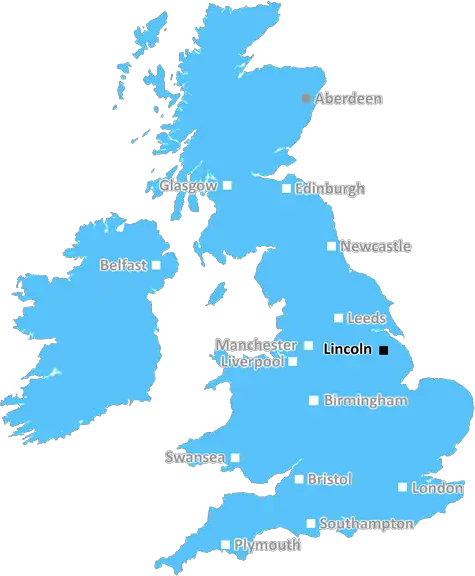
Lincoln (LN5)
The LN5 postcode area is located in the Lincoln postcode town region, within the county of Lincolnshire, and contains a total of 1508 individual postcodes.
There are 44 electoral wards in the LN5 postcode area, including Alford, Horncastle, Lincoln, Louth, Mablethorpe, Market Rasen, Woodhall Spa which come under the local authority of the North Kesteven Council.
Combining the whole postcode region, 20% of people in LN5 are classed as having an AB social grade, (i.e. 'white-collar' middle-upper class), compared to 27% across the UK.
This does not mean that the people of LN5 are poorer than other areas, but it may give an indication that there are areas of deprivation.
The LN5 postcode area is located in the eastern part of the city of Lincoln and encompasses the residential and rural areas east of the city centre. The postcode area is bounded by the A15 near Scampton to the north, by the boundaries of Nettleham and Haddington to the south, and by the River Witham to the east, covering an area of approximately 20 square miles.
The LN5 postcode district contains the following notable locations: the village of Heighington, the neighbourhoods of Birchwood and Hartsholme, the county town of Lincoln, the University of Lincoln, RAF Scampton and the Lincolnshire Aviation Heritage Centre. The postcode is also within close proximity to Lincolnshire Wolds AONB, the Lincolnshire Showground and the Lincoln golf and country club amongst other notable locations.
The postcode is served by a number of local transport options, including the Lincolnshire Roadcar bus services that run throughout the area, as well as connections to the nearby cities of Nottingham and Peterborough. The area is also close to the A15 road, which links it to further places away from the city, as well as other roads leading to Lincoln by-pass and into the city centre.
The local council is Lincoln City Council, providing services to those living in the postcode area. This includes council tax collection, planning and building control, local housing, leisure and environmental services, highways maintenance, refuse collection and more.
The economy of the area is mainly based on service industries, closely followed by manufacturing and construction, and is made up of independent businesses and local small companies. Some of the larger employers in the postcode area include the University of Lincoln, RAF Scampton, and local schools.
The postcode is also home to a number of schools, including primary and secondary schools, special education and childcare, and a number of religious schools. Further educational establishments in the area include Lincoln Christ's Hospital School, Lincoln College and the University of Lincoln.
The postcode is serviced by a wide range of leisure options, from golf courses to leisure centres, museums, theatres and cinemas. Additionally, for outdoor pursuits, Hartsholme Country Park is within the postcode area and is a popular area for running, walking and cycling.

Demographics

Lincolnshire

LN5 is located in the county of Lincolnshire, in England.
Lincolnshire has a total population of 1,073,300, making it the 18th largest county in the UK.
Lincolnshire has a total area of 2693 square miles, and a population density of 153 people per square kilometre. For comparison, Greater London has a density of 5,618 people/km2.
| Outward Code | LN5 |
| Postal Town | Lincoln |
| MSOA Name | North Kesteven 006 |
| LSOA Name | North Kesteven 006C |
| County | Lincolnshire |
| Region | Lincolnshire |
| Country | England |
| Local Authority | North Kesteven |
| Area Classification | Mainly Rural (rural including hub towns >=80%) |
LN5 Electoral Wards
The postal region of LN5, includes the local towns, villages, electoral wards and stations of:
Dig even deeper into the LN5 postcode by clicking on a postcode below:
Click on an outward postal code below for more information about the area. Each 'outward' postcode give you a comprehensive list of all postcodes within the outward code area (LN) and estimated address.
Click on an 'outward' code for more information. For example, the outward postcode page 'EC2M' will give you an alphabetical list covering all postcodes located in the region, from 'EC2M 1BB' through to 'EC2M 7YA'.
Chris H
Saturday, April 6, 2024
We don't have any views of LN5 right now. If you live in LN5 or have visited it, please help us to help others by telling others what you think of this neighbourhood.
Add your view of LN5
People need your local expertise. If you live in LN5 or have first-hand knowledge of the neighbourhood, please consider sharing your views. It's completely anonymous - all we ask is for your initials.
Please tell us what you like about the LN5 postcode area, what you don't like, and what it's like to live or work here.
| LOCAL AMENITIES | |
| FAMILY FRIENDLY | |
| PARKING | |
| GREEN SPACES |
Local News Lincolnshire
Plans to repair Grantham home after car crashed into living room - and the driver won't be prosecuted
Rachel Edgecombe was in her house with two dogs when the car knocked down her living room wall
Lincolnshire LiveMan found outside Skegness McDonald's with serious injuries as police ask for help
Lincolnshire Police is appealing for any witnesses
Lincolnshire LiveNew homes plan approved despite local concerns
Twenty homes will be built in Stallingborough despite some residents' concerns.
BBC NewsLincoln City 1-0 Leyton Orient
Substitute Jovon Makama scores a last-minute winner as in-form Lincoln beat Leyton Orient to move into the League One play-off positions for the first time this season.
BBC NewsLincolnshire weather forecast as highs of 21C expected over weekend
Warmer weather is on its way after a wet start to the year
Lincolnshire LiveLincoln's historic Glory Hole footpath to reopen
A local business says it has spent the past year in a "survival process".
BBC NewsListen: Non-league plus FA Trophy and FA Vase semi-finals
Listen to BBC local radio commentaries from the National League, National League North, National League South plus the FA Trophy and FA Vase semi-finals.
BBC NewsYouTuber likens Ingoldmells to Benidorm as he tours coastal town in search of a pint
He pointed out the large number of karaoke bars in the town
Lincolnshire LiveFrom the Postcode Area blog

Deciphering Crime Rates - a Deep Dive Into UK Postcode Analysis
Ever wondered about the crime rate in your UK postcode? You're not alone. We've dug deep into the data, uncovering trends and patterns that'll make your head spin.

Death of the High Street?
The BBC reports that despite councils' attempts to kurb them, the UK's high streets have seen a huge growth in fast food outlets. Could this mark the death knell for the Great British high street, and what can we do about it to halt its decline?

Discrimination by Postcode
You really couldn't make it up, could you? Some of the country's most vulnerable people are missing out on their weekly £25 Cold Weather Payment, just because the system that's in operation is discriminating against them because payments are based on postcode, rather than geographic location.

The Redesign is Underway
Well, the current website was absolutely in dire need of a good redesign - from the ground up. So I set out to pull it all apart and get it up and running again to become the most comprehensive guide to every postcode in the UK. And it's been a long, tough job from start to finish - and quite possibly the biggest project I've ever undertaken.
SOCIAL GRADES
According to census records, 20% of people here have a social grade of AB (highest), compared to the national average of 27%.