lincoln LN12 Postcodes
Spending a fortune on conveyancing?

Compare instant, low-cost online quotes from trusted conveyancing solicitors.
Backed by experts, our no-obligation service searches through the best conveyancing quotes on the market to save you time and money.
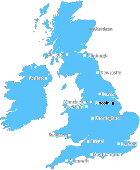
Lincoln (LN12)
The LN12 postcode area is located in the Lincoln postcode town region, within the county of Lincolnshire, and contains a total of 518 individual postcodes.
There are 17 electoral wards in the LN12 postcode area, including Alford, Horncastle, Lincoln, Louth, Mablethorpe, Market Rasen, Woodhall Spa which come under the local authority of the East Lindsey Council.
Combining the whole postcode region, 10% of people in LN12 are classed as having an AB social grade, (i.e. 'white-collar' middle-upper class), compared to 27% across the UK.
This does not mean that the people of LN12 are poorer than other areas, but it may give an indication that there are areas of deprivation.
The LN12 postcode for Lincoln district in the East Midlands of England is a relatively small area covering parts of the scenic Lincolnshire Wolds. It comprises several small rural villages including Welton le Marsh, Lusby, Ulceby, Utterby and Tetford. Located close to the town of Louth, it is within easy reach of the larger cities of Lincoln, Grimsby, Skegness, Cleethorpes and Boston.
The area benefits from stunning views of rolling fields, beautiful countryside and a number of picturesque landmarks, such as the Roman wall that used to encircle the city. Within the boundaries of LN12 there are an array of activities and attractions to occupy the whole family. Admire the Roman ruins or take a trip to one of the many archaeological sites that date back centuries. Take part in the local events and festivals held throughout the villages or enjoy a leisurely stroll along the Wolds Way and enjoy the wildlife and nature reserves along the way.
The market towns of Tetford, Ulceby and Lusby provide excellent shopping facilities for residents with a number of shops, pubs, restaurants, cafes and other services available. There are several nature reserves and country parks to explore, including Friskney Bog, Tetford Woods, Grimsby Dockside and Redhall Nature Reserve, all of which offer a variety of wildlife and tranquil walks.
For those wanting to explore further afield, the LN12 postcode is well connected to the road and rail networks as well as the nearby coast. The nearest train stations are at Louth, Grimsby and Cleethorpes, while the nearest motorway network links are at the A16 and A46. East Midlands Airport is also nearby.
The area is very popular for its varied landscape and stunning views, as well as its location close to the local amenities. It is perfect for those seeking a tranquil location to escape from the hustle and bustle of city life.

Demographics

Lincolnshire

LN12 is located in the county of Lincolnshire, in England.
Lincolnshire has a total population of 1,073,300, making it the 18th largest county in the UK.
Lincolnshire has a total area of 2693 square miles, and a population density of 153 people per square kilometre. For comparison, Greater London has a density of 5,618 people/km2.
| Outward Code | LN12 |
| Postal Town | Lincoln |
| MSOA Name | East Lindsey 005 |
| LSOA Name | East Lindsey 005B |
| County | Lincolnshire |
| Region | Lincolnshire |
| Country | England |
| Local Authority | East Lindsey |
| Area Classification | Mainly Rural (rural including hub towns >=80%) |
LN12 Electoral Wards
The postal region of LN12, includes the local towns, villages, electoral wards and stations of:
Dig even deeper into the LN12 postcode by clicking on a postcode below:
Click on an outward postal code below for more information about the area. Each 'outward' postcode give you a comprehensive list of all postcodes within the outward code area (LN) and estimated address.
Click on an 'outward' code for more information. For example, the outward postcode page 'EC2M' will give you an alphabetical list covering all postcodes located in the region, from 'EC2M 1BB' through to 'EC2M 7YA'.
ML, lincoln
Wednesday, March 20, 2019
Planning to move there. Its quiet and pleasant but Trusthorpe as a place isnt much to speak of. Walkinbg to the beach is through untidy scrubland next to the caravan site. It could be smartened up a bit.
Add your view of LN12
People need your local expertise. If you live in LN12 or have first-hand knowledge of the neighbourhood, please consider sharing your views. It's completely anonymous - all we ask is for your initials.
Please tell us what you like about the LN12 postcode area, what you don't like, and what it's like to live or work here.
| LOCAL AMENITIES | |
| FAMILY FRIENDLY | |
| PARKING | |
| GREEN SPACES |
Local News Lincolnshire
Cancer team wins national patient care award
The Royal College of Physicians has honoured the work of a Lincolnshire cancer support programme.
BBC NewsCalls to help bees after hives starve to death
Beekeeper lost four of his five hives due to the cold and wet weather in April.
BBC NewsPolice treat death of man whose body was found in Brayford Pool as 'unexplained'
They have issued an appeal for information following the find on Monday morning
Lincolnshire LiveMarc Jones is re-elected as PCC
Conservative Mr Jones says he is "part-way" through his plan to reduce crime in Lincolnshire.
BBC NewsLincolnshire to honour D-Day airmen at former base
US paratroopers from the 82nd Airborne Division bound for Normandy were based at Saltby Airfield.
BBC NewsLincoln mum's message to fellow cancer patients after chemotherapy at home treatment
When Elaine was diagnosed with cancer, it was the thought of having treatment at hospital that scared her the most
Lincolnshire LiveCity of Lincoln Council 2024 election results as it happened as Labour celebrate big wins
It was a busy night in Lincoln with the city electing 11 councillors as well as parish council votes, a county council by-election and a vote for the PCC
Lincolnshire LiveCharity feather tribute 'to honour loved ones'
A thousand ironwork feathers are on display to raise money for a hospice charity.
BBC NewsFrom the Postcode Area blog

Deciphering Crime Rates - a Deep Dive Into UK Postcode Analysis
Ever wondered about the crime rate in your UK postcode? You're not alone. We've dug deep into the data, uncovering trends and patterns that'll make your head spin.

Death of the High Street?
The BBC reports that despite councils' attempts to kurb them, the UK's high streets have seen a huge growth in fast food outlets. Could this mark the death knell for the Great British high street, and what can we do about it to halt its decline?

Discrimination by Postcode
You really couldn't make it up, could you? Some of the country's most vulnerable people are missing out on their weekly £25 Cold Weather Payment, just because the system that's in operation is discriminating against them because payments are based on postcode, rather than geographic location.

The Redesign is Underway
Well, the current website was absolutely in dire need of a good redesign - from the ground up. So I set out to pull it all apart and get it up and running again to become the most comprehensive guide to every postcode in the UK. And it's been a long, tough job from start to finish - and quite possibly the biggest project I've ever undertaken.
SOCIAL GRADES
According to census records, 10% of people here have a social grade of AB (highest), compared to the national average of 27%.