leicester LE17 Postcodes
Spending a fortune on conveyancing?

Compare instant, low-cost online quotes from trusted conveyancing solicitors.
Backed by experts, our no-obligation service searches through the best conveyancing quotes on the market to save you time and money.
Leicester (LE17)
The LE17 postcode area is located in the Leicester postcode town region, within the county of Leicestershire, and contains a total of 947 individual postcodes.
There are 66 electoral wards in the LE17 postcode area, including Ashby-De-La-Zouch, Coalville, Hinckley, Ibstock, Leicester, Loughborough, Lutterworth, Market Harborough, Markfield, Melton Mowbray, Oakham, Wigston which come under the local authority of the Harborough Council.
Combining the whole postcode region, 33% of people in LE17 are classed as having an AB social grade, (i.e. 'white-collar' middle-upper class), compared to 27% across the UK.
This does not mean that the people of LE17 are wealthier - or higher class - than average, but it can be an indication that the area may be prospering and desirable to live in.
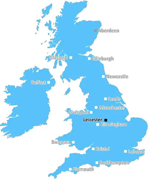
The LE17 postcode covers the rural area of Leicestershire, and is located to the South of Birmingham, around 30 miles away. It covers the villages of Cosby, Great Glen, Whetstone and Countesaken and some parts of the towns of Leicester, Market Harborough, Lutterworth and Ullesthorpe.
The area is home to a range of amenities and attractions that are within easy reach. A variety of supermarkets including Morrisons, Sainsbury's, Asda, Lidl, Aldi and Iceland are all located nearby, providing excellent grocery shopping options. Leicester's impressive city centre, designer shops, cultural attractions, eateries, galleries, cinemas and bars are just a short drive away. The renowned Great Central Railway, which recently added a steam train service, and Leicester Magna Carta Park are also close by.
The part of the LE17 postcode surrounding Great Glen is particularly well-known for its stunning surroundings and quintessential English countryside. Home to a much-loved pub which was once frequented by Charles Dickens, it is a great place for a countryside stroll or a scenic bike ride. The area features gently rolling hills, winding lanes, charming hamlets and a variety of quaint houses. The hilly landscape offers stunning views across the surrounding countryside, while a gentle rural charm surrounds the villages of Cosby and Whetstone.
Leicestershire is famous for its fantastic range of educational establishments. The postcode is home to highly-rated schools such as Kingsmead Primary in Great Glen, Countesthorpe Community College and Whetstone Primary School. It is also close to the University of Leicester and Leicester College, providing a range of higher education courses.
The area boasts a fantastic array of leisure activities like golf, walking, running, angling and even skiing at the Barclaycard Ski centre located near Cosby. Leicestershire's woods, meadows and canals combine to provide a sense of tranquil escape from the hustle and bustle of the city, while Cosby village is home to a variety of eateries, such as the George Newbold pub, Hyland at the Mill caf� and The Crown at Baron's Hill restaurant.
Le15 postcode is an area of great natural beauty, with plenty of entertainment, educational options and picturesque scenery on offer. Whether you're looking to find a place to call home, an ideal location for a day out or an outstanding educational establishment to pursue higher education, the LE17 postcode certainly won't disappoint.

Demographics

Leicestershire

LE17 is located in the county of Leicestershire, in England.
Leicestershire has a total population of 1,031,300, making it the 21st largest county in the UK.
Leicestershire has a total area of 832 square miles, and a population density of 478 people per square kilometre. For comparison, Greater London has a density of 5,618 people/km2.
| Outward Code | LE17 |
| Postal Town | Leicester |
| MSOA Name | Harborough 010 |
| LSOA Name | Harborough 010C |
| County | Leicestershire |
| Region | Leicestershire |
| Country | England |
| Local Authority | Harborough |
| Area Classification | Mainly Rural (rural including hub towns >=80%) |
LE17 Electoral Wards
The postal region of LE17, includes the local towns, villages, electoral wards and stations of:
Dig even deeper into the LE17 postcode by clicking on a postcode below:
Click on an outward postal code below for more information about the area. Each 'outward' postcode give you a comprehensive list of all postcodes within the outward code area (LE) and estimated address.
Click on an 'outward' code for more information. For example, the outward postcode page 'EC2M' will give you an alphabetical list covering all postcodes located in the region, from 'EC2M 1BB' through to 'EC2M 7YA'.
Chris H
Saturday, April 6, 2024
We don't have any views of LE17 right now. If you live in LE17 or have visited it, please help us to help others by telling others what you think of this neighbourhood.
Add your view of LE17
People need your local expertise. If you live in LE17 or have first-hand knowledge of the neighbourhood, please consider sharing your views. It's completely anonymous - all we ask is for your initials.
Please tell us what you like about the LE17 postcode area, what you don't like, and what it's like to live or work here.
| LOCAL AMENITIES | |
| FAMILY FRIENDLY | |
| PARKING | |
| GREEN SPACES |
Local News Leicestershire
Bereaved mum to help others through crash charity
Dee Beesley says she was "thrown into a world of unknowns" when her son, Reece, died in 2019.
BBC NewsBaby whose heart works at 20% reaches first birthday
Doctors feared Willow, who has dilated cardiomyopathy, would not survive but she defied the odds.
BBC NewsCouncil moves to buy office block turned into flats
Leicester City Council says the purchase would add 55 new homes to its housing stock.
BBC NewsTMS commentator Agnew signs new deal with BBC Sport
Jonathan Agnew will continue to lead the Test Match Special team after agreeing a new four-year deal with BBC Sport.
BBC NewsWarning to 'stay on guard' after cyber-attack
The council says work is ongoing to find out the amount and nature of data which was taken.
BBC NewsSelby considers future after loss to Wilson
Mark Selby says it's "maybe time to do something else" after losing 10-8 to Gary Wilson in the first round of the Tour Championship.
BBC NewsCan Surrey be beaten as County Championship returns?
With the new County Championship season starting on Friday, can anyone prevent Surrey winning a third straight title?
BBC NewsI reported explicit messages to police, says MP
Luke Evans says he was a victim of cyber-flashing in a suspected honeytrap plot targeting Westminster.
BBC NewsFrom the Postcode Area blog

Deciphering Crime Rates - a Deep Dive Into UK Postcode Analysis
Ever wondered about the crime rate in your UK postcode? You're not alone. We've dug deep into the data, uncovering trends and patterns that'll make your head spin.

Death of the High Street?
The BBC reports that despite councils' attempts to kurb them, the UK's high streets have seen a huge growth in fast food outlets. Could this mark the death knell for the Great British high street, and what can we do about it to halt its decline?

Discrimination by Postcode
You really couldn't make it up, could you? Some of the country's most vulnerable people are missing out on their weekly £25 Cold Weather Payment, just because the system that's in operation is discriminating against them because payments are based on postcode, rather than geographic location.

The Redesign is Underway
Well, the current website was absolutely in dire need of a good redesign - from the ground up. So I set out to pull it all apart and get it up and running again to become the most comprehensive guide to every postcode in the UK. And it's been a long, tough job from start to finish - and quite possibly the biggest project I've ever undertaken.
SOCIAL GRADES
According to census records, 33% of people here have a social grade of AB (highest), compared to the national average of 27%.