leicester LE16 Postcodes
Spending a fortune on conveyancing?

Compare instant, low-cost online quotes from trusted conveyancing solicitors.
Backed by experts, our no-obligation service searches through the best conveyancing quotes on the market to save you time and money.
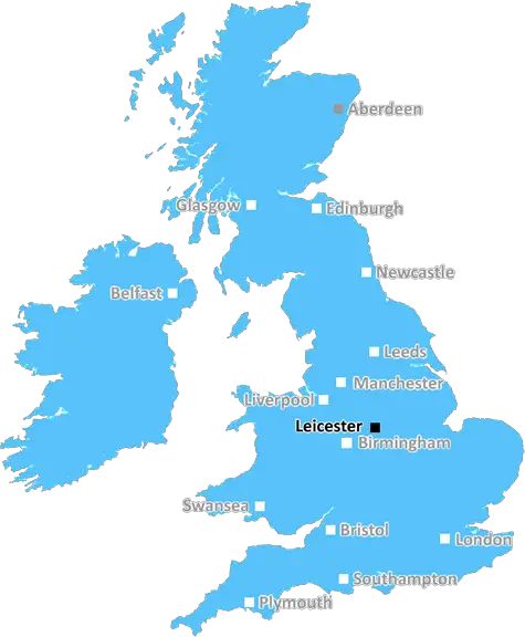
Leicester (LE16)
The LE16 postcode area is located in the Leicester postcode town region, within the county of Leicestershire, and contains a total of 1244 individual postcodes.
There are 70 electoral wards in the LE16 postcode area, including Ashby-De-La-Zouch, Coalville, Hinckley, Ibstock, Leicester, Loughborough, Lutterworth, Market Harborough, Markfield, Melton Mowbray, Oakham, Wigston which come under the local authority of the Harborough Council.
Combining the whole postcode region, 33% of people in LE16 are classed as having an AB social grade, (i.e. 'white-collar' middle-upper class), compared to 27% across the UK.
This does not mean that the people of LE16 are wealthier - or higher class - than average, but it can be an indication that the area may be prospering and desirable to live in.
The LE16 postcode district in the Leicester district in the UK encompasses the towns and villages of Lubenham, Market Harborough, Great Bowden, Draughton, Theddingworth, Clipston and Drayton.
The area is close to the M1 motorway, providing easy access to Birmingham and London. The area also has excellent rail connections, with regular services to Leicester and London St Pancras. The postcode is also within easy reach of East Midlands Airport.
The area has a rich local history dating back to the Iron Age, with evidence of Roman, Saxon and Norman settlements. This rich history is reflected through the buildings, monuments and archaelogical finds throughout the district.
The area has a strong industrial heritage, with firefighting, rubber and textiles manufacturing all playing a significant part in its history, as well as the more modern information and communication industry.
The market towns are bustling with independent shops, cafes, pubs and restaurants, making them popular locations for young people and families alike.
The local area is also home to the beautiful Welland Valley, with its lovely meadows, woodland and wildlife. The area is popular with ramblers and has been declared an Area of Outstanding Natural Beauty (AONB).
The LE16 postcode is served by a number of schools to cater for all ages, including both primary and secondary schools. The district also has two FE Colleges providing further and tertiary education.
The postcode also has close proximity to Leicester itself, providing easy access to the city's attractions, such as Leicester Cathedral, New Walk Museum and Leicester Castle. Leicester also boasts a vibrant and diverse shopping and eating quarter, as well as the West End, where there are plenty of cultural activities and events taking place throughout the year.

Demographics

Leicestershire

LE16 is located in the county of Leicestershire, in England.
Leicestershire has a total population of 1,031,300, making it the 21st largest county in the UK.
Leicestershire has a total area of 832 square miles, and a population density of 478 people per square kilometre. For comparison, Greater London has a density of 5,618 people/km2.
| Outward Code | LE16 |
| Postal Town | Leicester |
| MSOA Name | Harborough 008 |
| LSOA Name | Harborough 008B |
| County | Leicestershire |
| Region | Leicestershire |
| Country | England |
| Local Authority | Harborough |
| Area Classification | Mainly Rural (rural including hub towns >=80%) |
LE16 Electoral Wards
The postal region of LE16, includes the local towns, villages, electoral wards and stations of:
Dig even deeper into the LE16 postcode by clicking on a postcode below:
Click on an outward postal code below for more information about the area. Each 'outward' postcode give you a comprehensive list of all postcodes within the outward code area (LE) and estimated address.
Click on an 'outward' code for more information. For example, the outward postcode page 'EC2M' will give you an alphabetical list covering all postcodes located in the region, from 'EC2M 1BB' through to 'EC2M 7YA'.
Chris H
Monday, April 8, 2024
We don't have any views of LE16 right now. If you live in LE16 or have visited it, please help us to help others by telling others what you think of this neighbourhood.
Add your view of LE16
People need your local expertise. If you live in LE16 or have first-hand knowledge of the neighbourhood, please consider sharing your views. It's completely anonymous - all we ask is for your initials.
Please tell us what you like about the LE16 postcode area, what you don't like, and what it's like to live or work here.
| LOCAL AMENITIES | |
| FAMILY FRIENDLY | |
| PARKING | |
| GREEN SPACES |
Local News Leicestershire
More buses added to airport route
The extra services are introduced as part of efforts to improve punctuality.
BBC NewsLeicester beat Birmingham to go top of table
Leicester City go top of the Championship with late win against Birmingham City at the King Power Stadium.
BBC NewsI reported explicit messages to police, says MP
Luke Evans says he was a victim of cyber-flashing in a suspected honeytrap plot targeting Westminster.
BBC NewsArrest after teenagers got into stranger's car
Police say the two girls and a boy left the car safely but are concerned for their "welfare".
BBC NewsCommunity rallies to help fire-damaged pub reopen
The Leicestershire pub was badly damaged by a fire more than a year ago.
BBC NewsWork to repair landslip-hit railway line begins
The site, used to test new trains and technology, has been closed since last year.
BBC NewsNearly 100 drivers flagged in car cruise crackdown
Officers targeted nuisance drivers in the Castle Donington area over the Easter weekend.
BBC NewsDeveloper earmarks 900-home housing estate for town
Plans for more than 400 homes are lodged after almost 500 on neighbouring land were approved.
BBC NewsFrom the Postcode Area blog

Deciphering Crime Rates - a Deep Dive Into UK Postcode Analysis
Ever wondered about the crime rate in your UK postcode? You're not alone. We've dug deep into the data, uncovering trends and patterns that'll make your head spin.

Death of the High Street?
The BBC reports that despite councils' attempts to kurb them, the UK's high streets have seen a huge growth in fast food outlets. Could this mark the death knell for the Great British high street, and what can we do about it to halt its decline?

Discrimination by Postcode
You really couldn't make it up, could you? Some of the country's most vulnerable people are missing out on their weekly £25 Cold Weather Payment, just because the system that's in operation is discriminating against them because payments are based on postcode, rather than geographic location.

The Redesign is Underway
Well, the current website was absolutely in dire need of a good redesign - from the ground up. So I set out to pull it all apart and get it up and running again to become the most comprehensive guide to every postcode in the UK. And it's been a long, tough job from start to finish - and quite possibly the biggest project I've ever undertaken.
SOCIAL GRADES
According to census records, 33% of people here have a social grade of AB (highest), compared to the national average of 27%.