leicester LE13 Postcodes
Spending a fortune on conveyancing?

Compare instant, low-cost online quotes from trusted conveyancing solicitors.
Backed by experts, our no-obligation service searches through the best conveyancing quotes on the market to save you time and money.
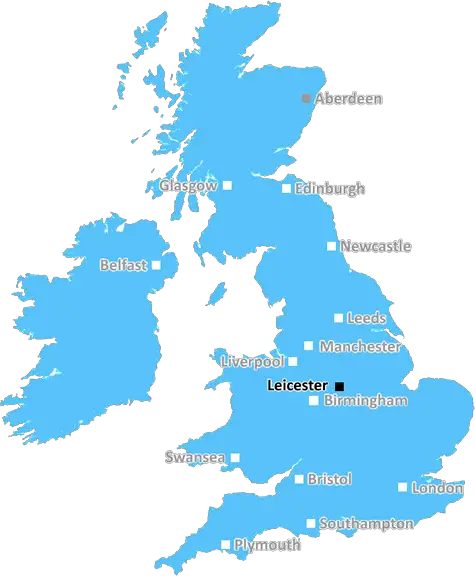
Leicester (LE13)
The LE13 postcode area is located in the Leicester postcode town region, within the county of Leicestershire, and contains a total of 800 individual postcodes.
There are 2 electoral wards in the LE13 postcode area, including Ashby-De-La-Zouch, Coalville, Hinckley, Ibstock, Leicester, Loughborough, Lutterworth, Market Harborough, Markfield, Melton Mowbray, Oakham, Wigston which come under the local authority of the Melton Council.
Combining the whole postcode region, 21% of people in LE13 are classed as having an AB social grade, (i.e. 'white-collar' middle-upper class), compared to 27% across the UK.
This does not mean that the people of LE13 are poorer than other areas, but it may give an indication that there are areas of deprivation.
The LE13 postcode is situated in the East Midlands region of the United Kingdom. It encompasses post towns of the districts of Melton, Harborough, Rutland, and North West Leicestershire of Leicestershire County.
Within Melton District, the postcode of LE13 serves numerous villages, including Copt Oak, Burton Lazars, Kirkby Bellairs, Croxton Kerrial, Shelthorpe, and Waltham-On-the-Wolds. This region is known for its rural landscape, providing historical sights such as the Burrough Hill Iron Age hill fort, and open spaces in its local parks.
Harborough District, located in south-east Leicestershire, is a area that includes a large range of villages near the borders of Northamptonshire and Rutland. These include Great Bowden, Great Oxenden, Smeeton Westerby, and Mallory. There are a number of historic sites in this area, such as the Church of St Mary at Nevill Holt, and for leisure activities, the Foxton Locks and Water Park.
The postcode LE13 also covers the Mercian town of Oakham in Rutland. This small county is known for its picturesque scenery and local attractions, such as Rutland Water Nature Reserve, Barnsdale Gardens, and Oakham Castle. All three districts provide a range of outdoor activities for visitors.
In North West Leicestershire, LE13 covers Market Bosworth, Shackerstone, and Sutton Cheney. The market town of Market Bosworth is a historical town, which is known for its redbrick buildings and stunning countryside walks. The villages of Shackerstone and Sutton Cheney are known for their canals, the Ashby Canal and Coventry Canal, respectively, and popular attractions such as the Battle of Bosworth Medieval Festival.
TheLE13 postcode is a great area that offers a nicely balanced area for rural and historic interests, with the added bonus of a range of outdoor activities. From Iron Age hill forts to open spaces in local parks, and large canals to stunning countryside walks � there is something here for everyone.

Demographics

Leicestershire

LE13 is located in the county of Leicestershire, in England.
Leicestershire has a total population of 1,031,300, making it the 21st largest county in the UK.
Leicestershire has a total area of 832 square miles, and a population density of 478 people per square kilometre. For comparison, Greater London has a density of 5,618 people/km2.
| Outward Code | LE13 |
| Postal Town | Leicester |
| MSOA Name | Melton 005 |
| LSOA Name | Melton 005E |
| County | Leicestershire |
| Region | Leicestershire |
| Country | England |
| Local Authority | Melton |
| Area Classification | Mainly Rural (rural including hub towns >=80%) |
LE13 Electoral Wards
The postal region of LE13, includes the local towns, villages, electoral wards and stations of:
Dig even deeper into the LE13 postcode by clicking on a postcode below:
Click on an outward postal code below for more information about the area. Each 'outward' postcode give you a comprehensive list of all postcodes within the outward code area (LE) and estimated address.
Click on an 'outward' code for more information. For example, the outward postcode page 'EC2M' will give you an alphabetical list covering all postcodes located in the region, from 'EC2M 1BB' through to 'EC2M 7YA'.
Chris H
Monday, April 8, 2024
We don't have any views of LE13 right now. If you live in LE13 or have visited it, please help us to help others by telling others what you think of this neighbourhood.
Add your view of LE13
People need your local expertise. If you live in LE13 or have first-hand knowledge of the neighbourhood, please consider sharing your views. It's completely anonymous - all we ask is for your initials.
Please tell us what you like about the LE13 postcode area, what you don't like, and what it's like to live or work here.
| LOCAL AMENITIES | |
| FAMILY FRIENDLY | |
| PARKING | |
| GREEN SPACES |
Local News Leicestershire
More buses added to airport route
The extra services are introduced as part of efforts to improve punctuality.
BBC NewsLeicester beat Birmingham to go top of table
Leicester City go top of the Championship with late win against Birmingham City at the King Power Stadium.
BBC NewsI reported explicit messages to police, says MP
Luke Evans says he was a victim of cyber-flashing in a suspected honeytrap plot targeting Westminster.
BBC NewsNearly 100 drivers flagged in car cruise crackdown
Officers targeted nuisance drivers in the Castle Donington area over the Easter weekend.
BBC NewsNo play possible in three Championship matches
There is no play for a third straight day in the Durham-Hampshire and Derbyshire-Gloucestershire games, while Yorkshire-Leicestershire is also rained off.
BBC NewsSpeeding tickets sent to man after his death
Shafiqul Haidhar was sent letters in the weeks after his death, causing his family "more pain".
BBC NewsWork to repair landslip-hit railway line begins
The site, used to test new trains and technology, has been closed since last year.
BBC NewsBaby whose heart works at 20% reaches first birthday
Doctors feared Willow, who has dilated cardiomyopathy, would not survive but she defied the odds.
BBC NewsFrom the Postcode Area blog

Deciphering Crime Rates - a Deep Dive Into UK Postcode Analysis
Ever wondered about the crime rate in your UK postcode? You're not alone. We've dug deep into the data, uncovering trends and patterns that'll make your head spin.

Death of the High Street?
The BBC reports that despite councils' attempts to kurb them, the UK's high streets have seen a huge growth in fast food outlets. Could this mark the death knell for the Great British high street, and what can we do about it to halt its decline?

Discrimination by Postcode
You really couldn't make it up, could you? Some of the country's most vulnerable people are missing out on their weekly £25 Cold Weather Payment, just because the system that's in operation is discriminating against them because payments are based on postcode, rather than geographic location.

The Redesign is Underway
Well, the current website was absolutely in dire need of a good redesign - from the ground up. So I set out to pull it all apart and get it up and running again to become the most comprehensive guide to every postcode in the UK. And it's been a long, tough job from start to finish - and quite possibly the biggest project I've ever undertaken.
SOCIAL GRADES
According to census records, 21% of people here have a social grade of AB (highest), compared to the national average of 27%.