leeds LS15 Postcodes
Spending a fortune on conveyancing?

Compare instant, low-cost online quotes from trusted conveyancing solicitors.
Backed by experts, our no-obligation service searches through the best conveyancing quotes on the market to save you time and money.
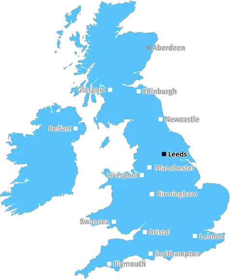
Leeds (LS15)
The LS15 postcode area is located in the Leeds postcode town region, within the county of West Yorkshire, and contains a total of 1179 individual postcodes.
There are 32 electoral wards in the LS15 postcode area, including Ilkley, Leeds, Otley, Pudsey, Tadcaster, Wetherby which come under the local authority of the Leeds Council.
Combining the whole postcode region, 18% of people in LS15 are classed as having an AB social grade, (i.e. 'white-collar' middle-upper class), compared to 27% across the UK.
This does not mean that the people of LS15 are poorer than other areas, but it may give an indication that there are areas of deprivation.
The LS15 postcode area is located in the Leeds district in the West Yorkshire region of England. It mainly covers the areas of Swillington, Halton, Colton, Oulton, Knostrop, Cross Gates, Austhorpe, Carlton, Scholes, Manston, Thorner, Whitkirk and Barwick-in-Elmet.
LS15 is a mainly residential area, host to many residential estates and villages as well as a large area of rural countryside and open fields. It is well connected by both road and rail links, with easy access to Leeds and Wakefield city centres.
The area is home to a number of parks and recreational facilities, including Crossgates football pitches, Colton primary school playing fields and Swillington allotment. It is also a popular place for walking and cycling. There is a range of convenience stores, pubs and restaurants scattered throughout the district.
LS15 has excellent transport links, with regular bus services operated by the West Yorkshire Metro. Many of the buses link the area to the nearby cities of Leeds and Wakefield, as well as connecting the area to surrounding villages and smaller towns. It also hosts a number of railway stations along the Wakefield-Leeds line.
The area hosts a number of parks, greens and open spaces, such as Swillington Common, Manston Rock, Thorner Closes and the Colton Primary School playing fields. There are also a number of leisure and recreational activities to enjoy such as bowling and golf.
The local economy is primarily based in services, construction, retail, leisure and manufacturing. It is home to many large companies such as Leeds City Council, NHS Leeds, Yorkshire Bank and Aviva.
Health services are well catered for in the area, with two NHS walk-in centres located in Crossgates and Halton, as well as a number of GP surgeries.
LS15 is a thriving postcode area, offering a mix of residential areas, leisure and recreational activities, and a variety of retail and manufacturing businesses. It is a great place to live and work, and offers excellent transport links into nearby cities.

Demographics
West Yorkshire

LS15 is located in the county of West Yorkshire, in England.
West Yorkshire has a total population of 2,299,700, making it the 4th largest county in the UK.
West Yorkshire has a total area of 783 square miles, and a population density of 1133 people per square kilometre. For comparison, Greater London has a density of 5,618 people/km2.
| Outward Code | LS15 |
| Postal Town | Leeds |
| MSOA Name | Leeds 073 |
| LSOA Name | Leeds 073B |
| County | West Yorkshire |
| Region | West Yorkshire |
| Country | England |
| Local Authority | Leeds |
| Area Classification | Urban with Major Conurbation |
LS15 Electoral Wards
The postal region of LS15, includes the local towns, villages, electoral wards and stations of:
Dig even deeper into the LS15 postcode by clicking on a postcode below:
Click on an outward postal code below for more information about the area. Each 'outward' postcode give you a comprehensive list of all postcodes within the outward code area (LS) and estimated address.
Click on an 'outward' code for more information. For example, the outward postcode page 'EC2M' will give you an alphabetical list covering all postcodes located in the region, from 'EC2M 1BB' through to 'EC2M 7YA'.
Chris H
Monday, May 6, 2024
We don't have any views of LS15 right now. If you live in LS15 or have visited it, please help us to help others by telling others what you think of this neighbourhood.
Add your view of LS15
People need your local expertise. If you live in LS15 or have first-hand knowledge of the neighbourhood, please consider sharing your views. It's completely anonymous - all we ask is for your initials.
Please tell us what you like about the LS15 postcode area, what you don't like, and what it's like to live or work here.
| LOCAL AMENITIES | |
| FAMILY FRIENDLY | |
| PARKING | |
| GREEN SPACES |
Local News West Yorkshire
Plans for former Leeds school site put forward
Sports pitches, shops, housing and a special needs school have all been lined up by Leeds Council.
BBC NewsLeeds woman given terminal diagnosis after doctors missed tumour on scan
Leeds NHS trust says it is "deeply sorry" after Anne Shaw's cancer went undiagnosed for two years.
BBC NewsActor Ferrell to join list of Leeds investors
Hollywood actor Will Ferrell is set to join the list of celebrity investors in Championship club Leeds United
BBC NewsHorbury: Plans to convert WW2 gas site into caf rejected
Objectors say the project would "fail to preserve the special historic interest" of the structure.
BBC NewsMurder victim told police she feared ex-partner would kill her
Katie Higton warned officers of threats from Marcus Osborne, a timeline obtained by the BBC reveals.
BBC NewsCriminals' cash pays to train future plumbers
Cash seized under the Proceeds of Crime Act is funding training for teenagers in West Yorkshire.
BBC NewsElland waste tip to close for up to two weeks
The waste recycling centre's closure is to allow "essential drainage works" to take place.
BBC NewsYorkshire well-placed to beat Glamorgan after run riot
Glamorgan go into the final day on 171-3 against Yorkshire, still 127 runs short of making the hosts bat again.
BBC NewsFrom the Postcode Area blog

Deciphering Crime Rates - a Deep Dive Into UK Postcode Analysis
Ever wondered about the crime rate in your UK postcode? You're not alone. We've dug deep into the data, uncovering trends and patterns that'll make your head spin.

Death of the High Street?
The BBC reports that despite councils' attempts to kurb them, the UK's high streets have seen a huge growth in fast food outlets. Could this mark the death knell for the Great British high street, and what can we do about it to halt its decline?

Discrimination by Postcode
You really couldn't make it up, could you? Some of the country's most vulnerable people are missing out on their weekly £25 Cold Weather Payment, just because the system that's in operation is discriminating against them because payments are based on postcode, rather than geographic location.

The Redesign is Underway
Well, the current website was absolutely in dire need of a good redesign - from the ground up. So I set out to pull it all apart and get it up and running again to become the most comprehensive guide to every postcode in the UK. And it's been a long, tough job from start to finish - and quite possibly the biggest project I've ever undertaken.
SOCIAL GRADES
According to census records, 18% of people here have a social grade of AB (highest), compared to the national average of 27%.