leeds LS11 Postcodes
Spending a fortune on conveyancing?

Compare instant, low-cost online quotes from trusted conveyancing solicitors.
Backed by experts, our no-obligation service searches through the best conveyancing quotes on the market to save you time and money.
Leeds (LS11)
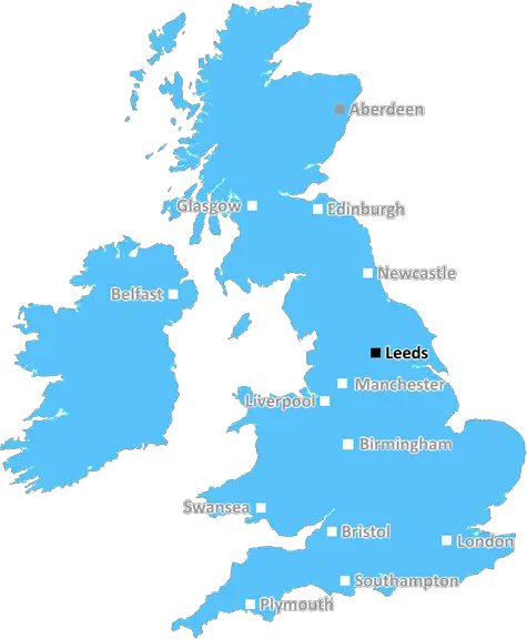
The LS11 postcode area is located in the Leeds postcode town region, within the county of West Yorkshire, and contains a total of 1515 individual postcodes.
There are 7 electoral wards in the LS11 postcode area, including Ilkley, Leeds, Otley, Pudsey, Tadcaster, Wetherby which come under the local authority of the Leeds Council.
Combining the whole postcode region, 14% of people in LS11 are classed as having an AB social grade, (i.e. 'white-collar' middle-upper class), compared to 27% across the UK.
This does not mean that the people of LS11 are poorer than other areas, but it may give an indication that there are areas of deprivation.
The LS11 postcode area in the Leeds district comprises nine post towns and 12 postcode districts in West Yorkshire, England. It covers most of the Beeston, Hunslet, Cottingley, Belle Isle, Middleton, Stourton and Holbeck areas of eastern Leeds and parts of south-east Leeds and south-west Leeds. It includes the main underlying wards of Beeston, Hunslet and Riverside, Cottingley, Belle Isle, Middleton Park, Stourton with Sugar Hill and Holbeck.
Beeston is a vibrant, multicultural suburb of Leeds, home to a diverse variety of local businesses, independent shops, bars and restaurants. Hunslet is a former industrial core with a heritage of engineering and shipbuilding, and now boasts the renovated Royal Armouries Museum and popular shops, cafes and eateries. Cottingley is a residential area of Leeds with a range of amenities including a supermarket and a leisure centre. Belle Isle is a densely populated, largely residential area of Leeds with a strong sense of community spirit. Middleton Park is a large park off the Leeds-Bradford Road with excellent recreational and sports facilities. Stourton with Sugar Hill is an excellent location to live close to the city centre's amenities while still enjoying the peace and tranquillity of parkland and open spaces. Lastly, Holbeck is a former industrial area now transformed into a vibrant community centre with shops, art galleries and independent eating places.
LS11 is an area full of character, combining both modern convenience and a unique sense of history. It is home to a multicultural population of over 28,000 people, each bring their own vibrant heritage and culture to the area. The district includes both residential areas and a variety of retail and leisure facilities including two large supermarkets. Basic amenities such as a GP practice, pharmacy, pubs and takeaways are also readily available. Excellent bus, train and road links make the area easy to access from the city centre and the surrounding areas. The postcode is served by three primary schools - Cottingley Primary School, Hunslet St Mary's CofE Primary School and Beeston Primary School - as well as various secondary schools. The LS11 postcode area provides the perfect balance for those seeking to escape the hustle and bustle of city life, yet remain close to the amenities of the Leeds city centre.

Demographics
West Yorkshire

LS11 is located in the county of West Yorkshire, in England.
West Yorkshire has a total population of 2,299,700, making it the 4th largest county in the UK.
West Yorkshire has a total area of 783 square miles, and a population density of 1133 people per square kilometre. For comparison, Greater London has a density of 5,618 people/km2.
| Outward Code | LS11 |
| Postal Town | Leeds |
| MSOA Name | Leeds 082 |
| LSOA Name | Leeds 082C |
| County | West Yorkshire |
| Region | West Yorkshire |
| Country | England |
| Local Authority | Leeds |
| Area Classification | Urban with Major Conurbation |
LS11 Electoral Wards
The postal region of LS11, includes the local towns, villages, electoral wards and stations of:
Dig even deeper into the LS11 postcode by clicking on a postcode below:
Click on an outward postal code below for more information about the area. Each 'outward' postcode give you a comprehensive list of all postcodes within the outward code area (LS) and estimated address.
Click on an 'outward' code for more information. For example, the outward postcode page 'EC2M' will give you an alphabetical list covering all postcodes located in the region, from 'EC2M 1BB' through to 'EC2M 7YA'.
Chris H
Saturday, April 6, 2024
We don't have any views of LS11 right now. If you live in LS11 or have visited it, please help us to help others by telling others what you think of this neighbourhood.
Add your view of LS11
People need your local expertise. If you live in LS11 or have first-hand knowledge of the neighbourhood, please consider sharing your views. It's completely anonymous - all we ask is for your initials.
Please tell us what you like about the LS11 postcode area, what you don't like, and what it's like to live or work here.
| LOCAL AMENITIES | |
| FAMILY FRIENDLY | |
| PARKING | |
| GREEN SPACES |
Local News West Yorkshire
National Coal Mining Museum hosts miners' memories of 1980s strike
Memories of the 1984 miners' strike at centre of 40th anniversary exhibition.
BBC NewsCriminals' cash pays to train future plumbers
Cash seized under the Proceeds of Crime Act is funding training for teenagers in West Yorkshire.
BBC NewsTom Holmes: Bradford Bulls full-back targets playing return after rare illness
Bradford Bulls full-back Tom Holmes is looking to make a "special" return to playing after having a rare form of skin lymphoma.
BBC NewsCoroner raises concern over indefinite jail terms after man's death
John Hobson has urged the Ministry of Justice to consider the impact on offender's mental health.
BBC NewsPlans for former Leeds school site put forward
Sports pitches, shops, housing and a special needs school have all been lined up by Leeds Council.
BBC NewsFebruary 29: 'Leaplings' finally get to celebrate their birthdays
Three people in Yorkshire born on 29 February can only mark their "real" birthdays every four years.
BBC NewsWakefield council tax rise agreed amid angry scenes at meeting
A Wakefield Council budget meeting is adjourned after a heated debate over spending cuts.
BBC NewsYorkshire: ECB must prevent 'return to business as usual', say MPs
The England and Wales Cricket Board (ECB) must "closely monitor" Yorkshire to prevent a "return to business as usual", say MPs.
BBC NewsFrom the Postcode Area blog

Deciphering Crime Rates - a Deep Dive Into UK Postcode Analysis
Ever wondered about the crime rate in your UK postcode? You're not alone. We've dug deep into the data, uncovering trends and patterns that'll make your head spin.

Death of the High Street?
The BBC reports that despite councils' attempts to kurb them, the UK's high streets have seen a huge growth in fast food outlets. Could this mark the death knell for the Great British high street, and what can we do about it to halt its decline?

Discrimination by Postcode
You really couldn't make it up, could you? Some of the country's most vulnerable people are missing out on their weekly £25 Cold Weather Payment, just because the system that's in operation is discriminating against them because payments are based on postcode, rather than geographic location.

The Redesign is Underway
Well, the current website was absolutely in dire need of a good redesign - from the ground up. So I set out to pull it all apart and get it up and running again to become the most comprehensive guide to every postcode in the UK. And it's been a long, tough job from start to finish - and quite possibly the biggest project I've ever undertaken.
SOCIAL GRADES
According to census records, 14% of people here have a social grade of AB (highest), compared to the national average of 27%.