lancaster LA6 Postcodes
Spending a fortune on conveyancing?

Compare instant, low-cost online quotes from trusted conveyancing solicitors.
Backed by experts, our no-obligation service searches through the best conveyancing quotes on the market to save you time and money.
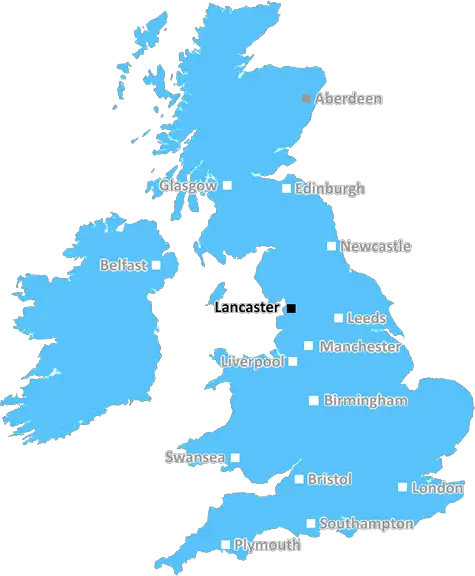
Lancaster (LA6)
The LA6 postcode area is located in the Lancaster postcode town region, within the county of Lancashire, and contains a total of 751 individual postcodes.
There are 121 electoral wards in the LA6 postcode area, including Ambleside, Askam-In-Furness, Barrow-In-Furness, Broughton-In-Furness, Carnforth, Coniston, Dalton-In-Furness, Grange-Over-Sands, Kendal, Kirkby-In-Furness, Lancaster, Millom, Milnthorpe, Morecambe, Sedbergh, Ulverston, Windermere which come under the local authority of the Lancaster Council.
Combining the whole postcode region, 30% of people in LA6 are classed as having an AB social grade, (i.e. 'white-collar' middle-upper class), compared to 27% across the UK.
This does not mean that the people of LA6 are wealthier - or higher class - than average, but it can be an indication that the area may be prospering and desirable to live in.
The LA6 postcode is part of the Lancaster post town in the Lancaster district of England. This region covers parts of the City of Lancaster, the neighbouring towns of Nether Kellet and Over Kellet, and some of the surrounding countryside. It also includes part of the scenic River Lune Valley.
The LA6 postcode covers an area of 9.5 square miles, mostly located in the south western part of the district. The major town in the area is Carnforth, which lies on the A6 road and historically provided railway services to the nearby Irish Sea coast. Other towns in the LA6 postcode area include Bolton-le-Sands, Over Kellet, Nether Kellet, and Cockerham.
There are several primary and secondary schools located in the LA6 postcode area, along with several further education campuses. The area is also well serviced by healthcare facilities, with the Royal Lancaster Infirmary located in Carnforth.
The local economy is largely driven by the tourism sector, due to its close proximity to the Lake District and the Lancashire coast. In recent decades, the area has seen significant investment, with a number of major businesses now based in the LA6 postcode.
Cultural attractions in the area include the Carnforth Station Heritage Centre, Holt Station Museum, and the Lancaster Canal, as well as the many areas of natural beauty in the district. The numerous pubs, restaurants, and venues which serve Carnforth and its surrounding areas are well-known throughout the region.
The LA6 postcode area is well-served by public transport, with regular bus, rail, and air links throughout the district. The area is also well-connected via the M6 motorway, with access to other nearby cities such as Manchester, Liverpool, and Leeds.
The LA6 postcode is located in a popular location with some of the most stunning scenery in the country, making it an ideal place for those looking to living or visit in the area. It's a place where residents are connected to both rural and urban life, with the stunning countryside at the doorstep and the nearby cities a short journey away.

Demographics
Lancashire

LA6 is located in the county of Lancashire, in England.
Lancashire has a total population of 1,485,000, making it the 8th largest county in the UK.
Lancashire has a total area of 1187 square miles, and a population density of 482 people per square kilometre. For comparison, Greater London has a density of 5,618 people/km2.
| Outward Code | LA6 |
| Postal Town | Lancaster |
| MSOA Name | Lancaster 001 |
| LSOA Name | Lancaster 001D |
| County | Lancashire |
| Region | Lancashire |
| Country | England |
| Local Authority | Lancaster |
| Area Classification | Urban with Significant Rural (rural including hub towns 26-49%) |
LA6 Electoral Wards
The postal region of LA6, includes the local towns, villages, electoral wards and stations of:
Dig even deeper into the LA6 postcode by clicking on a postcode below:
Click on an outward postal code below for more information about the area. Each 'outward' postcode give you a comprehensive list of all postcodes within the outward code area (LA) and estimated address.
Click on an 'outward' code for more information. For example, the outward postcode page 'EC2M' will give you an alphabetical list covering all postcodes located in the region, from 'EC2M 1BB' through to 'EC2M 7YA'.
Chris H
Tuesday, April 9, 2024
We don't have any views of LA6 right now. If you live in LA6 or have visited it, please help us to help others by telling others what you think of this neighbourhood.
Add your view of LA6
People need your local expertise. If you live in LA6 or have first-hand knowledge of the neighbourhood, please consider sharing your views. It's completely anonymous - all we ask is for your initials.
Please tell us what you like about the LA6 postcode area, what you don't like, and what it's like to live or work here.
| LOCAL AMENITIES | |
| FAMILY FRIENDLY | |
| PARKING | |
| GREEN SPACES |
Local News Lancashire
Critically ill boy fulfils soldier dream for a day
Noah, who is from Leyland, loves tanks and wished to be a soldier for a day.
BBC NewsCouncil-run children's homes could double
There are concerns children in care in Lancashire are being placed far away from their communities.
BBC NewsPharmacy robots speed up prescription picking
The robots are "like giant vending machines" that find medicines faster than humans, a Trust says.
BBC NewsFour in five of borough's ash trees could be lost
There is currently no cure or clear method of stopping the spread of ash dieback.
BBC NewsFamily jailed over multimillion-pound drugs trade
Ian Shacklady, his family and associates supplied large amounts of cocaine and heroin across the UK.
BBC NewsBradford stabbing victim named as manhunt continues
Kulsuma Akter, from Oldham, was stabbed to death while pushing her baby in a pram, police say.
BBC NewsFull steam ahead for historic mill after repairs
"Steam Sunday" at Bancroft Mill was delayed by problems with the 112-year-old boiler.
BBC NewsEverton beat Burnley to boost survival hopes
Dominic Calvert-Lewin capitalises on an Arijanet Muric error to score his second goal in as many games and help Everton to a priceless win over fellow strugglers Burnley.
BBC NewsFrom the Postcode Area blog

Deciphering Crime Rates - a Deep Dive Into UK Postcode Analysis
Ever wondered about the crime rate in your UK postcode? You're not alone. We've dug deep into the data, uncovering trends and patterns that'll make your head spin.

Death of the High Street?
The BBC reports that despite councils' attempts to kurb them, the UK's high streets have seen a huge growth in fast food outlets. Could this mark the death knell for the Great British high street, and what can we do about it to halt its decline?

Discrimination by Postcode
You really couldn't make it up, could you? Some of the country's most vulnerable people are missing out on their weekly £25 Cold Weather Payment, just because the system that's in operation is discriminating against them because payments are based on postcode, rather than geographic location.

The Redesign is Underway
Well, the current website was absolutely in dire need of a good redesign - from the ground up. So I set out to pull it all apart and get it up and running again to become the most comprehensive guide to every postcode in the UK. And it's been a long, tough job from start to finish - and quite possibly the biggest project I've ever undertaken.
SOCIAL GRADES
According to census records, 30% of people here have a social grade of AB (highest), compared to the national average of 27%.