kingston-upon-thames KT6 Postcodes
Spending a fortune on conveyancing?

Compare instant, low-cost online quotes from trusted conveyancing solicitors.
Backed by experts, our no-obligation service searches through the best conveyancing quotes on the market to save you time and money.
Kingston Upon Thames (KT6)
The KT6 postcode area is located in the Kingston Upon Thames postcode town region, within the county of Greater London, and contains a total of 1147 individual postcodes.
There are 5 electoral wards in the KT6 postcode area, including Addlestone, Ashtead, Chertsey, Chessington, Cobham, East Molesey, Epsom, Esher, Kingston Upon Thames, Leatherhead, New Malden, Surbiton, Tadworth, Thames Ditton, Walton-On-Thames, West Byfleet, West Molesey, Weybridge, Worcester Park which come under the local authority of the Kingston upon Thames Council.
Combining the whole postcode region, 40% of people in KT6 are classed as having an AB social grade, (i.e. 'white-collar' middle-upper class), compared to 27% across the UK.
This does not mean that the people of KT6 are wealthier - or higher class - than average, but it can be an indication that the area may be prospering and desirable to live in.
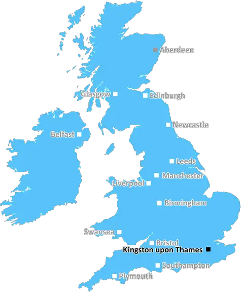
KT6 is a postcode district located in the Royal Borough of Kingston upon Thames, Greater London, England, and covers Old Malden, Coombe, New Malden and Kingston Vale. It is about 11 miles (18 km) south-west of central London and is criss-crossed by the A3 trunk road which provides access to central London, the M25 orbital motorway (which lies to the north) and Heathrow Airport.
KT6 is a mainly residential area, but the area also includes retail, leisure and educational facilities. Major shopping and leisure facilities exist in the form of New Malden's centre, Kingston Vale Business Park and the enormous retail facilities at New Malden's shopping centre, which includes supermarkets, restaurants, banks and other specialist shops.
The area also offers some open spaces, from public parks to woodland. Cannizaro Park offers 39 hectares of parkland, formal gardens, grassland, woodlands and ponds, while Coombe Wood is a mature and beautiful ancient woodland, located on the boundary between Coombe and New Malden. There are also two golf courses; Tolworth Court and Burhill Golf Course.
In terms of housing, KT6 provides a variety of both private and public housing, ranging from flats, terraced properties, semis and detached dwellings, in the form of new-builds and period style homes. Properties are available to rent as well as to buy.
Transport links from KT6 are good, serviced by trains from nearby Norbiton station, which is just outside the boundary of the postcode, as well as buses from New Malden High Street and Kingston Vale to Wimbledon, Richmond, the West End, Guildford and beyond.
The area is well-served for education from nursery to secondary levels, including some outstanding International schools such as Kingston Grammar and Tiffin Girls. The surrounding areas, namely, Kingston, New Malden, Hook and Raynes Park are all within a comfortable reach, and have an array of amenities and facilities open to the residents of KT6.

Demographics

Greater London

KT6 is located in the county of Greater London, in England.
Greater London has a total population of 8,778,500, making it the 1st largest county in the UK.
Greater London has a total area of 606 square miles, and a population density of 5594 people per square kilometre. For comparison, Greater London has a density of 5,618 people/km2.
| Outward Code | KT6 |
| Postal Town | Kingston Upon Thames |
| MSOA Name | Kingston upon Thames 011 |
| LSOA Name | Kingston upon Thames 011D |
| County | Greater London |
| Region | Greater London |
| Country | England |
| Local Authority | Kingston upon Thames |
| Area Classification | Urban with Major Conurbation |
KT6 Electoral Wards
The postal region of KT6, includes the local towns, villages, electoral wards and stations of:
Dig even deeper into the KT6 postcode by clicking on a postcode below:
Click on an outward postal code below for more information about the area. Each 'outward' postcode give you a comprehensive list of all postcodes within the outward code area (KT) and estimated address.
Click on an 'outward' code for more information. For example, the outward postcode page 'EC2M' will give you an alphabetical list covering all postcodes located in the region, from 'EC2M 1BB' through to 'EC2M 7YA'.
KT6 , Kingston Upon Thames
Sunday, July 2, 2023
Hi cen you send water bill please
Add your view of KT6
People need your local expertise. If you live in KT6 or have first-hand knowledge of the neighbourhood, please consider sharing your views. It's completely anonymous - all we ask is for your initials.
Please tell us what you like about the KT6 postcode area, what you don't like, and what it's like to live or work here.
| LOCAL AMENITIES | |
| FAMILY FRIENDLY | |
| PARKING | |
| GREEN SPACES |
Local News Surrey
Wealdstone 4-2 Dorking Wanderers
Dorking are close to the drop after letting a two-goal lead slip to lose at fellow National League strugglers Wealdstone.
BBC NewsPCC candidates say visible patrols reduce shoplifting
Surrey's PCC candidates have called for high profile policing to tackle rising levels of shoplifting.
BBC NewsEx-Post Office manager apologises for celebrating after Surrey subpostmistress jailed
Mrs Misra began running a Post Office in West Byfleet, Surrey and was accused of stealing 74,000
Get SurreySurrey sports' club's 'superscale' expansion sparks fears of 'ruining village feel'
Banstead Cricket Club said it has been in the community for more than 150 years and wants to work with neighbours - it does not want to become an events business
Get SurreyMissing teenager, 15, disappears again a day after being found
Surrey Police are now appealing again to the public to find him
Get SurreySurrey Fire and Rescue improves after concerns
Inspectors say "considerable work" has been carried out after shortcomings were found.
BBC NewsWrexham edge closer to promotion with Crawley win
Wrexham move a step closer to securing promotion to League One with an impressive victory over Crawley Town.
BBC NewsThe Surrey roads where potholes will be fixed with new funding
Surrey County Council has shared details of its road resurfacing plans
Get SurreyFrom the Postcode Area blog

Deciphering Crime Rates - a Deep Dive Into UK Postcode Analysis
Ever wondered about the crime rate in your UK postcode? You're not alone. We've dug deep into the data, uncovering trends and patterns that'll make your head spin.

Death of the High Street?
The BBC reports that despite councils' attempts to kurb them, the UK's high streets have seen a huge growth in fast food outlets. Could this mark the death knell for the Great British high street, and what can we do about it to halt its decline?

Discrimination by Postcode
You really couldn't make it up, could you? Some of the country's most vulnerable people are missing out on their weekly £25 Cold Weather Payment, just because the system that's in operation is discriminating against them because payments are based on postcode, rather than geographic location.

The Redesign is Underway
Well, the current website was absolutely in dire need of a good redesign - from the ground up. So I set out to pull it all apart and get it up and running again to become the most comprehensive guide to every postcode in the UK. And it's been a long, tough job from start to finish - and quite possibly the biggest project I've ever undertaken.
SOCIAL GRADES
According to census records, 40% of people here have a social grade of AB (highest), compared to the national average of 27%.