kingston-upon-thames KT16 Postcodes
Spending a fortune on conveyancing?

Compare instant, low-cost online quotes from trusted conveyancing solicitors.
Backed by experts, our no-obligation service searches through the best conveyancing quotes on the market to save you time and money.
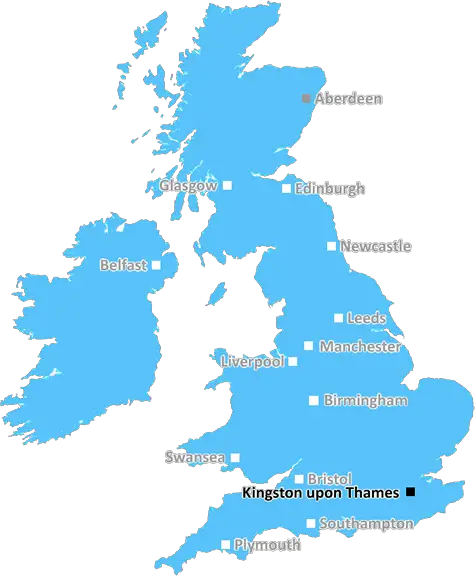
Kingston Upon Thames (KT16)
The KT16 postcode area is located in the Kingston Upon Thames postcode town region, within the county of Surrey, and contains a total of 864 individual postcodes.
There are 21 electoral wards in the KT16 postcode area, including Addlestone, Ashtead, Chertsey, Chessington, Cobham, East Molesey, Epsom, Esher, Kingston Upon Thames, Leatherhead, New Malden, Surbiton, Tadworth, Thames Ditton, Walton-On-Thames, West Byfleet, West Molesey, Weybridge, Worcester Park which come under the local authority of the Runnymede Council.
Combining the whole postcode region, 30% of people in KT16 are classed as having an AB social grade, (i.e. 'white-collar' middle-upper class), compared to 27% across the UK.
This does not mean that the people of KT16 are wealthier - or higher class - than average, but it can be an indication that the area may be prospering and desirable to live in.
KT16 is a postcode district within the Kingston upon Thames post town, located in the Royal Borough of Surrey, southwest London. The area is bounded by the M25 motorway to the north, the town of Chertsey to the west, and the London Borough of Richmond upon Thames to the south.
KT16 covers the geographical locales of Addlestone, Woodham, Ottershaw, Lyne, Pyrford, Byfleet, New Haw, West Byfleet and the eastern half of the town of Weybridge.
It has good access to London � it's a 25 minute journey by rail to the centre of the city. There are several railway stations within the postcode district, including Junction Station (which services Staines, Reading and London Waterloo) and Byfleet and New Haw Station (which services Woking, Waterloo and London Victoria). In addition, the postcode district is served by numerous other transport links, including buses and an underground line.
KT16 is known for its green open spaces, with many parks and sports grounds, such as Horne Park, Paddock Field and The Green. The area is also home to some well known businesses, including McLaren Automotive and Oakleaf Golf Club.
The postcode district is notable for its thriving education sector � featuring a diverse range of schools, such as Inchmery Primary School, St John's Primary School and the highly rated Tiffin School. The district also has a high number of independent schools, such as Waverley School, St Andrew's School and Barrow Hills.
In terms of culture, the postcode offers a variety of local pubs, restaurants and cafe culture, as well as galleries and cultural centres such as Addlestone Cornerstone Arts Centre. Popular amenities in the postcode district include cinemas, libraries and leisure centres, such as the Edge and the Lion Centre.
KT16 is home to a wide variety of housing, from older Victorian and Edwardian terraced homes and cottages, to modern estates, townhouses and flats. Prices in the area have continued to rise over the last few years, making it an attractive location for investment.

Demographics

Surrey

KT16 is located in the county of Surrey, in England.
Surrey has a total population of 1,176,500, making it the 13th largest county in the UK.
Surrey has a total area of 642 square miles, and a population density of 707 people per square kilometre. For comparison, Greater London has a density of 5,618 people/km2.
| Outward Code | KT16 |
| Postal Town | Kingston Upon Thames |
| MSOA Name | Runnymede 008 |
| LSOA Name | Runnymede 008A |
| County | Surrey |
| Region | Surrey |
| Country | England |
| Local Authority | Runnymede |
| Area Classification | Urban with Major Conurbation |
KT16 Electoral Wards
The postal region of KT16, includes the local towns, villages, electoral wards and stations of:
Dig even deeper into the KT16 postcode by clicking on a postcode below:
Click on an outward postal code below for more information about the area. Each 'outward' postcode give you a comprehensive list of all postcodes within the outward code area (KT) and estimated address.
Click on an 'outward' code for more information. For example, the outward postcode page 'EC2M' will give you an alphabetical list covering all postcodes located in the region, from 'EC2M 1BB' through to 'EC2M 7YA'.
Chris H
Monday, April 8, 2024
We don't have any views of KT16 right now. If you live in KT16 or have visited it, please help us to help others by telling others what you think of this neighbourhood.
Add your view of KT16
People need your local expertise. If you live in KT16 or have first-hand knowledge of the neighbourhood, please consider sharing your views. It's completely anonymous - all we ask is for your initials.
Please tell us what you like about the KT16 postcode area, what you don't like, and what it's like to live or work here.
| LOCAL AMENITIES | |
| FAMILY FRIENDLY | |
| PARKING | |
| GREEN SPACES |
Local News Surrey
Surrey weather latest as 'mini heatwave' forecast this weekend with temperature of 19C
Guildford, Dorking and Staines to see temperatures in the high teens
Get SurreyResidents of closing care unit yet to get new home
Council working to find new accommodation for six residents of Jutland Place which is closing.
BBC NewsPolice appeal for suspects who 'assaulted Ashford Superdrug staff' before 'stealing hayfever medication'
Two suspects entered the Station Road store, assaulting staff before leaving with hay fever medication
Get Surrey'Heartbreaking' vandalism of Reigate Scouts minibus torched and abandoned in field
This is the second time one of the unit's mini buses has been targeted
Get SurreyInside the stunning 1.5m Dorking barn with garden that looks like tropical resort
The property is nestled within the countryside
Get SurreyPost Office bosses earned millions despite scandal
Top executives have made 19.4m over 24 years since the flawed IT system was in place
BBC NewsWarning to NHS after Surrey man's death could have been prevented if hospital bed free
A man tragically took his own life after a mental health relapse, prompting a coroner to warn of a shortage of psychiatric beds in hospitals
Get SurreyEnglish amateur Woad, 20, wins at Augusta
England's Lottie Woad birdies the final two holes to win the Augusta National Women's Amateur.
BBC NewsFrom the Postcode Area blog

Deciphering Crime Rates - a Deep Dive Into UK Postcode Analysis
Ever wondered about the crime rate in your UK postcode? You're not alone. We've dug deep into the data, uncovering trends and patterns that'll make your head spin.

Death of the High Street?
The BBC reports that despite councils' attempts to kurb them, the UK's high streets have seen a huge growth in fast food outlets. Could this mark the death knell for the Great British high street, and what can we do about it to halt its decline?

Discrimination by Postcode
You really couldn't make it up, could you? Some of the country's most vulnerable people are missing out on their weekly £25 Cold Weather Payment, just because the system that's in operation is discriminating against them because payments are based on postcode, rather than geographic location.

The Redesign is Underway
Well, the current website was absolutely in dire need of a good redesign - from the ground up. So I set out to pull it all apart and get it up and running again to become the most comprehensive guide to every postcode in the UK. And it's been a long, tough job from start to finish - and quite possibly the biggest project I've ever undertaken.
SOCIAL GRADES
According to census records, 30% of people here have a social grade of AB (highest), compared to the national average of 27%.