oxford OX5 Postcodes
Spending a fortune on conveyancing?

Compare instant, low-cost online quotes from trusted conveyancing solicitors.
Backed by experts, our no-obligation service searches through the best conveyancing quotes on the market to save you time and money.
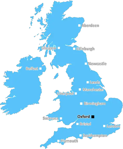
Oxford (OX5)
The OX5 postcode area is located in the Oxford postcode town region, within the county of Oxfordshire, and contains a total of 1229 individual postcodes.
There are 41 electoral wards in the OX5 postcode area, including Abingdon, Bampton, Banbury, Bicester, Burford, Carterton, Chinnor, Chipping Norton, Didcot, Kidlington, Oxford, Thame, Wallingford, Wantage, Watlington, Witney, Woodstock which come under the local authority of the Cherwell Council.
Combining the whole postcode region, 33% of people in OX5 are classed as having an AB social grade, (i.e. 'white-collar' middle-upper class), compared to 27% across the UK.
This does not mean that the people of OX5 are wealthier - or higher class - than average, but it can be an indication that the area may be prospering and desirable to live in.
The OX5 postcode of Oxford District encompasses a total of three post towns - Headington, Kidlington and Yarnton. It includes the area of Woodstock and Bladon which lies to the north-west of the city of Oxford. This is a mostly rural area in the Oxfordshire County.
The OX5 postcode covers an area of 84 square miles and the main villages and settlements of this area include Yarnton, Middle Aston, Lower Heyford, Godington, Tackley, Begbroke, Bladon, Wootton, Launton, Steeple Aston, Eynsham, Freeland, Wootton, Water Eaton and Nuneham Courtenay. This stretch of land also includes the Pennefathers Farm, the Blackthorn Railway Junction and the Blenheim Palace.
Within this postcode area, one can access a wide range of amenities that are available in the villages and settlements. These range from supermarkets to pubs, coffee shops, restaurants, banks, post offices, libraries, churches, health centres and leisure centres. For entertainment, the area has its own multiplex, Clifton Centre theatre and cinemas located within it.
In terms of transport, the area is served by several bus routes, trains (from Oxford and London), as well as Oxford Airport and Oxford Parkway railway station. The area is also served by several bus routes including the X90 which goes through Oxford and Kidlington, connecting the two towns.
For education purposes, the area has its own two sixth form colleges, as well as several primary and secondary schools. These include the Oxford Academy, Wood Green School and the Henry Box School. The area is very much green and offers a lot of activities for outdoor fun such as horse riding, hiking, cycling, bowling green and cricket and it is popular with tourists and locals alike.

Demographics

Oxfordshire

OX5 is located in the county of Oxfordshire, in England.
Oxfordshire has a total population of 683,200, making it the 35th largest county in the UK.
Oxfordshire has a total area of 1005 square miles, and a population density of 262 people per square kilometre. For comparison, Greater London has a density of 5,618 people/km2.
| Outward Code | OX5 |
| Postal Town | Oxford |
| MSOA Name | Cherwell 017 |
| LSOA Name | Cherwell 017D |
| County | Oxfordshire |
| Region | Oxfordshire |
| Country | England |
| Local Authority | Cherwell |
| Area Classification | Urban with Significant Rural (rural including hub towns 26-49%) |
OX5 Electoral Wards
The postal region of OX5, includes the local towns, villages, electoral wards and stations of:
Dig even deeper into the OX5 postcode by clicking on a postcode below:
Click on an outward postal code below for more information about the area. Each 'outward' postcode give you a comprehensive list of all postcodes within the outward code area (OX) and estimated address.
Click on an 'outward' code for more information. For example, the outward postcode page 'EC2M' will give you an alphabetical list covering all postcodes located in the region, from 'EC2M 1BB' through to 'EC2M 7YA'.
Chris H
Wednesday, April 10, 2024
We don't have any views of OX5 right now. If you live in OX5 or have visited it, please help us to help others by telling others what you think of this neighbourhood.
Add your view of OX5
People need your local expertise. If you live in OX5 or have first-hand knowledge of the neighbourhood, please consider sharing your views. It's completely anonymous - all we ask is for your initials.
Please tell us what you like about the OX5 postcode area, what you don't like, and what it's like to live or work here.
| LOCAL AMENITIES | |
| FAMILY FRIENDLY | |
| PARKING | |
| GREEN SPACES |
Local News Oxfordshire
Northern lights put on spectacular surprise display
Northern lights give spectacular surprise display
BBC NewsScientists in awe of detail in telescope photos
Nasa releases images of 19 spiral galaxies taken from the James Webb Space Telescope.
BBC NewsHomes England acquires Worthing site to deliver 250 homes
The acquisition forms part of the body's plans to regenerate challenging brownfield areas.
Property WeekBarnet 3-1 Oxford City
Nicke Kabamba scores twice as leading National League play-off contenders Barnet beat bottom club Oxford City.
BBC NewsCambridge complete Boat Race double over Oxford
Cambridge win both the men's and women's Boat Races for the second year running.
BBC NewsOfsted says county's children services are 'good'
Ofsted has judged Oxfordshire County Council's children's services as good as part of an inspection in February.
BBC NewsPortsmouth NHS trust takes offices at Lakeside North Harbour
The trust has signed a 10-year lease for space at the business park.
Property WeekOxford United 4-0 Fleetwood Town
Mark Harris scores twice as Oxford rekindle their push for a League One play-off place with a 4-0 victory over struggling Fleetwood Town.
BBC NewsFrom the Postcode Area blog

Deciphering Crime Rates - a Deep Dive Into UK Postcode Analysis
Ever wondered about the crime rate in your UK postcode? You're not alone. We've dug deep into the data, uncovering trends and patterns that'll make your head spin.

Death of the High Street?
The BBC reports that despite councils' attempts to kurb them, the UK's high streets have seen a huge growth in fast food outlets. Could this mark the death knell for the Great British high street, and what can we do about it to halt its decline?

Discrimination by Postcode
You really couldn't make it up, could you? Some of the country's most vulnerable people are missing out on their weekly £25 Cold Weather Payment, just because the system that's in operation is discriminating against them because payments are based on postcode, rather than geographic location.

The Redesign is Underway
Well, the current website was absolutely in dire need of a good redesign - from the ground up. So I set out to pull it all apart and get it up and running again to become the most comprehensive guide to every postcode in the UK. And it's been a long, tough job from start to finish - and quite possibly the biggest project I've ever undertaken.
SOCIAL GRADES
According to census records, 33% of people here have a social grade of AB (highest), compared to the national average of 27%.