northampton NN14 Postcodes
Spending a fortune on conveyancing?

Compare instant, low-cost online quotes from trusted conveyancing solicitors.
Backed by experts, our no-obligation service searches through the best conveyancing quotes on the market to save you time and money.
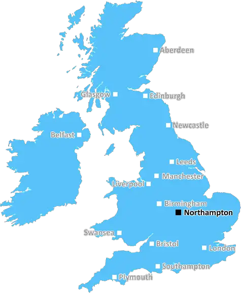
Northampton (NN14)
The NN14 postcode area is located in the Northampton postcode town region, within the county of Northamptonshire, and contains a total of 1421 individual postcodes.
There are 66 electoral wards in the NN14 postcode area, including Brackley, Corby, Daventry, Kettering, Northampton, Rushden, Towcester, Wellingborough which come under the local authority of the Kettering Council.
Combining the whole postcode region, 27% of people in NN14 are classed as having an AB social grade, (i.e. 'white-collar' middle-upper class), compared to 27% across the UK.
This does not mean that the people of NN14 are poorer than other areas, but it may give an indication that there are areas of deprivation.
NN14 postcode is located in the Kettering, Corby and Northampton district, England. It covers a geographical area spanning the northern part of Kettering Borough, the eastern part of Corby Borough and the southern part of Northampton Borough. It is a mainly rural area situated towards the western end of the Nene Valley and includes the villages of Little Cransley, Desborough, Great Folds, Great Oakley and Zeals.
The postcode is approximately 5 miles (8 km) west of the bustling town of Corby, 12 miles (19 km) north-west of the county town of Northampton and 18 miles (29 km) east of Market Harborough. Nearby places of interest include the stately house of Rushton Triangular Lodge, the Kelmarsh Hall, the 18th century Lyveden New Bield and the Walpoles which are Early Saxon structures.
The area is served by several transport links, including the A14, A45 and A43 roads, making it easily accessible from both Corby and Northampton in the south and Peterborough in the north. There is a regular bus service to Kettering and Corby, as well as rail links from the nearby station at Kettering.
The postcode is made up of a combination of residential and commercial property, with an even split between the two categories. The majority of the housing in the area consists of terraced and semi-detached properties as well as a few detached houses.
NN14 postcode area also has a number of public parks and open spaces where visitors can enjoy outdoor activities, such as walking, bird watching and fishing as well as various sports including cricket and football. Additionally, the area is home to a number of local primary and secondary educational establishments, which receive a high level of attendance from both students and staff.
Finally, the region has become known as an excellent shopping destination, with a variety of shops and supermarkets providing goods and amenities to its locals. This includes shops for fashion and footwear, household items, furniture, home and garden goods and food and drink.

Demographics

Northamptonshire

NN14 is located in the county of Northamptonshire, in England.
Northamptonshire has a total population of 733,100, making it the 33rd largest county in the UK.
Northamptonshire has a total area of 913 square miles, and a population density of 310 people per square kilometre. For comparison, Greater London has a density of 5,618 people/km2.
| Outward Code | NN14 |
| Postal Town | Northampton |
| MSOA Name | Kettering 001 |
| LSOA Name | Kettering 001B |
| County | Northamptonshire |
| Region | Northamptonshire |
| Country | England |
| Local Authority | Kettering |
| Area Classification | Urban with City and Town |
NN14 Electoral Wards
The postal region of NN14, includes the local towns, villages, electoral wards and stations of:
Dig even deeper into the NN14 postcode by clicking on a postcode below:
Click on an outward postal code below for more information about the area. Each 'outward' postcode give you a comprehensive list of all postcodes within the outward code area (NN) and estimated address.
Click on an 'outward' code for more information. For example, the outward postcode page 'EC2M' will give you an alphabetical list covering all postcodes located in the region, from 'EC2M 1BB' through to 'EC2M 7YA'.
Chris H
Thursday, May 16, 2024
We don't have any views of NN14 right now. If you live in NN14 or have visited it, please help us to help others by telling others what you think of this neighbourhood.
Add your view of NN14
People need your local expertise. If you live in NN14 or have first-hand knowledge of the neighbourhood, please consider sharing your views. It's completely anonymous - all we ask is for your initials.
Please tell us what you like about the NN14 postcode area, what you don't like, and what it's like to live or work here.
| LOCAL AMENITIES | |
| FAMILY FRIENDLY | |
| PARKING | |
| GREEN SPACES |
Local News Northamptonshire
Pedestrian, 75, dies two weeks after road crash
A teenage motorist arrested on suspicion of causing serious injury by dangerous driving is on bail.
BBC NewsMental health charity volunteers attend royal party
Mary Oxley, 94, and Roger Brewer, 79, said it was a "dream" to attend the event at Buckingham Palace.
BBC NewsNon-league club's proposed ground move called off
AFC Rushden & Diamonds will no longer be playing at Wellingborough Town's Dog and Duck next season.
BBC NewsLocal election results in maps and charts
Analysis of results in the local elections 2024, including the London mayor and councils around England.
BBC NewsWatch: Lorry crashes into horsebox on motorway
A driver is jailed after his lorry ploughed into the back of a horsebox that had broken down.
BBC News'It's amazing to see our skatepark open at last'
Alfie and Jamie are delighted to see the facility they campaigned for up and running.
BBC NewsMidfielder Fox agrees new contract at Northampton
Northampton Town midfielder Ben Fox agrees a new 12-month contract, with an option for a further year.
BBC NewsBoy and grandad make dinosaur discovery at park
Experts say the footprint probably belongs to a megalosaurus.
BBC NewsFrom the Postcode Area blog

Deciphering Crime Rates - a Deep Dive Into UK Postcode Analysis
Ever wondered about the crime rate in your UK postcode? You're not alone. We've dug deep into the data, uncovering trends and patterns that'll make your head spin.

Death of the High Street?
The BBC reports that despite councils' attempts to kurb them, the UK's high streets have seen a huge growth in fast food outlets. Could this mark the death knell for the Great British high street, and what can we do about it to halt its decline?

Discrimination by Postcode
You really couldn't make it up, could you? Some of the country's most vulnerable people are missing out on their weekly £25 Cold Weather Payment, just because the system that's in operation is discriminating against them because payments are based on postcode, rather than geographic location.

The Redesign is Underway
Well, the current website was absolutely in dire need of a good redesign - from the ground up. So I set out to pull it all apart and get it up and running again to become the most comprehensive guide to every postcode in the UK. And it's been a long, tough job from start to finish - and quite possibly the biggest project I've ever undertaken.
SOCIAL GRADES
According to census records, 27% of people here have a social grade of AB (highest), compared to the national average of 27%.