ipswich IP29 Postcodes
Spending a fortune on conveyancing?

Compare instant, low-cost online quotes from trusted conveyancing solicitors.
Backed by experts, our no-obligation service searches through the best conveyancing quotes on the market to save you time and money.
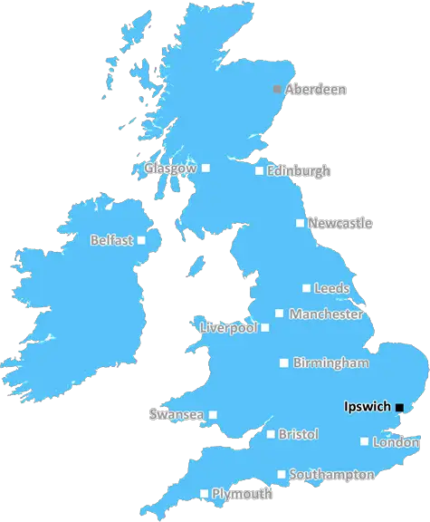
Ipswich (IP29)
The IP29 postcode area is located in the Ipswich postcode town region, within the county of Suffolk, and contains a total of 472 individual postcodes.
There are 81 electoral wards in the IP29 postcode area, including Aldeburgh, Brandon, Bury St Edmunds, Diss, Eye, Felixstowe, Halesworth, Harleston, Ipswich, Leiston, Saxmundham, Southwold, Stowmarket, Thetford, Woodbridge which come under the local authority of the St Edmundsbury Council.
Combining the whole postcode region, 26% of people in IP29 are classed as having an AB social grade, (i.e. 'white-collar' middle-upper class), compared to 27% across the UK.
This does not mean that the people of IP29 are poorer than other areas, but it may give an indication that there are areas of deprivation.
The IP29 postcode is situated in the Ipswich district of the UK. It is located in the historic county of Suffolk, and covers a stretch of land running from Rattlesden in the south, to Lavenham in the north, and from Sproughton in the west to Nedging-Tye in the east.
The area is home to some delightful countryside, including picturesque rolling hills, woodlands, rivers and meadows. The Ipswich and Stowmarket branch of the Mid-Suffolk Light Railway, Britain's last remaining light railway, passes through the area, as does the Rivers Brett and Gipping. The A45 and A143 also form major trunks of the IP29 region.
The area boasts a strong local economy and community spirit, with a large number of local businesses and organisations that serve both the local population and tourists from further afield. There are a variety of shops, pubs, restaurants, cafes, art galleries, and other leisure activities in the region, as well as two local secondary schools and one academy.
Sites of interest in the IP29 postcode area include the Lavenham Guildhall, a Grade I listed building, Rushbrooke Hall, the beautiful church of St Mary's and Holy Trinity, the 17th century manor house of Rushbrooke Hall, and the former wool mill of Elmswell Mill. The nearby Middleton Woods are popular with walkers, while the parish church of St Mary's in Polstead is well known for its wall paintings, which date back to the middle ages.
Ipswich is only a short drive away, and provides access to some of the East of England's most vibrant cities. It also provides access to picturesque coastal towns such as Southwold, Aldeburgh and Thorpeness.

Demographics

Suffolk

IP29 is located in the county of Suffolk, in England.
Suffolk has a total population of 745,300, making it the 32nd largest county in the UK.
Suffolk has a total area of 1500 square miles, and a population density of 196 people per square kilometre. For comparison, Greater London has a density of 5,618 people/km2.
| Outward Code | IP29 |
| Postal Town | Ipswich |
| MSOA Name | St Edmundsbury 010 |
| LSOA Name | St Edmundsbury 010A |
| County | Suffolk |
| Region | Suffolk |
| Country | England |
| Local Authority | St Edmundsbury |
| Area Classification | Largely Rural (rural including hub towns 50-79%) |
IP29 Electoral Wards
The postal region of IP29, includes the local towns, villages, electoral wards and stations of:
Dig even deeper into the IP29 postcode by clicking on a postcode below:
Click on an outward postal code below for more information about the area. Each 'outward' postcode give you a comprehensive list of all postcodes within the outward code area (IP) and estimated address.
Click on an 'outward' code for more information. For example, the outward postcode page 'EC2M' will give you an alphabetical list covering all postcodes located in the region, from 'EC2M 1BB' through to 'EC2M 7YA'.
Chris H
Friday, March 29, 2024
We don't have any views of IP29 right now. If you live in IP29 or have visited it, please help us to help others by telling others what you think of this neighbourhood.
Add your view of IP29
People need your local expertise. If you live in IP29 or have first-hand knowledge of the neighbourhood, please consider sharing your views. It's completely anonymous - all we ask is for your initials.
Please tell us what you like about the IP29 postcode area, what you don't like, and what it's like to live or work here.
| LOCAL AMENITIES | |
| FAMILY FRIENDLY | |
| PARKING | |
| GREEN SPACES |
Local News Suffolk
Dental plan 'fundamentally flawed' say campaigners
Toothless in England say the strategy is "underdeveloped and lacks real evidence".
BBC NewsIpswich Women relish Portman Road 'showcase'
Ipswich boss Joe Sheehan believes inspiring young girls is more important than the result when the women's team play at Portman Road for the first time.
BBC Newse-sports course for the University of Suffolk
The University is launching a new course for students who want to create online sports
BBC NewsMini racer Walmsley targets first top-three finish
Suffolk driver Lydia Walmsley is targeting a first podium finish in this year's Mini Challenge JCW Championship.
BBC NewsSweet stall made to leave market shuts for last time
The council issued a termination notice and says the market needs a "healthy" rebrand to survive.
BBC NewsUniversity to run 'cutting-edge' esports degree
The University of Suffolk will accept its first competitive video gaming students in 2025.
BBC NewsButley ferryman: Titanic connection
It hasn't sunk yet!
BBC NewsMan in court accused of rape and strangulation
Matthew Edgerton is remanded in custody until the next hearing in April.
BBC NewsFrom the Postcode Area blog

Deciphering Crime Rates - a Deep Dive Into UK Postcode Analysis
Ever wondered about the crime rate in your UK postcode? You're not alone. We've dug deep into the data, uncovering trends and patterns that'll make your head spin.

Death of the High Street?
The BBC reports that despite councils' attempts to kurb them, the UK's high streets have seen a huge growth in fast food outlets. Could this mark the death knell for the Great British high street, and what can we do about it to halt its decline?

Discrimination by Postcode
You really couldn't make it up, could you? Some of the country's most vulnerable people are missing out on their weekly £25 Cold Weather Payment, just because the system that's in operation is discriminating against them because payments are based on postcode, rather than geographic location.

The Redesign is Underway
Well, the current website was absolutely in dire need of a good redesign - from the ground up. So I set out to pull it all apart and get it up and running again to become the most comprehensive guide to every postcode in the UK. And it's been a long, tough job from start to finish - and quite possibly the biggest project I've ever undertaken.
SOCIAL GRADES
According to census records, 26% of people here have a social grade of AB (highest), compared to the national average of 27%.