hull HU1 Postcodes
Spending a fortune on conveyancing?

Compare instant, low-cost online quotes from trusted conveyancing solicitors.
Backed by experts, our no-obligation service searches through the best conveyancing quotes on the market to save you time and money.
Hull (HU1)
The HU1 postcode area is located in the Hull postcode town region, within the county of Yorkshire, and contains a total of 767 individual postcodes.
There are 0 electoral wards in the HU1 postcode area, including Beverley, Brough, Cottingham, Hessle, Hornsea, Hull, North Ferriby, Withernsea which come under the local authority of the Kingston upon Hull, City of Council.
Combining the whole postcode region, 19% of people in HU1 are classed as having an AB social grade, (i.e. 'white-collar' middle-upper class), compared to 27% across the UK.
This does not mean that the people of HU1 are poorer than other areas, but it may give an indication that there are areas of deprivation.
HU1 postcode is one of the 18 postcode districts in and around Hull, a city in the Yorkshire and Humberside region in England. It is centred around Hull town centre and also includes areas such as St. Andrew's Quay, Alexandra Dock, Albert Avenue and Hessle.
The local education authority for all of postcode district HU1 is Hull City Council. It is an area which has improved its schools significantly over the past few years, with many seeing improved Ofsted ratings in recent inspections. There are a range of educational options available, from nurseries, primary and secondary schools to sixth form colleges, special schools and the University of Hull.
The main shopping area of Hull is located in the HU1 district, and the city centre houses a range of high street stores and a variety of boutique and independent shops. There are also two large shopping centres, St Stephen's and Princes Quay. There are a range of markets, including the Humber Street Market in the Fruit Market area of the city centre, which offer local foods and produce to customers throughout the week.
Transportation links in the HU1 postcode are well-developed, with numerous bus stops serving the area, as well as a number of taxi networks. Hull is served by Paragon Interchange, which is the main railway station and provides direct services to and from a number of major cities including London and Leeds.
The area is also well-connected to the rest of the UK, given its location on the Humber Estuary, with fast ferry services operating between Hull and the ports of Rotterdam, Zeebrugge and Copenhagen. There is also access to a regional airport located south of the city centre.
HU1 postcode is a vibrant area which is rapidly developing and is home to a number of historical sites such as the Museum Quarter, Hull Maritime Museum, The Deep and the Rivers of Hull and Humber. The district offers plenty of entertainment and leisure options with venues such as Hull New Theatre, Bonus Arena and Hull City Hall offering concerts, plays and other events.
There are several parks and recreational areas located in the HU1 postcode, which provides a great place to relax and enjoy the outdoors, including Pearson Park, West Park and Pickering Parks. The area has also seen an increase in housing development in recent years, with new developments popping up to meet the demand for city-living.

Demographics
Yorkshire

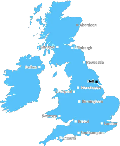
HU1 is located in the county of Yorkshire, in England.
Yorkshire has a total population of 0, making it the largest county in the UK.
Yorkshire has a total area of square miles, and a population density of people per square kilometre. For comparison, Greater London has a density of 5,618 people/km2.
| Outward Code | HU1 |
| Postal Town | Hull |
| MSOA Name | Kingston upon Hull 029 |
| LSOA Name | Kingston upon Hull 029E |
| County | Yorkshire |
| Region | Yorkshire |
| Country | England |
| Local Authority | Kingston upon Hull, City of |
| Area Classification | Urban with City and Town |
HU1 Electoral Wards
The postal region of HU1, includes the local towns, villages, electoral wards and stations of:
Dig even deeper into the HU1 postcode by clicking on a postcode below:
Click on an outward postal code below for more information about the area. Each 'outward' postcode give you a comprehensive list of all postcodes within the outward code area (HU) and estimated address.
Click on an 'outward' code for more information. For example, the outward postcode page 'EC2M' will give you an alphabetical list covering all postcodes located in the region, from 'EC2M 1BB' through to 'EC2M 7YA'.
Chris H
Sunday, April 7, 2024
We don't have any views of HU1 right now. If you live in HU1 or have visited it, please help us to help others by telling others what you think of this neighbourhood.
Add your view of HU1
People need your local expertise. If you live in HU1 or have first-hand knowledge of the neighbourhood, please consider sharing your views. It's completely anonymous - all we ask is for your initials.
Please tell us what you like about the HU1 postcode area, what you don't like, and what it's like to live or work here.
| LOCAL AMENITIES | |
| FAMILY FRIENDLY | |
| PARKING | |
| GREEN SPACES |
From the Postcode Area blog

Deciphering Crime Rates - a Deep Dive Into UK Postcode Analysis
Ever wondered about the crime rate in your UK postcode? You're not alone. We've dug deep into the data, uncovering trends and patterns that'll make your head spin.

Death of the High Street?
The BBC reports that despite councils' attempts to kurb them, the UK's high streets have seen a huge growth in fast food outlets. Could this mark the death knell for the Great British high street, and what can we do about it to halt its decline?

Discrimination by Postcode
You really couldn't make it up, could you? Some of the country's most vulnerable people are missing out on their weekly £25 Cold Weather Payment, just because the system that's in operation is discriminating against them because payments are based on postcode, rather than geographic location.

The Redesign is Underway
Well, the current website was absolutely in dire need of a good redesign - from the ground up. So I set out to pull it all apart and get it up and running again to become the most comprehensive guide to every postcode in the UK. And it's been a long, tough job from start to finish - and quite possibly the biggest project I've ever undertaken.
SOCIAL GRADES
According to census records, 19% of people here have a social grade of AB (highest), compared to the national average of 27%.