huddersfield HD6 Postcodes
Spending a fortune on conveyancing?

Compare instant, low-cost online quotes from trusted conveyancing solicitors.
Backed by experts, our no-obligation service searches through the best conveyancing quotes on the market to save you time and money.
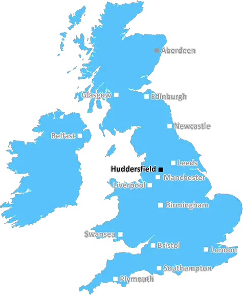
Huddersfield (HD6)
The HD6 postcode area is located in the Huddersfield postcode town region, within the county of West Yorkshire, and contains a total of 1057 individual postcodes.
There are 19 electoral wards in the HD6 postcode area, including Brighouse, Holmfirth, Huddersfield which come under the local authority of the Calderdale Council.
Combining the whole postcode region, 24% of people in HD6 are classed as having an AB social grade, (i.e. 'white-collar' middle-upper class), compared to 27% across the UK.
This does not mean that the people of HD6 are poorer than other areas, but it may give an indication that there are areas of deprivation.
The HD6 postcode is a postcode in the Huddersfield District of West Yorkshire, England. It covers the western parts of the Huddersfield Borough, stretching from Birkby and Bradley through to Deighton and Sheepridge. HD6 is a well-serviced area, boasting numerous convenience stores, supermarkets and other shops in addition to leisure and entertainment facilities such as pubs, cafes, restaurants and cinemas.
HD6 is home to a variety of places of worship including Cross-Lane Baptist Church which has been in existence since 1907 and All Nations Church which was established in 1999. Public transport in the area includes trains, buses and taxis running frequently throughout the day from Huddersfield station, providing connections to nearby towns and cities such as Halifax, Leeds and Bradford.
Education in HD6 encompasses both primary and secondary levels, with Rawthorpe High School, All Saints Catholic College and Fartown High School providing secondary level education, while there are an abundance of primary level schools too including Birkby Infant and Junior School and Rawthorpe Primary School.
The recreational opportunities in HD6 are diverse and cater to a variety of interests. The area boasts 8 parks, 3 recreational grounds, 4 playgrounds and the Examiner Stadium � the home of the Huddersfield Giants Rugby League Club. In addition, there are many shops, pubs, restaurants, churches and leisure facilities within HD6 making it very attractive to those looking to relocate to the area.
HD6 is also home to two NHS trusts; Calderdale and Huddersfield NHS Foundation Trust (CHFT) which provides mental health and learning disability services and serves both local and regional areas, and The Huddersfield Royal Infirmary which is a major hospital providing acute care services covering a wide variety of specialities.
In a 2014 national survey this area of the Huddersfield District was rated as being extensively greenfields and was officially located in the �rural' part of West Yorkshire, with a great sporting landscape, providing natural beauty and plentiful outdoor and leisure activities for residents to enjoy.

Demographics
West Yorkshire

HD6 is located in the county of West Yorkshire, in England.
West Yorkshire has a total population of 2,299,700, making it the 4th largest county in the UK.
West Yorkshire has a total area of 783 square miles, and a population density of 1133 people per square kilometre. For comparison, Greater London has a density of 5,618 people/km2.
| Outward Code | HD6 |
| Postal Town | Huddersfield |
| MSOA Name | Calderdale 019 |
| LSOA Name | Calderdale 019E |
| County | West Yorkshire |
| Region | West Yorkshire |
| Country | England |
| Local Authority | Calderdale |
| Area Classification | Urban with Major Conurbation |
HD6 Electoral Wards
The postal region of HD6, includes the local towns, villages, electoral wards and stations of:
Dig even deeper into the HD6 postcode by clicking on a postcode below:
Click on an outward postal code below for more information about the area. Each 'outward' postcode give you a comprehensive list of all postcodes within the outward code area (HD) and estimated address.
Click on an 'outward' code for more information. For example, the outward postcode page 'EC2M' will give you an alphabetical list covering all postcodes located in the region, from 'EC2M 1BB' through to 'EC2M 7YA'.
Chris H
Sunday, April 7, 2024
We don't have any views of HD6 right now. If you live in HD6 or have visited it, please help us to help others by telling others what you think of this neighbourhood.
Add your view of HD6
People need your local expertise. If you live in HD6 or have first-hand knowledge of the neighbourhood, please consider sharing your views. It's completely anonymous - all we ask is for your initials.
Please tell us what you like about the HD6 postcode area, what you don't like, and what it's like to live or work here.
| LOCAL AMENITIES | |
| FAMILY FRIENDLY | |
| PARKING | |
| GREEN SPACES |
Local News West Yorkshire
February 29: 'Leaplings' finally get to celebrate their birthdays
Three people in Yorkshire born on 29 February can only mark their "real" birthdays every four years.
BBC NewsNational Coal Mining Museum hosts miners' memories of 1980s strike
Memories of the 1984 miners' strike at centre of 40th anniversary exhibition.
BBC NewsHuddersfield Town 1-0 Millwall: Substitute Rhys Healey scores in added time to secure Town win
Substitute Rhys Healey's header deep into added time secures three points for Huddersfield in their fight to avoid Championship relegation.
BBC NewsElland waste tip to close for up to two weeks
The waste recycling centre's closure is to allow "essential drainage works" to take place.
BBC NewsRapper Ja Rule denied UK entry ahead of Cardiff gig
The musician says his criminal record was the reason he has to shelve the British leg of his tour.
BBC NewsLeeds woman given terminal diagnosis after doctors missed tumour on scan
Leeds NHS trust says it is "deeply sorry" after Anne Shaw's cancer went undiagnosed for two years.
BBC NewsHalifax volunteers save 99-year-old library from closure
Volunteers say they are determined to make the library a community focal point.
BBC NewsCoroner raises concern over indefinite jail terms after man's death
John Hobson has urged the Ministry of Justice to consider the impact on offender's mental health.
BBC NewsFrom the Postcode Area blog

Deciphering Crime Rates - a Deep Dive Into UK Postcode Analysis
Ever wondered about the crime rate in your UK postcode? You're not alone. We've dug deep into the data, uncovering trends and patterns that'll make your head spin.

Death of the High Street?
The BBC reports that despite councils' attempts to kurb them, the UK's high streets have seen a huge growth in fast food outlets. Could this mark the death knell for the Great British high street, and what can we do about it to halt its decline?

Discrimination by Postcode
You really couldn't make it up, could you? Some of the country's most vulnerable people are missing out on their weekly £25 Cold Weather Payment, just because the system that's in operation is discriminating against them because payments are based on postcode, rather than geographic location.

The Redesign is Underway
Well, the current website was absolutely in dire need of a good redesign - from the ground up. So I set out to pull it all apart and get it up and running again to become the most comprehensive guide to every postcode in the UK. And it's been a long, tough job from start to finish - and quite possibly the biggest project I've ever undertaken.
SOCIAL GRADES
According to census records, 24% of people here have a social grade of AB (highest), compared to the national average of 27%.