stevenage SG5 Postcodes
Spending a fortune on conveyancing?

Compare instant, low-cost online quotes from trusted conveyancing solicitors.
Backed by experts, our no-obligation service searches through the best conveyancing quotes on the market to save you time and money.
Stevenage (SG5)
The SG5 postcode area is located in the Stevenage postcode town region, within the county of Hertfordshire, and contains a total of 1311 individual postcodes.
There are 57 electoral wards in the SG5 postcode area, including Arlesey, Baldock, Biggleswade, Buntingford, Henlow, Hertford, Hitchin, Knebworth, Letchworth Garden City, Much Hadham, Royston, Sandy, Shefford, Stevenage, Ware which come under the local authority of the North Hertfordshire Council.
Combining the whole postcode region, 32% of people in SG5 are classed as having an AB social grade, (i.e. 'white-collar' middle-upper class), compared to 27% across the UK.
This does not mean that the people of SG5 are wealthier - or higher class - than average, but it can be an indication that the area may be prospering and desirable to live in.
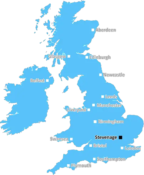
The SG5 postcode is located in the Stevenage district of Hertfordshire in the United Kingdom. It covers a sizeable area that includes parts of Great and Little Wymondley, as well as villages such as Knebworth and Langley. The location of the SG5 postcode is approximately 7 miles to the south of Hitchin, 7 miles to the north of Welwyn Garden City and 8 miles to the east of Luton.
The SG5 postcode district is one of several administered by the Stevenage Borough Council. It is home to a range of local attractions, including Knebworth House, ruins of the Old Thinford Church and gardens, the Commonwealth War Grave cemetery and the site of the annual Knebworth Park Music Festival.
The SG5 postcode district is served by a range of local amenities. It is home to several schools, such as Comet Primary School, Knebworth Church Of England Primary School, Primary School Of Jupiter and Lordship Farm Nursery and Pre-School. It also has a selection of shops and dining options in the area, with supermarkets, shops, pubs, restaurants, cafes and takeaways serving the local area.
The SG5 postcode district is a great place for those looking to relocate and take advantage of the nearby countryside while being able to enjoy all the amenities and attractions on offer in the area. It is well-connected to London and the rest of Hertfordshire by rail and road, with Luton Airport located just a short drive away. The area is also served by regular bus services and is within close proximity to Stevenage town centre.

Demographics

Hertfordshire

SG5 is located in the county of Hertfordshire, in England.
Hertfordshire has a total population of 1,176,700, making it the 12th largest county in the UK.
Hertfordshire has a total area of 634 square miles, and a population density of 716 people per square kilometre. For comparison, Greater London has a density of 5,618 people/km2.
| Outward Code | SG5 |
| Postal Town | Stevenage |
| MSOA Name | North Hertfordshire 012 |
| LSOA Name | North Hertfordshire 012F |
| County | Hertfordshire |
| Region | Hertfordshire |
| Country | England |
| Local Authority | North Hertfordshire |
| Area Classification | Urban with Significant Rural (rural including hub towns 26-49%) |
SG5 Electoral Wards
The postal region of SG5, includes the local towns, villages, electoral wards and stations of:
Dig even deeper into the SG5 postcode by clicking on a postcode below:
Click on an outward postal code below for more information about the area. Each 'outward' postcode give you a comprehensive list of all postcodes within the outward code area (SG) and estimated address.
Click on an 'outward' code for more information. For example, the outward postcode page 'EC2M' will give you an alphabetical list covering all postcodes located in the region, from 'EC2M 1BB' through to 'EC2M 7YA'.
Chris H
Monday, April 8, 2024
We don't have any views of SG5 right now. If you live in SG5 or have visited it, please help us to help others by telling others what you think of this neighbourhood.
Add your view of SG5
People need your local expertise. If you live in SG5 or have first-hand knowledge of the neighbourhood, please consider sharing your views. It's completely anonymous - all we ask is for your initials.
Please tell us what you like about the SG5 postcode area, what you don't like, and what it's like to live or work here.
| LOCAL AMENITIES | |
| FAMILY FRIENDLY | |
| PARKING | |
| GREEN SPACES |
Local News Hertfordshire
'Losing my legs changed my life for the better'
A former footballer says he would not change a thing after a hit-and-run driver ran him over.
BBC NewsDelays on M25 and M1 as equipment is transported
An abnormal load bound for a power station will affect some M1 and M25 traffic this weekend.
BBC News99 for a private ambulance in Hertfordshire
MET Medical has launched the service for St Albans, Harpenden, Hatfield and Welwyn.
BBC NewsRunning 5k every day while fasting during Ramadan
Bilal Hussain took on the challenge to raise money for Luton Food Bank.
BBC NewsSpanish funeral cancelled after UK passport mishap
Keith Rudd had five months left on his passport, but was not allowed to fly out of a UK airport.
BBC NewsMan taken to hospital after serious crash
The man is taken to Luton and Dunstable Hospital for further treatment.
BBC NewsNo hosepipe ban, says Anglian Water
Anglian Water says it has no plans to restrict the use of hosepipes this summer.
BBC NewsBus driver in hospital after crashing into wall
Police are appealing for information, such as dashcam footage, following the collision in St Albans.
BBC NewsFrom the Postcode Area blog

Deciphering Crime Rates - a Deep Dive Into UK Postcode Analysis
Ever wondered about the crime rate in your UK postcode? You're not alone. We've dug deep into the data, uncovering trends and patterns that'll make your head spin.

Death of the High Street?
The BBC reports that despite councils' attempts to kurb them, the UK's high streets have seen a huge growth in fast food outlets. Could this mark the death knell for the Great British high street, and what can we do about it to halt its decline?

Discrimination by Postcode
You really couldn't make it up, could you? Some of the country's most vulnerable people are missing out on their weekly £25 Cold Weather Payment, just because the system that's in operation is discriminating against them because payments are based on postcode, rather than geographic location.

The Redesign is Underway
Well, the current website was absolutely in dire need of a good redesign - from the ground up. So I set out to pull it all apart and get it up and running again to become the most comprehensive guide to every postcode in the UK. And it's been a long, tough job from start to finish - and quite possibly the biggest project I've ever undertaken.
SOCIAL GRADES
According to census records, 32% of people here have a social grade of AB (highest), compared to the national average of 27%.