hemel-hempstead HP5 Postcodes
Spending a fortune on conveyancing?

Compare instant, low-cost online quotes from trusted conveyancing solicitors.
Backed by experts, our no-obligation service searches through the best conveyancing quotes on the market to save you time and money.
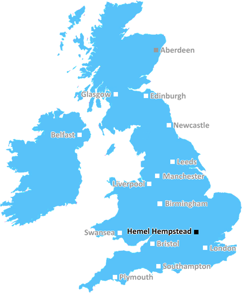
Hemel Hempstead (HP5)
The HP5 postcode area is located in the Hemel Hempstead postcode town region, within the county of Buckinghamshire, and contains a total of 1047 individual postcodes.
There are 39 electoral wards in the HP5 postcode area, including Amersham, Aylesbury, Beaconsfield, Berkhamsted, Chalfont St Giles, Chesham, Great Missenden, Hemel Hempstead, High Wycombe, Princes Risborough, Tring which come under the local authority of the Chiltern Council.
Combining the whole postcode region, 33% of people in HP5 are classed as having an AB social grade, (i.e. 'white-collar' middle-upper class), compared to 27% across the UK.
This does not mean that the people of HP5 are wealthier - or higher class - than average, but it can be an indication that the area may be prospering and desirable to live in.
The HP5 postcode covers the town of Chesham and two surrounding villages, Hyde Heath and Latimer, in the borough of Dacorum within the county of Hertfordshire. The postcode centres around the town of Chesham, which has a station on the Metropolitan Line of the London Underground.
Chesham itself is known as the Gateway to the Chilterns, and is a charming market town with plenty of restaurants, pubs, and shopping opportunities. Hyde Heath is a small village just to the south of Chesham, nestled near the Chiltern Hills and wildflower meadows. Latimer is a village situated in the Chess Valley.
The HP5 postcode has stunning countryside views, with the Chiltern Hills nearby. Outdoor activities such as walking and cycling, and other sports such as horse riding, are popular in the area. Nearby attractions include the Black Park Country Park, the Chiltern Hills, and the Chilterns Area of Outstanding Natural Beauty.
The HP5 postcode also has strong transport links, with the Chesham station on the Metropolitan Line of the London Underground providing easy access to the capital. Other transport links in the area include Coach services, in particular a dial-a-ride service providing a door-to-door accessible service, and national coach services calling at Heathrow Airport, London Victoria, Oxford, and Birmingham.
Education in the HP5 postcode is varied, with a wide range of schools available for all ages. There are nine primary schools, one secondary school, two special schools, and a university technical college in the area, providing a comprehensive education system.
Local amenities include leisure centres, cinemas, and bowling alleys, as well as a comprehensive library service and sporting clubs. The area is also well served with health care, with two hospitals, several GP surgeries, and a variety of specialist services in the postcode.
The HP5 postcode offers a range of housing options, covering an array of styles and prices, from small terraced houses to large family homes. All of this, combined with the stunning countryside and easy transport links to London, makes the HP5 postcode an attractive and popular residential area.

Demographics

Buckinghamshire

HP5 is located in the county of Buckinghamshire, in England.
Buckinghamshire has a total population of 799,200, making it the 30th largest county in the UK.
Buckinghamshire has a total area of 723 square miles, and a population density of 426 people per square kilometre. For comparison, Greater London has a density of 5,618 people/km2.
| Outward Code | HP5 |
| Postal Town | Hemel Hempstead |
| MSOA Name | Chiltern 004 |
| LSOA Name | Chiltern 004C |
| County | Buckinghamshire |
| Region | Buckinghamshire |
| Country | England |
| Local Authority | Chiltern |
| Area Classification | Urban with Significant Rural (rural including hub towns 26-49%) |
HP5 Electoral Wards
The postal region of HP5, includes the local towns, villages, electoral wards and stations of:
Dig even deeper into the HP5 postcode by clicking on a postcode below:
Click on an outward postal code below for more information about the area. Each 'outward' postcode give you a comprehensive list of all postcodes within the outward code area (HP) and estimated address.
Click on an 'outward' code for more information. For example, the outward postcode page 'EC2M' will give you an alphabetical list covering all postcodes located in the region, from 'EC2M 1BB' through to 'EC2M 7YA'.
Chris H
Friday, April 12, 2024
We don't have any views of HP5 right now. If you live in HP5 or have visited it, please help us to help others by telling others what you think of this neighbourhood.
Add your view of HP5
People need your local expertise. If you live in HP5 or have first-hand knowledge of the neighbourhood, please consider sharing your views. It's completely anonymous - all we ask is for your initials.
Please tell us what you like about the HP5 postcode area, what you don't like, and what it's like to live or work here.
| LOCAL AMENITIES | |
| FAMILY FRIENDLY | |
| PARKING | |
| GREEN SPACES |
Local News Buckinghamshire
L&G acquires Cambridgeshire BTR scheme from Stonebond
The 41-unit development comprises 10 flats and 31 houses.
Property WeekDrone footage captures airport car park demolition
The airport says 60% of the structure has been dismantled so far, six months after a major fire.
BBC NewsCrawley's The Create Building lands British Airways Holidays as tenant
The company has signed a lease for the top floor of the nine-storey tower.
Property WeekWhitlock to retire after Paris Olympics
Britain's most successful gymnast Max Whitlock says it "feels right" to announce that he will retire after the Olympics this summer.
BBC NewsCountdown: Bucks doctor gets racist comments
Dr Nighat Arif received vitriol on social media after appearing on the Channel 4 show.
BBC NewsPolice arrest man over alleged sex assault on runner
Police arrest a 20-year-old man after a report the woman was targeted while in a field.
BBC NewsPaddington hotel to go under the hammer for 16m at Strettons' April auction
The asset is among the highest-valued lots ever to be offered at an auction in the UK.
Property WeekPortsmouth NHS trust takes offices at Lakeside North Harbour
The trust has signed a 10-year lease for space at the business park.
Property WeekFrom the Postcode Area blog

Deciphering Crime Rates - a Deep Dive Into UK Postcode Analysis
Ever wondered about the crime rate in your UK postcode? You're not alone. We've dug deep into the data, uncovering trends and patterns that'll make your head spin.

Death of the High Street?
The BBC reports that despite councils' attempts to kurb them, the UK's high streets have seen a huge growth in fast food outlets. Could this mark the death knell for the Great British high street, and what can we do about it to halt its decline?

Discrimination by Postcode
You really couldn't make it up, could you? Some of the country's most vulnerable people are missing out on their weekly £25 Cold Weather Payment, just because the system that's in operation is discriminating against them because payments are based on postcode, rather than geographic location.

The Redesign is Underway
Well, the current website was absolutely in dire need of a good redesign - from the ground up. So I set out to pull it all apart and get it up and running again to become the most comprehensive guide to every postcode in the UK. And it's been a long, tough job from start to finish - and quite possibly the biggest project I've ever undertaken.
SOCIAL GRADES
According to census records, 33% of people here have a social grade of AB (highest), compared to the national average of 27%.