truro TR27 Postcodes
Spending a fortune on conveyancing?

Compare instant, low-cost online quotes from trusted conveyancing solicitors.
Backed by experts, our no-obligation service searches through the best conveyancing quotes on the market to save you time and money.
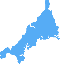
Truro (TR27)
The TR27 postcode area is located in the Truro postcode town region, within the county of Cornwall, and contains a total of 631 individual postcodes.
There are 55 electoral wards in the TR27 postcode area, including Camborne, Falmouth, Hayle, Helston, Isles Of Scilly, Marazion, Newquay, Penryn, Penzance, Perranporth, Redruth, St Agnes, St Columb, St Ives, Truro which come under the local authority of the Cornwall,Isles of Scilly Council.
Combining the whole postcode region, 18% of people in TR27 are classed as having an AB social grade, (i.e. 'white-collar' middle-upper class), compared to 27% across the UK.
This does not mean that the people of TR27 are poorer than other areas, but it may give an indication that there are areas of deprivation.
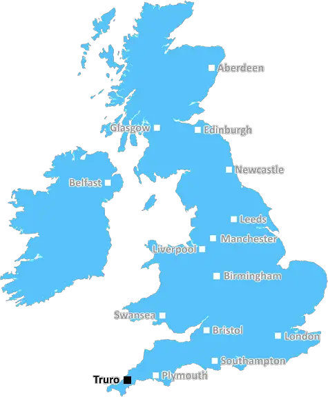
The TR27 postcode is situated in the Truro district of Cornwall in the United Kingdom and covers a large area including the towns of Penwith, St Austell, and Redruth. This postcode district has an estimated population of over 22,000 people, and is home to a vibrant economy and a vibrant cultural life.
The TR27 area includes the tourist destinations of Newquay, St Ives, and Hayle, providing visitors with a chance to access some of the best beaches and attractions in Cornwall. The local economy is based around service industries such as retail and tourism, and many businesses rely on local people and tourists for their customers.
The culture of the TR27 area celebrates its local history and traditions, with a number of festivals taking place throughout the year. One of the most popular events is the St Piran's Festival, which celebrates the patron saint of Cornwall, Saint Piran, each year with live music, theatre, and food stalls.
The area is also popular with artists due to its natural landscape, which is home to a number of popular hiking trails, and serves as a base for many cycle trails, particularly the Coast to Coast route. The area is also popular with surfers and other water-sports enthusiasts, and there are a number of popular spots for these activities.
The local council actively encourage the preservation of the natural environment in the area, with a variety of conservation organisations working to ensure the safety of wildlife and other habitats across the district.
For education, there are a number of primary and secondary schools in the postcode area, as well as the University of Cornwall and Truro College. The university offers a number of courses and is particularly well known for its maritime and marine-based courses, making it an ideal destination for students who are interested in these topics.

Demographics

Cornwall
TR27 is located in the county of Cornwall, in England.
Cornwall has a total population of 556,000, making it the 40th largest county in the UK.
Cornwall has a total area of 1375 square miles, and a population density of 156 people per square kilometre. For comparison, Greater London has a density of 5,618 people/km2.
| Outward Code | TR27 |
| Postal Town | Truro |
| MSOA Name | Cornwall 057 |
| LSOA Name | Cornwall 057E |
| County | Cornwall |
| Region | Cornwall |
| Country | England |
| Local Authority | Cornwall,Isles of Scilly |
| Area Classification | Mainly Rural (rural including hub towns >=80%) |
TR27 Electoral Wards
The postal region of TR27, includes the local towns, villages, electoral wards and stations of:
Dig even deeper into the TR27 postcode by clicking on a postcode below:
Click on an outward postal code below for more information about the area. Each 'outward' postcode give you a comprehensive list of all postcodes within the outward code area (TR) and estimated address.
Click on an 'outward' code for more information. For example, the outward postcode page 'EC2M' will give you an alphabetical list covering all postcodes located in the region, from 'EC2M 1BB' through to 'EC2M 7YA'.
Chris H
Thursday, April 18, 2024
We don't have any views of TR27 right now. If you live in TR27 or have visited it, please help us to help others by telling others what you think of this neighbourhood.
Add your view of TR27
People need your local expertise. If you live in TR27 or have first-hand knowledge of the neighbourhood, please consider sharing your views. It's completely anonymous - all we ask is for your initials.
Please tell us what you like about the TR27 postcode area, what you don't like, and what it's like to live or work here.
| LOCAL AMENITIES | |
| FAMILY FRIENDLY | |
| PARKING | |
| GREEN SPACES |
Local News Cornwall
Family's knife crime fight in name of murdered 'amazing' Mike
The aim is to help tackle rising knife crime in rural areas like Cornwall
Cornwall LiveNeighbours raise concerns about drugs, noise and litter at Cornwall Parkdean holiday park
Residents of a hamlet next to a Parkdean resort have raised concerns about changes to its premises licence
Cornwall LiveWarning that Truro's Pydar scheme will be Cornwall Council's own 'bankruptcy project'
Conservative councillor asks for 10m funding for Truro development to be thrown out because he says the council can't afford it
Cornwall Live'Cornwall needs another hospital' as NHS waiting times surge
Cornwall Live's readers debate the state of the area's hospitals
Cornwall LiveMulti-vehicle crash on A38 sparks major rush hour delays
There was heavy traffic on the A38 this evening, Tuesday, April 16, following a multi-vehicle crash
Cornwall LiveAldi's Next Big Thing sees Cornwall marshmallow maker compete for supermarket spot
The Channel 4 competition could see the products created by Moosh Mallows hit the supermarket's shelves nationwide
Cornwall LiveTikTok social media influencers fly drone over Cornwall naturist beach
A two-man film crew who invaded the privacy of a nudist beach in Cornwall were also filmed flying a drone over the naturist beach after being told to stop vlogging
Cornwall LiveSon described as 'charming' and 'friendly' before he slashed mum's throat, inquest hears
An inquest into the death of Sally Poynton is being held in Truro
Cornwall LiveFrom the Postcode Area blog

Deciphering Crime Rates - a Deep Dive Into UK Postcode Analysis
Ever wondered about the crime rate in your UK postcode? You're not alone. We've dug deep into the data, uncovering trends and patterns that'll make your head spin.

Death of the High Street?
The BBC reports that despite councils' attempts to kurb them, the UK's high streets have seen a huge growth in fast food outlets. Could this mark the death knell for the Great British high street, and what can we do about it to halt its decline?

Discrimination by Postcode
You really couldn't make it up, could you? Some of the country's most vulnerable people are missing out on their weekly £25 Cold Weather Payment, just because the system that's in operation is discriminating against them because payments are based on postcode, rather than geographic location.

The Redesign is Underway
Well, the current website was absolutely in dire need of a good redesign - from the ground up. So I set out to pull it all apart and get it up and running again to become the most comprehensive guide to every postcode in the UK. And it's been a long, tough job from start to finish - and quite possibly the biggest project I've ever undertaken.
SOCIAL GRADES
According to census records, 18% of people here have a social grade of AB (highest), compared to the national average of 27%.