tweed TD9 Postcodes
Spending a fortune on conveyancing?

Compare instant, low-cost online quotes from trusted conveyancing solicitors.
Backed by experts, our no-obligation service searches through the best conveyancing quotes on the market to save you time and money.
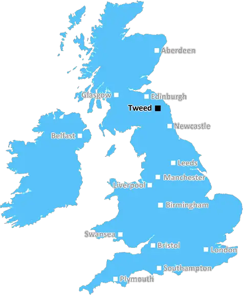
Tweed (TD9)
The TD9 postcode area is located in the Tweed postcode town region, within the county of Borders, and contains a total of 858 individual postcodes.
There are 131 electoral wards in the TD9 postcode area, including Berwick-Upon-Tweed, Cockburnspath, Coldstream, Cornhill-On-Tweed, Duns, Earlston, Eyemouth, Galashiels, Gordon, Hawick, Jedburgh, Kelso, Lauder, Melrose, Mindrum, Newcastleton, Selkirk which come under the local authority of the Scottish Borders Council.
Combining the whole postcode region, 19% of people in TD9 are classed as having an AB social grade, (i.e. 'white-collar' middle-upper class), compared to 27% across the UK.
This does not mean that the people of TD9 are poorer than other areas, but it may give an indication that there are areas of deprivation.
The TD9 postcode is an area of the rural Tweed district in the Scottish Borders. It covers the small towns of Newcastleton and Canonbie, as well as the more rural settlements of Auchengray, Crosslee and Beattock.
The TD9 postcode is a primarily agricultural area, with most of the local population employed in farming and agricultural related jobs. There are also several service industries in the area, such as forestry, building and engineering, and tourism.
Within the TD9 postcode area there are two primary schools � Netherurd House, and Newcastleton Primary School � providing education for children aged 5-11 years. The nearby towns of Hawick and Langholm offer secondary schools for ages 11-16, and both have college campuses for further education.
The TD9 postcode is also home to a number of outdoor activities, such as golf courses, fishing, and walking. Close to Newcastleton is the Kielder Water and Forest Park, which offers a wealth of outdoor activities, including mountain biking and sailing.
There are also a number of historical attractions, most prominently Hermitage Castle. Built in the 13th century, this ruin now forms part of the National Trust's network of protected sites.
The TD9 postcode is well serviced by local transport links, with regular bus services running to the larger towns of Langholm, Hawick, and Carlisle. There is also an airport near Newcastleton, as well as the Glasgow Prestwick to Carlisle rail line.
There are a number of local services and businesses available in the TD9 postcode area, including shops, caf�s, pubs, garages, banks, and post offices.
TD9 postcode is an idyllic rural area where the population is largely employed in the agricultural sector. There is plenty of outdoor activities and historical attractions to explore, as well as local services and transport links to explore the wider region.

Demographics
Borders

TD9 is located in the county of Borders, in Scotland.
Borders has a total population of 0, making it the largest county in the UK.
Borders has a total area of square miles, and a population density of people per square kilometre. For comparison, Greater London has a density of 5,618 people/km2.
| Outward Code | TD9 |
| Postal Town | Tweed |
| MSOA Name | Hawick Central |
| LSOA Name | |
| County | Borders |
| Region | Borders |
| Country | Scotland |
| Local Authority | Scottish Borders |
| Area Classification | Unclassified |
TD9 Electoral Wards
The postal region of TD9, includes the local towns, villages, electoral wards and stations of:
Dig even deeper into the TD9 postcode by clicking on a postcode below:
Click on an outward postal code below for more information about the area. Each 'outward' postcode give you a comprehensive list of all postcodes within the outward code area (TD) and estimated address.
Click on an 'outward' code for more information. For example, the outward postcode page 'EC2M' will give you an alphabetical list covering all postcodes located in the region, from 'EC2M 1BB' through to 'EC2M 7YA'.
Chris H
Wednesday, April 10, 2024
We don't have any views of TD9 right now. If you live in TD9 or have visited it, please help us to help others by telling others what you think of this neighbourhood.
Add your view of TD9
People need your local expertise. If you live in TD9 or have first-hand knowledge of the neighbourhood, please consider sharing your views. It's completely anonymous - all we ask is for your initials.
Please tell us what you like about the TD9 postcode area, what you don't like, and what it's like to live or work here.
| LOCAL AMENITIES | |
| FAMILY FRIENDLY | |
| PARKING | |
| GREEN SPACES |
From the Postcode Area blog

Deciphering Crime Rates - a Deep Dive Into UK Postcode Analysis
Ever wondered about the crime rate in your UK postcode? You're not alone. We've dug deep into the data, uncovering trends and patterns that'll make your head spin.

Death of the High Street?
The BBC reports that despite councils' attempts to kurb them, the UK's high streets have seen a huge growth in fast food outlets. Could this mark the death knell for the Great British high street, and what can we do about it to halt its decline?

Discrimination by Postcode
You really couldn't make it up, could you? Some of the country's most vulnerable people are missing out on their weekly £25 Cold Weather Payment, just because the system that's in operation is discriminating against them because payments are based on postcode, rather than geographic location.

The Redesign is Underway
Well, the current website was absolutely in dire need of a good redesign - from the ground up. So I set out to pull it all apart and get it up and running again to become the most comprehensive guide to every postcode in the UK. And it's been a long, tough job from start to finish - and quite possibly the biggest project I've ever undertaken.
SOCIAL GRADES
According to census records, 19% of people here have a social grade of AB (highest), compared to the national average of 27%.