harrogate HG2 Postcodes
Spending a fortune on conveyancing?

Compare instant, low-cost online quotes from trusted conveyancing solicitors.
Backed by experts, our no-obligation service searches through the best conveyancing quotes on the market to save you time and money.
Harrogate (HG2)
The HG2 postcode area is located in the Harrogate postcode town region, within the county of North Yorkshire, and contains a total of 1021 individual postcodes.
There are 9 electoral wards in the HG2 postcode area, including Harrogate, Knaresborough, Ripon which come under the local authority of the Harrogate Council.
Combining the whole postcode region, 35% of people in HG2 are classed as having an AB social grade, (i.e. 'white-collar' middle-upper class), compared to 27% across the UK.
This does not mean that the people of HG2 are wealthier - or higher class - than average, but it can be an indication that the area may be prospering and desirable to live in.
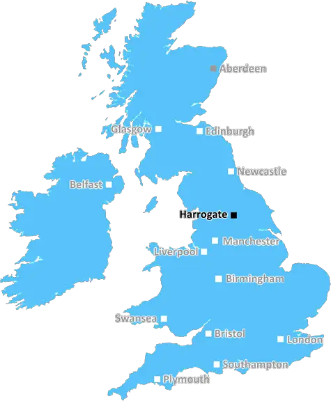
HG2 is a postcode located in the district of Harrogate, in the county of North Yorkshire in the United Kingdom. It is a small area and covers approximately Ben Rhydding, Burley in Wharfedale, Farnham, High Eldwick, Menston, Nesfield, and Tinshill. It is adjacent to the BD23 and LS21 postcodes.
HG2 is located just 5 miles away from Moorside, the largest population centre in Harrogate and 12 miles from the historic city centre of York. This postcode area is known for its tranquil, rural surroundings and picturesque views of the Yorkshire Dales. The scenery and tranquillity combined with its proximity to popular tourist attractions make it an ideal location for people who want the options of both a countryside and city lifestyle.
Some of the attractions within this area include the nearby National Trust property, East Riddlesden Hall. Nature is in abundance here and the variety of wildlife makes it a great place for nature lovers. Nearby River Wharfe runs through the district, providing fantastic walking paths along its banks.
This area is well-connected with two major roads, the A65 and A59, allowing easy access to nearby towns and cities. There are several bus services regularly operating throughout the area, providing transport links to the nearby towns of Leeds and Bradford, and further away, to bigger cities such as Manchester and Liverpool.
HG2 has a vibrant education system with multiple primary and secondary schools, as well as two further education centres: Bradford College and Leeds College of Art. The district provides students with an excellent selection of opportunities for learning. This area also has a range of local shops, pubs and restaurants, offering an abundance of places to eat, drink and shop in and around the district.
Although HG2 is a rural area, it is within a short distance of Moorside, ensuring access to a range of amenities, shops, and leisure facilities. The area also offers a vibrant community with plenty of local events, activities and clubs for people of all ages.

Demographics
North Yorkshire

HG2 is located in the county of North Yorkshire, in England.
North Yorkshire has a total population of 1,145,700, making it the 14th largest county in the UK.
North Yorkshire has a total area of 3341 square miles, and a population density of 132 people per square kilometre. For comparison, Greater London has a density of 5,618 people/km2.
| Outward Code | HG2 |
| Postal Town | Harrogate |
| MSOA Name | Harrogate 020 |
| LSOA Name | Harrogate 020A |
| County | North Yorkshire |
| Region | North Yorkshire |
| Country | England |
| Local Authority | Harrogate |
| Area Classification | Urban with Significant Rural (rural including hub towns 26-49%) |
HG2 Electoral Wards
The postal region of HG2, includes the local towns, villages, electoral wards and stations of:
Dig even deeper into the HG2 postcode by clicking on a postcode below:
Click on an outward postal code below for more information about the area. Each 'outward' postcode give you a comprehensive list of all postcodes within the outward code area (HG) and estimated address.
Click on an 'outward' code for more information. For example, the outward postcode page 'EC2M' will give you an alphabetical list covering all postcodes located in the region, from 'EC2M 1BB' through to 'EC2M 7YA'.
Chris H
Saturday, April 6, 2024
We don't have any views of HG2 right now. If you live in HG2 or have visited it, please help us to help others by telling others what you think of this neighbourhood.
Add your view of HG2
People need your local expertise. If you live in HG2 or have first-hand knowledge of the neighbourhood, please consider sharing your views. It's completely anonymous - all we ask is for your initials.
Please tell us what you like about the HG2 postcode area, what you don't like, and what it's like to live or work here.
| LOCAL AMENITIES | |
| FAMILY FRIENDLY | |
| PARKING | |
| GREEN SPACES |
Local News North Yorkshire
Ripon: Parish poll proposed over cathedral's 8m new annexe
The poll, which would not be legally binding, could cost Ripon City Council 10,000.
BBC NewsBerwick Kaler: Final curtain for UK's longest-serving panto dame
Berwick Kaler, 78, says he is "bowing out gracefully" after starring in York's pantos since 1977.
BBC NewsCounty Championship 2024 preview: Surrey look to continue dominance
With the new County Championship season starting on Friday, can anyone prevent Surrey winning a third straight title?
BBC NewsYorkshire Water building underground reservoir between York and Malton
The new underground reservoir is due to be completed in May 2025, the firm says.
BBC NewsNorth Yorkshire councillor Pat Marsh quits over 'antisemitic' tweets row
Pat Marsh was suspended from the Lib Dems over comments on Israel's offensive against Hamas in Gaza.
BBC NewsCounty Championship: Yorkshire take five Leicestershire wickets on rain-hit day one
George Hill takes three wickets as Yorkshire chip away at Leicestershire on a rain-hit opening day.
BBC NewsNorth Yorkshire Police officers attacked while arresting thief
A suspect became aggressive and started kicking two police officers while under arrest.
BBC NewsNorth Yorkshire Police: Drivers warned over mobile phone use
Police say it is "disappointing" some drivers continue to put themselves and others at risk.
BBC NewsFrom the Postcode Area blog

Deciphering Crime Rates - a Deep Dive Into UK Postcode Analysis
Ever wondered about the crime rate in your UK postcode? You're not alone. We've dug deep into the data, uncovering trends and patterns that'll make your head spin.

Death of the High Street?
The BBC reports that despite councils' attempts to kurb them, the UK's high streets have seen a huge growth in fast food outlets. Could this mark the death knell for the Great British high street, and what can we do about it to halt its decline?

Discrimination by Postcode
You really couldn't make it up, could you? Some of the country's most vulnerable people are missing out on their weekly £25 Cold Weather Payment, just because the system that's in operation is discriminating against them because payments are based on postcode, rather than geographic location.

The Redesign is Underway
Well, the current website was absolutely in dire need of a good redesign - from the ground up. So I set out to pull it all apart and get it up and running again to become the most comprehensive guide to every postcode in the UK. And it's been a long, tough job from start to finish - and quite possibly the biggest project I've ever undertaken.
SOCIAL GRADES
According to census records, 35% of people here have a social grade of AB (highest), compared to the national average of 27%.