glasgow G60 Postcodes
Spending a fortune on conveyancing?

Compare instant, low-cost online quotes from trusted conveyancing solicitors.
Backed by experts, our no-obligation service searches through the best conveyancing quotes on the market to save you time and money.
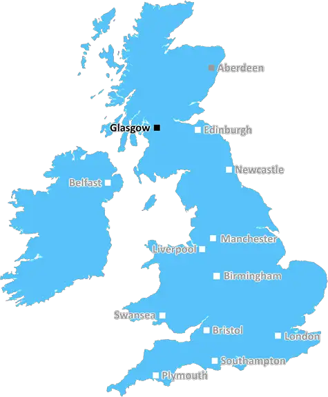
Glasgow (G60)
The G60 postcode area is located in the Glasgow postcode town region, within the county of Dunbartonshire, and contains a total of 194 individual postcodes.
There are 1 electoral wards in the G60 postcode area, including Alexandria, Arrochar, Clydebank, Dumbarton, Glasgow, Helensburgh which come under the local authority of the West Dunbartonshire Council.
Combining the whole postcode region, 0% of people in G60 are classed as having an AB social grade, (i.e. 'white-collar' middle-upper class), compared to 27% across the UK.
This does not mean that the people of G60 are poorer than other areas, but it may give an indication that there are areas of deprivation.
The G60 postcode covers the town of Clydebank on the northern outskirts of Glasgow. It is within theWest Dunbartonshire region and forms part of the wider Greater Glasgow area.
Clydebank is a historic town that was initially established in 1888. Glasgow, located around 10 miles down the River Clyde, has been absorbing the neighbouring towns' populations since the 1950s and as such Clydebank's population has seen a steady decline since. The G60 postcode covers a mixture of residential areas, as well as some commercial and industrial areas on the periphery.
The area is served well by transport links with the Clydebank railway station on the Glasgow to Helensburgh line offering regular services with connections to the city centre. There are frequent bus services, and the nearby M8 motorway offers direct access to Glasgow and other local areas.
G60 is also close to two major shopping centres, the Clydebank Shopping Centre and the Glasgow Fort. The shopping centres are complemented by smaller local convenience shopping centres and retail parks. The town is also home to the Xscape Braehead and the Centre for Contemporary Arts, providing entertainment, socialising, conural and leisure opportunities.
The G60 postcode consists of a range of housing, with modernised flats and maisonettes being built in recent years. Although the local housing stock is in decline, the area does have some newer mid market developments, providing good quality and affordable housing for residents.
The area is home to various parks and recreational areas, such as the Antonine Wall and the Canal Corridor, which runs from Glasgow to Bowling, providing riverside recreation and leisure opportunities.
Residents of G60 benefit from access to local healthcare services, with the main hospital being the Queen Elizabeth University Hospital in Glasgow. Education services are comprehensive with the local Authority schools educating primary and secondary age children. There is also a further educational college in the area, the West College Scotland.
The area is also home to a large number of churches representing a range of denominations, and a number of sports clubs host regular activities and fixtures.

Demographics
Dunbartonshire

G60 is located in the county of Dunbartonshire, in Scotland.
Dunbartonshire has a total population of 0, making it the largest county in the UK.
Dunbartonshire has a total area of square miles, and a population density of people per square kilometre. For comparison, Greater London has a density of 5,618 people/km2.
| Outward Code | G60 |
| Postal Town | Glasgow |
| MSOA Name | IZ Eleven |
| LSOA Name | |
| County | Dunbartonshire |
| Region | Dunbartonshire |
| Country | Scotland |
| Local Authority | West Dunbartonshire |
| Area Classification | Unclassified |
G60 Electoral Wards
The postal region of G60, includes the local towns, villages, electoral wards and stations of:
Dig even deeper into the G60 postcode by clicking on a postcode below:
Click on an outward postal code below for more information about the area. Each 'outward' postcode give you a comprehensive list of all postcodes within the outward code area (G) and estimated address.
Click on an 'outward' code for more information. For example, the outward postcode page 'EC2M' will give you an alphabetical list covering all postcodes located in the region, from 'EC2M 1BB' through to 'EC2M 7YA'.
Chris H
Friday, April 12, 2024
We don't have any views of G60 right now. If you live in G60 or have visited it, please help us to help others by telling others what you think of this neighbourhood.
Add your view of G60
People need your local expertise. If you live in G60 or have first-hand knowledge of the neighbourhood, please consider sharing your views. It's completely anonymous - all we ask is for your initials.
Please tell us what you like about the G60 postcode area, what you don't like, and what it's like to live or work here.
| LOCAL AMENITIES | |
| FAMILY FRIENDLY | |
| PARKING | |
| GREEN SPACES |
From the Postcode Area blog

Deciphering Crime Rates - a Deep Dive Into UK Postcode Analysis
Ever wondered about the crime rate in your UK postcode? You're not alone. We've dug deep into the data, uncovering trends and patterns that'll make your head spin.

Death of the High Street?
The BBC reports that despite councils' attempts to kurb them, the UK's high streets have seen a huge growth in fast food outlets. Could this mark the death knell for the Great British high street, and what can we do about it to halt its decline?

Discrimination by Postcode
You really couldn't make it up, could you? Some of the country's most vulnerable people are missing out on their weekly £25 Cold Weather Payment, just because the system that's in operation is discriminating against them because payments are based on postcode, rather than geographic location.

The Redesign is Underway
Well, the current website was absolutely in dire need of a good redesign - from the ground up. So I set out to pull it all apart and get it up and running again to become the most comprehensive guide to every postcode in the UK. And it's been a long, tough job from start to finish - and quite possibly the biggest project I've ever undertaken.
SOCIAL GRADES
According to census records, 0% of people here have a social grade of AB (highest), compared to the national average of 27%.