durham DH7 Postcodes
Spending a fortune on conveyancing?

Compare instant, low-cost online quotes from trusted conveyancing solicitors.
Backed by experts, our no-obligation service searches through the best conveyancing quotes on the market to save you time and money.
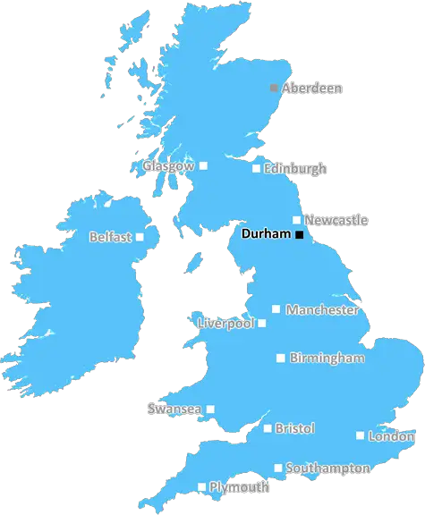
Durham (DH7)
The DH7 postcode area is located in the Durham postcode town region, within the county of Durham, and contains a total of 1425 individual postcodes.
There are 47 electoral wards in the DH7 postcode area, including Chester Le Street, Consett, Durham, Houghton Le Spring, Stanley which come under the local authority of the County Durham Council.
Combining the whole postcode region, 20% of people in DH7 are classed as having an AB social grade, (i.e. 'white-collar' middle-upper class), compared to 27% across the UK.
This does not mean that the people of DH7 are poorer than other areas, but it may give an indication that there are areas of deprivation.
The DH7 postcode covers a large section of County Durham, part of the North East of England. It spans a total area of approximately 261 km2 and covers a variety of communities within its boundaries.
The DH7 postcode is divided into two main areas, the Consett area (which includes leadgate, Medomsley, Moorside, Muggleswick, Ouston, Shotley Bridge, Stony Heap and West Quieton) and the Spennymoor, the areas surrounding which include Kelloe and Croxdale.
Within the postcode area there are a range of amenities and leisure activities to suit all, including a selection of shops, pubs, restaurants, leisure centres, spas and historical buildings. In addition there are a number of museums and rural walks that are scattered throughout the postcode area.
The location of the postcode means that it is within easy reach of both Newcastle upon Tyne and the main counties of Northumberland and Cumbria. The area is also within reach of the North Pennines AONB, providing beautiful open countryside and rolling hills for those interested in outdoor pursuits.
Transport links are excellent, with the A1 offering good transport links to both England and Scotland, as well as providing easy access to surrounding towns and cities, such as Durham, Sunderland and Gateshead. Additionally a well established local bus network provides transport between the areas with routes running through both the Consett and Spennymoor areas.
County Durham is renowned for its steelworks and coalmining industry and is the home to many cultural, heritage and educational sites, such as museums and archeological sites. The area is also known for its vibrant nightlife and attractions, such as the Beamish Living Museum, High Force waterfall and the Durham County Cricket Club. There are numerous attractions within the DH7 postcode too, such as the Tanfield Railway, the Iconic Global Museum of Mining and Beamish Open Air Museum.
Through its diverse range of amenities, recreational activities and attractions County Durham has something to offer everyone and with the postcode DH7 being in the heart of the county, these are available all year round.

Demographics

Durham

DH7 is located in the county of Durham, in England.
Durham has a total population of 0, making it the largest county in the UK.
Durham has a total area of square miles, and a population density of people per square kilometre. For comparison, Greater London has a density of 5,618 people/km2.
| Outward Code | DH7 |
| Postal Town | Durham |
| MSOA Name | County Durham 020 |
| LSOA Name | County Durham 020A |
| County | Durham |
| Region | Durham |
| Country | England |
| Local Authority | County Durham |
| Area Classification | Largely Rural (rural including hub towns 50-79%) |
DH7 Electoral Wards
The postal region of DH7, includes the local towns, villages, electoral wards and stations of:
Dig even deeper into the DH7 postcode by clicking on a postcode below:
Click on an outward postal code below for more information about the area. Each 'outward' postcode give you a comprehensive list of all postcodes within the outward code area (DH) and estimated address.
Click on an 'outward' code for more information. For example, the outward postcode page 'EC2M' will give you an alphabetical list covering all postcodes located in the region, from 'EC2M 1BB' through to 'EC2M 7YA'.
MR, durham
Saturday, September 14, 2019
Very lovely friendly srea
Add your view of DH7
People need your local expertise. If you live in DH7 or have first-hand knowledge of the neighbourhood, please consider sharing your views. It's completely anonymous - all we ask is for your initials.
Please tell us what you like about the DH7 postcode area, what you don't like, and what it's like to live or work here.
| LOCAL AMENITIES | |
| FAMILY FRIENDLY | |
| PARKING | |
| GREEN SPACES |
Local News County Durham
Circular walk round woods and water of Malham Tarn, North Yorkshire
Last week was a walk round Grimwith Reservoir. This week is another circuit of the highest freshwater (glacial) lakes in England - Malham Tarn.
Northern EchoA66 near Darlington to close for one week for works
The A66 in Darlington will be closed overnight between junctions with the A1150 Little Burdon, and B6279 near Lingfield (Tornado Way) for one week for works
Northern EchoNewcastle: Plans for Eldon Square revamp of ex-Debenhams store
A 65 million redevelopment of Eldon Square looks set to be signed off next week after designs were unveiled last year for a major revamp that would create a range of food, drink, culture, leisure and&hellip
Northern Echo5 of the most amazing castles in the North East to visit
Some of the best castles to visit across County Durham and the North East, now open for the 2024 season, including Raby Castle and Auckland Castle.
Northern EchoSix Teesside and Tyne and Wear drivers fined 2000 in court
The following cases were heard at Cleveland Magistrates' Court:
Northern EchoGreggs to open new store at Bishop Auckland retail park
Greggs has confirmed it will open a new store at Bishop Auckland's new retail park next week.
Northern EchoA171 Guisborough LIVE: Birk Brow Road closed due to medical incident
The A171 Birk Brow Road in Guisborough has been closed in both directions due to a 'fuel spillage'
Northern EchoThe Bay Horse, Bishop Auckland, to get huge facelift
The Bay Horse in Bishop Auckland is set to close for two weeks while having a huge facelift
Northern EchoFrom the Postcode Area blog

Deciphering Crime Rates - a Deep Dive Into UK Postcode Analysis
Ever wondered about the crime rate in your UK postcode? You're not alone. We've dug deep into the data, uncovering trends and patterns that'll make your head spin.

Death of the High Street?
The BBC reports that despite councils' attempts to kurb them, the UK's high streets have seen a huge growth in fast food outlets. Could this mark the death knell for the Great British high street, and what can we do about it to halt its decline?

Discrimination by Postcode
You really couldn't make it up, could you? Some of the country's most vulnerable people are missing out on their weekly £25 Cold Weather Payment, just because the system that's in operation is discriminating against them because payments are based on postcode, rather than geographic location.

The Redesign is Underway
Well, the current website was absolutely in dire need of a good redesign - from the ground up. So I set out to pull it all apart and get it up and running again to become the most comprehensive guide to every postcode in the UK. And it's been a long, tough job from start to finish - and quite possibly the biggest project I've ever undertaken.
SOCIAL GRADES
According to census records, 20% of people here have a social grade of AB (highest), compared to the national average of 27%.