durham DH1 Postcodes
Spending a fortune on conveyancing?

Compare instant, low-cost online quotes from trusted conveyancing solicitors.
Backed by experts, our no-obligation service searches through the best conveyancing quotes on the market to save you time and money.
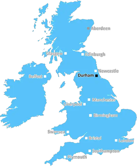
Durham (DH1)
The DH1 postcode area is located in the Durham postcode town region, within the county of Durham, and contains a total of 1912 individual postcodes.
There are 39 electoral wards in the DH1 postcode area, including Chester Le Street, Consett, Durham, Houghton Le Spring, Stanley which come under the local authority of the County Durham Council.
Combining the whole postcode region, 29% of people in DH1 are classed as having an AB social grade, (i.e. 'white-collar' middle-upper class), compared to 27% across the UK.
This does not mean that the people of DH1 are wealthier - or higher class - than average, but it can be an indication that the area may be prospering and desirable to live in.
The DH1 postcode is the geographical designation of the Durham region, covering the areas of Framwellgate Moor, Pity Me, Durham City Centre, Gilesgate, Sherburn, Belmont, Bowburn, Pelton, Shincliffe, Old Durham and Partington. It is a suburban area located in the northeast of England.
Framwellgate Moor is one of the larger suburbs of Durham and is located just South of the city centre. This area is popular amongst students- the University of Durham's Palatine Centre is located here. Gilesgate is located northeast of Durham city centre, right next to the River Wear. Here you can find the Butterbee Farm, which is a local attraction.
Pity Me is located southwest of the city centre and is known for its excellent transport links, including the East Coast Mainline. The Shotton Hall industrial area is also located here. Sherburn is situated East of Durham city centre and is host to a number of exclusive, family-owned businesses. Further North of Sherburn lies Belmont, a village that first developed during the medieval period.
Bowburn is located just South of Belmont and was once the home of a coal mining community. Pelton is a small village situated further East of Bowburn. Shincliffe is located further East of Pelton and is an affluent village known for its landscape and bluebell wood. Old Durham is situated South of Pelton and is known for being the birthplace of the 12th century prince Bishop of Durham. Partington, lies along the riverside of the River Wear and is host to a large number of recreational activities.
TheDH1 postcode is a diverse region � from large suburban areas like Framwellgate Moor and Pity Me to the rural villages of Belmont and Shincliffe. It is a location filled with character, culture, and history.

Demographics

Durham

DH1 is located in the county of Durham, in England.
Durham has a total population of 0, making it the largest county in the UK.
Durham has a total area of square miles, and a population density of people per square kilometre. For comparison, Greater London has a density of 5,618 people/km2.
| Outward Code | DH1 |
| Postal Town | Durham |
| MSOA Name | County Durham 030 |
| LSOA Name | County Durham 030D |
| County | Durham |
| Region | Durham |
| Country | England |
| Local Authority | County Durham |
| Area Classification | Largely Rural (rural including hub towns 50-79%) |
DH1 Electoral Wards
The postal region of DH1, includes the local towns, villages, electoral wards and stations of:
Dig even deeper into the DH1 postcode by clicking on a postcode below:
Click on an outward postal code below for more information about the area. Each 'outward' postcode give you a comprehensive list of all postcodes within the outward code area (DH) and estimated address.
Click on an 'outward' code for more information. For example, the outward postcode page 'EC2M' will give you an alphabetical list covering all postcodes located in the region, from 'EC2M 1BB' through to 'EC2M 7YA'.
Chris H
Saturday, April 6, 2024
We don't have any views of DH1 right now. If you live in DH1 or have visited it, please help us to help others by telling others what you think of this neighbourhood.
Add your view of DH1
People need your local expertise. If you live in DH1 or have first-hand knowledge of the neighbourhood, please consider sharing your views. It's completely anonymous - all we ask is for your initials.
Please tell us what you like about the DH1 postcode area, what you don't like, and what it's like to live or work here.
| LOCAL AMENITIES | |
| FAMILY FRIENDLY | |
| PARKING | |
| GREEN SPACES |
Local News County Durham
Eight people arrested after firearm shot in Grangetown
Eight people have been arrested after a man was taken to hospital following a firearms incident in Grangetown, Middlesbrough on Bank Holiday Monday.
Northern EchoDental services to return to Firthmoor Community Centre in Darlington
Dental services are poised to return to a Darlington community after residents faced over a year without treatment.
Northern EchoArrests made from dispersal orders in Middlesborough
A number of recent dispersal orders put in place in the Netherfields area in Middlesbrough have resulted in arrests in a bid to tackle antisocial behaviour.
Northern EchoDarlington business thriving after retweet by Theo Paphitis
Darlington based business Rainbow Dandelion Crochet gets a Twitter boost from Theo Paphitis.
Northern EchoAccused admits burglary at Peterlee house in which car keys were taken
A man has admitted the burglary of a home from where he took the keys for a car parked outside, in which he then drove away from the scene.
Northern EchoThree Teesside fish and chip shop fires over four day period
Firefighters and police were called out to all three fires - which saw the fires start in the kitchens of the premises.
Northern EchoA171 Guisborough LIVE: Birk Brow Road closed due to medical incident
The A171 Birk Brow Road in Guisborough has been closed in both directions due to a 'fuel spillage'
Northern EchoGreen Party candidate quits Tees Valley Mayoral election
The Green Party's candidate for Tees Valley Mayor Sally Bunce has quit the race less than a month before polling day.
Northern EchoFrom the Postcode Area blog

Deciphering Crime Rates - a Deep Dive Into UK Postcode Analysis
Ever wondered about the crime rate in your UK postcode? You're not alone. We've dug deep into the data, uncovering trends and patterns that'll make your head spin.

Death of the High Street?
The BBC reports that despite councils' attempts to kurb them, the UK's high streets have seen a huge growth in fast food outlets. Could this mark the death knell for the Great British high street, and what can we do about it to halt its decline?

Discrimination by Postcode
You really couldn't make it up, could you? Some of the country's most vulnerable people are missing out on their weekly £25 Cold Weather Payment, just because the system that's in operation is discriminating against them because payments are based on postcode, rather than geographic location.

The Redesign is Underway
Well, the current website was absolutely in dire need of a good redesign - from the ground up. So I set out to pull it all apart and get it up and running again to become the most comprehensive guide to every postcode in the UK. And it's been a long, tough job from start to finish - and quite possibly the biggest project I've ever undertaken.
SOCIAL GRADES
According to census records, 29% of people here have a social grade of AB (highest), compared to the national average of 27%.