doncaster DN9 Postcodes
Spending a fortune on conveyancing?

Compare instant, low-cost online quotes from trusted conveyancing solicitors.
Backed by experts, our no-obligation service searches through the best conveyancing quotes on the market to save you time and money.
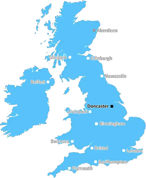
Doncaster (DN9)
The DN9 postcode area is located in the Doncaster postcode town region, within the county of Lincolnshire, and contains a total of 818 individual postcodes.
There are 47 electoral wards in the DN9 postcode area, including Barnetby, Barrow-Upon-Humber, Barton-Upon-Humber, Brigg, Cleethorpes, Doncaster, Gainsborough, Goole, Grimsby, Immingham, Retford, Scunthorpe, Ulceby which come under the local authority of the North Lincolnshire Council.
Combining the whole postcode region, 25% of people in DN9 are classed as having an AB social grade, (i.e. 'white-collar' middle-upper class), compared to 27% across the UK.
This does not mean that the people of DN9 are poorer than other areas, but it may give an indication that there are areas of deprivation.
The DN9 postcode is in the Doncaster district of South Yorkshire, England. It covers the settlements of Rossington, Styrrup and Blaxton and parts of Wheatley, Harworth and Finningley.
Rossington is a largely residential village which is located south of Doncaster and forms part of the Metropolitan Borough of Doncaster. It is home to a large business park which was formerly home to Airbus. Styrrup is a small, mostly rural, village characterised by farmland and horticulture.
Blaxton is a semi-rural village located approximately 170m above sea level and is home to the St Martha's Church which dates from the 13th century. The village primarily consists of private houses and is near to a number of agricultural holdings and small businesses. Wheatley is a larger village to the north of Doncaster and consists of mainly residential developments.
Harworth is a former mining town located to the immediate east of Doncaster. It was historically an important mining town and is home to the largest employer in the area, British Steel. Finningley is a village located near to the M18 motorway and Doncaster Airport which was formerly RAF Finningley.
The DN9 postcode is estimated to contain a population of approximately 11,000 people and its economy is largely based on service industry and retail. It is well connected by road and air, with the M18 motorway close by and Robin Hood Airport located at Finningley. The area is served by a number of local bus routes which connect it to Doncaster, Scunthorpe, Leeds and Sheffield.
The postcode has been home to the Doncaster Rovers Football Club since 1879 and it also has its own local newspaper, The Doncaster Free Press, which was first published in 1853. It covers news from the region as well as national stories and sports reports. There are also a number of local pubs and restaurants in the area.
The DN9 postcode is home to a number of schools and nurseries which include: Rossington All Saints Church of England Primary School, Harworth Primary School, Harworth and Bircotes High School and Wheatley Primary School. The area has an active community with a range of clubs and societies such as Rossington Amateur Dramatic Society and several sports clubs.

Demographics
Lincolnshire

DN9 is located in the county of Lincolnshire, in England.
Lincolnshire has a total population of 1,073,300, making it the 18th largest county in the UK.
Lincolnshire has a total area of 2693 square miles, and a population density of 153 people per square kilometre. For comparison, Greater London has a density of 5,618 people/km2.
| Outward Code | DN9 |
| Postal Town | Doncaster |
| MSOA Name | North Lincolnshire 020 |
| LSOA Name | North Lincolnshire 020A |
| County | Lincolnshire |
| Region | Lincolnshire |
| Country | England |
| Local Authority | North Lincolnshire |
| Area Classification | Urban with Significant Rural (rural including hub towns 26-49%) |
DN9 Electoral Wards
The postal region of DN9, includes the local towns, villages, electoral wards and stations of:
Dig even deeper into the DN9 postcode by clicking on a postcode below:
Click on an outward postal code below for more information about the area. Each 'outward' postcode give you a comprehensive list of all postcodes within the outward code area (DN) and estimated address.
Click on an 'outward' code for more information. For example, the outward postcode page 'EC2M' will give you an alphabetical list covering all postcodes located in the region, from 'EC2M 1BB' through to 'EC2M 7YA'.
Chris H
Sunday, April 7, 2024
We don't have any views of DN9 right now. If you live in DN9 or have visited it, please help us to help others by telling others what you think of this neighbourhood.
Add your view of DN9
People need your local expertise. If you live in DN9 or have first-hand knowledge of the neighbourhood, please consider sharing your views. It's completely anonymous - all we ask is for your initials.
Please tell us what you like about the DN9 postcode area, what you don't like, and what it's like to live or work here.
| LOCAL AMENITIES | |
| FAMILY FRIENDLY | |
| PARKING | |
| GREEN SPACES |
From the Postcode Area blog

Deciphering Crime Rates - a Deep Dive Into UK Postcode Analysis
Ever wondered about the crime rate in your UK postcode? You're not alone. We've dug deep into the data, uncovering trends and patterns that'll make your head spin.

Death of the High Street?
The BBC reports that despite councils' attempts to kurb them, the UK's high streets have seen a huge growth in fast food outlets. Could this mark the death knell for the Great British high street, and what can we do about it to halt its decline?

Discrimination by Postcode
You really couldn't make it up, could you? Some of the country's most vulnerable people are missing out on their weekly £25 Cold Weather Payment, just because the system that's in operation is discriminating against them because payments are based on postcode, rather than geographic location.

The Redesign is Underway
Well, the current website was absolutely in dire need of a good redesign - from the ground up. So I set out to pull it all apart and get it up and running again to become the most comprehensive guide to every postcode in the UK. And it's been a long, tough job from start to finish - and quite possibly the biggest project I've ever undertaken.
SOCIAL GRADES
According to census records, 25% of people here have a social grade of AB (highest), compared to the national average of 27%.