doncaster DN11 Postcodes
Spending a fortune on conveyancing?

Compare instant, low-cost online quotes from trusted conveyancing solicitors.
Backed by experts, our no-obligation service searches through the best conveyancing quotes on the market to save you time and money.
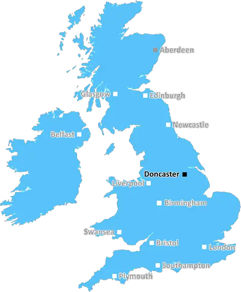
Doncaster (DN11)
The DN11 postcode area is located in the Doncaster postcode town region, within the county of South Yorkshire, and contains a total of 907 individual postcodes.
There are 16 electoral wards in the DN11 postcode area, including Barnetby, Barrow-Upon-Humber, Barton-Upon-Humber, Brigg, Cleethorpes, Doncaster, Gainsborough, Goole, Grimsby, Immingham, Retford, Scunthorpe, Ulceby which come under the local authority of the Doncaster Council.
Combining the whole postcode region, 17% of people in DN11 are classed as having an AB social grade, (i.e. 'white-collar' middle-upper class), compared to 27% across the UK.
This does not mean that the people of DN11 are poorer than other areas, but it may give an indication that there are areas of deprivation.
The DN11 postcode is in the Doncaster district of South Yorkshire in the UK. It covers the areas of Armthorpe, Edenthorpe, Dunsville, Kirk Sandall, Highfields, Hatfield, Thorne, and Stainforth.
Armthorpe is a sprawling and historic village, home to local pubs and smaller retail outlets. Edenthorpe is a charming village offering a range of suburban amenities and services, while Dunsville is a smaller village with a few local amenities and a pub. Kirk Sandall is a rural area of the district, with only a few local shops. Highfields is situated on the outskirts of the district and offers a few properties and some small local businesses. Hatfield is a larger village with a range of amenities and services for local residents. Thorne is the largest settlement in the district, and is home to a large industrial estate and development. Stainforth is a smaller village located on the north side of the district, known for its major industrial development, mainly in the form of chemical companies and paper factories.
Transport links in the region are well served, as the postcode is located close to the M18 motorway, providing access to Sheffield, Leeds, Doncaster, and Hull. Numerous bus and train services are available from the district, connecting to local towns and cities.
Schools in the area include Armthorpe Primary in Armthorpe, Don Valley Academy in Thorne, and Hatfield Primary in Hatfield. There are also further education colleges locally, such as Doncaster College in Thorne. Local leisure facilities include the Thorne Leisure Centre, Armthorpe Leisure Centre, and Hatfield Leisure Centre, all of which offer a range of activities and services. The Don Valley Stadium in Thorne hosts numerous sporting events and concerts, as well as being the home of Doncaster Rugby Union Football Club.
The DN11 postcode reflects its diverse range of villages, towns, and industry. It is an attractive area with a mix of modern and rural locations, providing a great range of amenities.

Demographics
South Yorkshire

DN11 is located in the county of South Yorkshire, in England.
South Yorkshire has a total population of 1,385,000, making it the 10th largest county in the UK.
South Yorkshire has a total area of 599 square miles, and a population density of 892 people per square kilometre. For comparison, Greater London has a density of 5,618 people/km2.
| Outward Code | DN11 |
| Postal Town | Doncaster |
| MSOA Name | Doncaster 036 |
| LSOA Name | Doncaster 036D |
| County | South Yorkshire |
| Region | South Yorkshire |
| Country | England |
| Local Authority | Doncaster |
| Area Classification | Urban with Minor Conurbation |
DN11 Electoral Wards
The postal region of DN11, includes the local towns, villages, electoral wards and stations of:
Dig even deeper into the DN11 postcode by clicking on a postcode below:
Click on an outward postal code below for more information about the area. Each 'outward' postcode give you a comprehensive list of all postcodes within the outward code area (DN) and estimated address.
Click on an 'outward' code for more information. For example, the outward postcode page 'EC2M' will give you an alphabetical list covering all postcodes located in the region, from 'EC2M 1BB' through to 'EC2M 7YA'.
Chris H
Saturday, April 6, 2024
We don't have any views of DN11 right now. If you live in DN11 or have visited it, please help us to help others by telling others what you think of this neighbourhood.
Add your view of DN11
People need your local expertise. If you live in DN11 or have first-hand knowledge of the neighbourhood, please consider sharing your views. It's completely anonymous - all we ask is for your initials.
Please tell us what you like about the DN11 postcode area, what you don't like, and what it's like to live or work here.
| LOCAL AMENITIES | |
| FAMILY FRIENDLY | |
| PARKING | |
| GREEN SPACES |
From the Postcode Area blog

Deciphering Crime Rates - a Deep Dive Into UK Postcode Analysis
Ever wondered about the crime rate in your UK postcode? You're not alone. We've dug deep into the data, uncovering trends and patterns that'll make your head spin.

Death of the High Street?
The BBC reports that despite councils' attempts to kurb them, the UK's high streets have seen a huge growth in fast food outlets. Could this mark the death knell for the Great British high street, and what can we do about it to halt its decline?

Discrimination by Postcode
You really couldn't make it up, could you? Some of the country's most vulnerable people are missing out on their weekly £25 Cold Weather Payment, just because the system that's in operation is discriminating against them because payments are based on postcode, rather than geographic location.

The Redesign is Underway
Well, the current website was absolutely in dire need of a good redesign - from the ground up. So I set out to pull it all apart and get it up and running again to become the most comprehensive guide to every postcode in the UK. And it's been a long, tough job from start to finish - and quite possibly the biggest project I've ever undertaken.
SOCIAL GRADES
According to census records, 17% of people here have a social grade of AB (highest), compared to the national average of 27%.