derby DE6 Postcodes
Spending a fortune on conveyancing?

Compare instant, low-cost online quotes from trusted conveyancing solicitors.
Backed by experts, our no-obligation service searches through the best conveyancing quotes on the market to save you time and money.
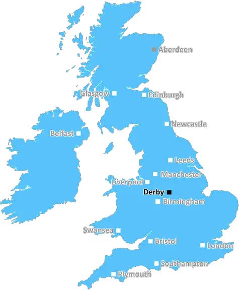
Derby (DE6)
The DE6 postcode area is located in the Derby postcode town region, within the county of Derbyshire, and contains a total of 1373 individual postcodes.
There are 195 electoral wards in the DE6 postcode area, including Alfreton, Ashbourne, Bakewell, Belper, Burton-On-Trent, Derby, Heanor, Ilkeston, Matlock, Ripley, Swadlincote which come under the local authority of the Derbyshire Dales Council.
Combining the whole postcode region, 34% of people in DE6 are classed as having an AB social grade, (i.e. 'white-collar' middle-upper class), compared to 27% across the UK.
This does not mean that the people of DE6 are wealthier - or higher class - than average, but it can be an indication that the area may be prospering and desirable to live in.
DE6 is a postcode district in Derbyshire, England.
DE6 covers more than 200 square kilometres, stretching from the edge of the Peak District in the northeast, to the Trent Valley and River Derwent in the southwest. The majority of the area is rural, with much of it lying within the Peak District National Park.
The main urban areas within the DE6 postcode include the villages of Ashbourne, Alfreton, Belper, Brailsford, Bradbourne, Cromford, and Ellastone, as well as parts of Ashover and Sudbury. Ashbourne is the main hub within DE6 and is a thriving market town with a variety of independent and national shops, pubs and eateries, as well as a weekly farmers' market.
Much of the DE6 area is agricultural land, with farms and smallholdings producing local produce. It is also home to a large number of farms, smallholdings and agritourism attractions.
DE6 also contains several nature reserves, such as Kedleston Hall Nature Reserve and Stanton Moor National Nature Reserve, both managed by Derbyshire Wildlife Trust. These areas provide homes for many local species of flora and fauna, including rare and protected species found in the area.
The DE6 postcode district is home to a range of recreational activities, from walking and cycling routes to horse riding, golf courses and swimming pools. The Peak District is a popular destination for visitors, with popular attractions such as Chatsworth House, Alton Towers and Izaak Walton's Cottage.
The area also contains a number of historic sites, such as Pickford's House Museum, a late 18th century Georgian townhouse, and the Iron Age fort of Arbury Banks.
TheDE6 postcode area is an idyllic location situated right at the heart of the Peak District, surrounded by stunning countryside. With its wide range of local amenities, attractions and activities, it provides an ideal base for exploring nearby towns and cities or simply enjoying the peace and tranquillity of the Derbyshire countryside.

Demographics

Derbyshire

DE6 is located in the county of Derbyshire, in England.
Derbyshire has a total population of 1,042,000, making it the 20th largest county in the UK.
Derbyshire has a total area of 1013 square miles, and a population density of 396 people per square kilometre. For comparison, Greater London has a density of 5,618 people/km2.
| Outward Code | DE6 |
| Postal Town | Derby |
| MSOA Name | Derbyshire Dales 009 |
| LSOA Name | Derbyshire Dales 009D |
| County | Derbyshire |
| Region | Derbyshire |
| Country | England |
| Local Authority | Derbyshire Dales |
| Area Classification | Mainly Rural (rural including hub towns >=80%) |
DE6 Electoral Wards
The postal region of DE6, includes the local towns, villages, electoral wards and stations of:
Dig even deeper into the DE6 postcode by clicking on a postcode below:
Click on an outward postal code below for more information about the area. Each 'outward' postcode give you a comprehensive list of all postcodes within the outward code area (DE) and estimated address.
Click on an 'outward' code for more information. For example, the outward postcode page 'EC2M' will give you an alphabetical list covering all postcodes located in the region, from 'EC2M 1BB' through to 'EC2M 7YA'.
Chris H
Monday, April 8, 2024
We don't have any views of DE6 right now. If you live in DE6 or have visited it, please help us to help others by telling others what you think of this neighbourhood.
Add your view of DE6
People need your local expertise. If you live in DE6 or have first-hand knowledge of the neighbourhood, please consider sharing your views. It's completely anonymous - all we ask is for your initials.
Please tell us what you like about the DE6 postcode area, what you don't like, and what it's like to live or work here.
| LOCAL AMENITIES | |
| FAMILY FRIENDLY | |
| PARKING | |
| GREEN SPACES |
Local News Derbyshire
Jail for driver who left pensioner with catastrophic injuries in Long Eaton
'At times in hospital I wish I had been killed'
Derby TelegraphMan and woman die in early hours house fire
Emergency services say they are investigating the cause of the blaze.
BBC NewsGreen light for major Rolls-Royce site revamp plans
The redevelopment of the site could create more than 1,000 new jobs in Derby.
BBC NewsTesco is now charging customers 10p for an item that has always been free
The supermarket chain announced it would be testing out a new pilot scheme
Derby Telegraph'Beautiful' Chellaston mum in Derby Telegraph funeral notices this weekend
Our thoughts are with the friends and family of those who have died recently
Derby Telegraph'Rarely busy' stunning beach just two hours away from Derby voted best in the region
The beach is described as an "unspoilt sandy beach backed by sand dunes"
Derby TelegraphUnfit and frustrated Mackworth man sheds eight stone in 12 months
John turned his life around after realising he was too unfit to walk to the local park
Derby TelegraphCouncil's reassurances over 'horrendous' pavement
Paving slabs were not relayed due to the 15.2m Ashbourne Reborn project, a council says.
BBC NewsFrom the Postcode Area blog

Deciphering Crime Rates - a Deep Dive Into UK Postcode Analysis
Ever wondered about the crime rate in your UK postcode? You're not alone. We've dug deep into the data, uncovering trends and patterns that'll make your head spin.

Death of the High Street?
The BBC reports that despite councils' attempts to kurb them, the UK's high streets have seen a huge growth in fast food outlets. Could this mark the death knell for the Great British high street, and what can we do about it to halt its decline?

Discrimination by Postcode
You really couldn't make it up, could you? Some of the country's most vulnerable people are missing out on their weekly £25 Cold Weather Payment, just because the system that's in operation is discriminating against them because payments are based on postcode, rather than geographic location.

The Redesign is Underway
Well, the current website was absolutely in dire need of a good redesign - from the ground up. So I set out to pull it all apart and get it up and running again to become the most comprehensive guide to every postcode in the UK. And it's been a long, tough job from start to finish - and quite possibly the biggest project I've ever undertaken.
SOCIAL GRADES
According to census records, 34% of people here have a social grade of AB (highest), compared to the national average of 27%.