derby DE21 Postcodes
Spending a fortune on conveyancing?

Compare instant, low-cost online quotes from trusted conveyancing solicitors.
Backed by experts, our no-obligation service searches through the best conveyancing quotes on the market to save you time and money.
Derby (DE21)
The DE21 postcode area is located in the Derby postcode town region, within the county of Derbyshire, and contains a total of 1417 individual postcodes.
There are 26 electoral wards in the DE21 postcode area, including Alfreton, Ashbourne, Bakewell, Belper, Burton-On-Trent, Derby, Heanor, Ilkeston, Matlock, Ripley, Swadlincote which come under the local authority of the Derby Council.
Combining the whole postcode region, 19% of people in DE21 are classed as having an AB social grade, (i.e. 'white-collar' middle-upper class), compared to 27% across the UK.
This does not mean that the people of DE21 are poorer than other areas, but it may give an indication that there are areas of deprivation.
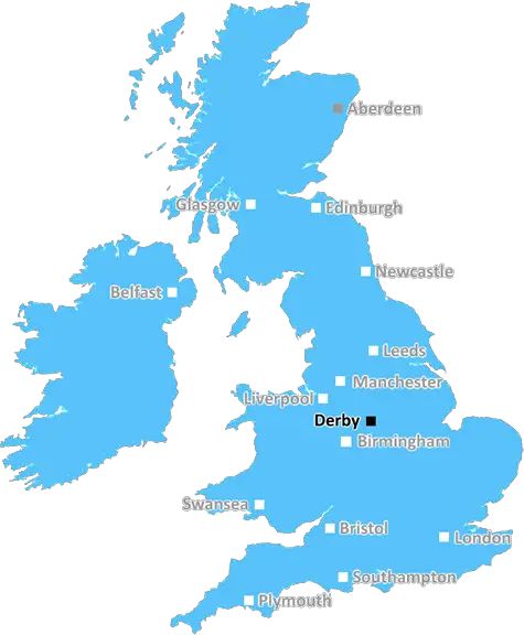
The DE21 postcode is in the Derby district in the U.K., and is commonly referred to as Derby. It is an area of Derbyshire, and is bordered by the county of Derbyshire in the west, and Nottinghamshire in the east, and a part of the administrative county that is also called Derbyshire. It includes the city of Derby itself and a number of small towns and villages. It has various suburbs of Derby, with the surrounding countryside being semi-rural, with rolling hills in the south.
In terms of economics, the DE21 postcode has a range of business and economic activities. The city is a renowned manufacturing centre, with a long history in shoe-making, engineering, engine-building and printing. The area is home to two universities, the University of Derby and Derby College. It has a number of retail lots of national stores such as Debenhams, Topshop, and JD Sports.
On the transport side, the area is well connected by road, with connections to the M1, M42 and M6 motorways in the vicinity. As of May 2020, Derby has four railway lines, providing direct connections to London, Manchester, Birmingham and Sheffield. The area is served by East Midlands Airport, with direct connections to most major destinations in the U.K., as well as some European cities. The Nottingham-Derby Cycleway also passes through the DE21 postcode.
In terms of culture, the area has some established names such as the Derby Museum and Art Gallery, the Derby Archaeological Museum, The Quad arts and entertainment venue, and the Derby Theatre. It also has a range of pubs, clubs and restaurants, as well as a cinema. In terms of recreational activities, there is a range of parks, open green spaces, tourist attractions and walks in the area.
The area is served with health and education services provided by the Derbyshire Health and Social Care Council and two of the county's hospital trusts. It also has several primary schools, libraries and a variety of other community services.
Including the city itself, the DE21 postcode covers an area of 250 square kilometres (97 square miles). The population as of 2019 recorded in the most recent census was 219,218, making it one of the most densely populated areas of the county.

Demographics

Derbyshire

DE21 is located in the county of Derbyshire, in England.
Derbyshire has a total population of 1,042,000, making it the 20th largest county in the UK.
Derbyshire has a total area of 1013 square miles, and a population density of 396 people per square kilometre. For comparison, Greater London has a density of 5,618 people/km2.
| Outward Code | DE21 |
| Postal Town | Derby |
| MSOA Name | Derby 003 |
| LSOA Name | Derby 003A |
| County | Derbyshire |
| Region | Derbyshire |
| Country | England |
| Local Authority | Derby |
| Area Classification | Urban with City and Town |
DE21 Electoral Wards
The postal region of DE21, includes the local towns, villages, electoral wards and stations of:
Dig even deeper into the DE21 postcode by clicking on a postcode below:
Click on an outward postal code below for more information about the area. Each 'outward' postcode give you a comprehensive list of all postcodes within the outward code area (DE) and estimated address.
Click on an 'outward' code for more information. For example, the outward postcode page 'EC2M' will give you an alphabetical list covering all postcodes located in the region, from 'EC2M 1BB' through to 'EC2M 7YA'.
Chris H
Sunday, April 7, 2024
We don't have any views of DE21 right now. If you live in DE21 or have visited it, please help us to help others by telling others what you think of this neighbourhood.
Add your view of DE21
People need your local expertise. If you live in DE21 or have first-hand knowledge of the neighbourhood, please consider sharing your views. It's completely anonymous - all we ask is for your initials.
Please tell us what you like about the DE21 postcode area, what you don't like, and what it's like to live or work here.
| LOCAL AMENITIES | |
| FAMILY FRIENDLY | |
| PARKING | |
| GREEN SPACES |
Local News Derbyshire
Picture-perfect Peak District village dark past brought back to life
The village became famous after the Black Death
Derby TelegraphDay centres facing closure under council shake-up
Four centres supporting people who are autistic or have learning disabilities could be closed.
BBC NewsTeen injured in Ilkeston street fight, police make 4 arrests
A teenager suffered a swollen lip, cut to the head and grazes and was taken to hospital
Derby Telegraph'Beautiful' Chellaston mum in Derby Telegraph funeral notices this weekend
Our thoughts are with the friends and family of those who have died recently
Derby TelegraphPolice launch appeal after serious assault in Derby
Police would like to speak to two men in connection with the incident
Derby TelegraphEuroMillions draw results live: Winning numbers for Friday, April 5, 2024 for 62 million jackpot prize
It could be your lucky day if you are in tonight's huge draw
Derby TelegraphDerbyshire man stabbed Costa worker a dozen times after being told he couldn't charge vape
Daren Laken attacked hotel staff, stole knives and poured wine over a computer during the rampage
Derby TelegraphGreen light for major Rolls-Royce site revamp plans
The redevelopment of the site could create more than 1,000 new jobs in Derby.
BBC NewsFrom the Postcode Area blog

Deciphering Crime Rates - a Deep Dive Into UK Postcode Analysis
Ever wondered about the crime rate in your UK postcode? You're not alone. We've dug deep into the data, uncovering trends and patterns that'll make your head spin.

Death of the High Street?
The BBC reports that despite councils' attempts to kurb them, the UK's high streets have seen a huge growth in fast food outlets. Could this mark the death knell for the Great British high street, and what can we do about it to halt its decline?

Discrimination by Postcode
You really couldn't make it up, could you? Some of the country's most vulnerable people are missing out on their weekly £25 Cold Weather Payment, just because the system that's in operation is discriminating against them because payments are based on postcode, rather than geographic location.

The Redesign is Underway
Well, the current website was absolutely in dire need of a good redesign - from the ground up. So I set out to pull it all apart and get it up and running again to become the most comprehensive guide to every postcode in the UK. And it's been a long, tough job from start to finish - and quite possibly the biggest project I've ever undertaken.
SOCIAL GRADES
According to census records, 19% of people here have a social grade of AB (highest), compared to the national average of 27%.