derby DE14 Postcodes
Spending a fortune on conveyancing?

Compare instant, low-cost online quotes from trusted conveyancing solicitors.
Backed by experts, our no-obligation service searches through the best conveyancing quotes on the market to save you time and money.
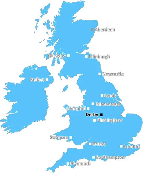
Derby (DE14)
The DE14 postcode area is located in the Derby postcode town region, within the county of Staffordshire, and contains a total of 1207 individual postcodes.
There are 8 electoral wards in the DE14 postcode area, including Alfreton, Ashbourne, Bakewell, Belper, Burton-On-Trent, Derby, Heanor, Ilkeston, Matlock, Ripley, Swadlincote which come under the local authority of the East Staffordshire Council.
Combining the whole postcode region, 15% of people in DE14 are classed as having an AB social grade, (i.e. 'white-collar' middle-upper class), compared to 27% across the UK.
This does not mean that the people of DE14 are poorer than other areas, but it may give an indication that there are areas of deprivation.
The DE14 postcode, located in East Staffordshire, covers the towns of Burton-upon-Trent, Stretton, Winshill and parts of Tutbury, Needwood, and Horninglow.
In terms of amenities, the area sees a varied range of shops, restaurants, gyms and pubs. In particular, the Coopers Square shopping centre offers a selection of retail outlets including department stores and high street names. The National Brewery Centre is the UK's biggest museum dedicated to brewing and allows visitors to learn about the sights, sounds and smells of brewing.
Transport links in DE14 are plentiful thanks to the M1 motorway, A38 road, two railway stations (Burton-on-Trent and Tutbury and Hatton) and East Midlands Airport nearby.
Schools in the area are of good quality and include The de Ferrers Academy; John Taylor High School; Granville Academy; Rykneld Primary School; St Chad's Catholic and Church of England Primary School; John Wass Primary School; Abbot Beyne Senior and Junior School; and Abbotsholme School.
A variety of community and leisure amenities are available locally. Burton is home to Queen's hospital and Christie's Medical Centre, as well as an Odeon cinema and the Brewhouse arts �centre. The area has two outdoor swimming pools and numerous parks from which to enjoy the rural sights, including Stretton Garrock Woods and the River Trent meandering through the area.
DE14 has an abundance of places of historical interest including Burton Abbey; Tutbury Castle, a grade I listed, medieval building; St Modwen's Church, which dates back to the 11th century; and St Mary's Church, the oldest parish church in the area.
Sports fans can enjoy all kinds of activities such as golf and fishing, while the area also offers the opportunity to take part in regular festivals and events, including the annual Marston's Beer Festival and the Stretton Music Festival.

Demographics

Staffordshire

DE14 is located in the county of Staffordshire, in England.
Staffordshire has a total population of 1,120,300, making it the 17th largest county in the UK.
Staffordshire has a total area of 1047 square miles, and a population density of 412 people per square kilometre. For comparison, Greater London has a density of 5,618 people/km2.
| Outward Code | DE14 |
| Postal Town | Derby |
| MSOA Name | East Staffordshire 011 |
| LSOA Name | East Staffordshire 011F |
| County | Staffordshire |
| Region | Staffordshire |
| Country | England |
| Local Authority | East Staffordshire |
| Area Classification | Urban with Significant Rural (rural including hub towns 26-49%) |
DE14 Electoral Wards
The postal region of DE14, includes the local towns, villages, electoral wards and stations of:
Dig even deeper into the DE14 postcode by clicking on a postcode below:
Click on an outward postal code below for more information about the area. Each 'outward' postcode give you a comprehensive list of all postcodes within the outward code area (DE) and estimated address.
Click on an 'outward' code for more information. For example, the outward postcode page 'EC2M' will give you an alphabetical list covering all postcodes located in the region, from 'EC2M 1BB' through to 'EC2M 7YA'.
Chris H
Friday, May 10, 2024
We don't have any views of DE14 right now. If you live in DE14 or have visited it, please help us to help others by telling others what you think of this neighbourhood.
Add your view of DE14
People need your local expertise. If you live in DE14 or have first-hand knowledge of the neighbourhood, please consider sharing your views. It's completely anonymous - all we ask is for your initials.
Please tell us what you like about the DE14 postcode area, what you don't like, and what it's like to live or work here.
| LOCAL AMENITIES | |
| FAMILY FRIENDLY | |
| PARKING | |
| GREEN SPACES |
Local News Staffordshire
Businesses encouraged to offer discounts to social care workers
Staffordshire and Stoke-on-Trent businesses are being encouraged to offer cost-of-living support to social care workers, who help some of the most vulnerable people in society.
Staffordshire County CouncilOver 80,000 miles of Staffordshire's roads gritted over Winter period
Highways crews have worked around the clock throughout the winter period to keep Staffordshire's roads safe, gritting the equivalent of 80,000 miles.
Staffordshire County CouncilArsonists hunted after lorry trailers blaze
Four lorry trailers were well alight and it took crews around six hours to put the blaze out.
BBC NewsRachel Shenton's 'Potteries Podcast' goes global
Her podcast, 'Gladstone Girls' is heading to New York's Tribeca film festival.
BBC NewsHighways improvements to start in Lichfield next week
A major highways improvements scheme in Lichfield will start on Monday 25 March.
Staffordshire County CouncilCouncil given national recognition for supporting residents to learn vital employability skills
Staffordshire County Council's Community Learning service has been awarded the international quality Matrix Standard for providing high quality information and advice to residents about learning and w&hellip
Staffordshire County CouncilTWO jailed after police bust THREE cannabis factories on ONE street
Staffordshire Police made the discoveries on Stanley Street, in Tunstall
Stoke SentinelFour friends recreate epic charity walk for 55 year reunion
Bill Ollier and Ian Griffin discuss their nostalgic charity walk reunion for Oxfam.
BBC NewsFrom the Postcode Area blog

Deciphering Crime Rates - a Deep Dive Into UK Postcode Analysis
Ever wondered about the crime rate in your UK postcode? You're not alone. We've dug deep into the data, uncovering trends and patterns that'll make your head spin.

Death of the High Street?
The BBC reports that despite councils' attempts to kurb them, the UK's high streets have seen a huge growth in fast food outlets. Could this mark the death knell for the Great British high street, and what can we do about it to halt its decline?

Discrimination by Postcode
You really couldn't make it up, could you? Some of the country's most vulnerable people are missing out on their weekly £25 Cold Weather Payment, just because the system that's in operation is discriminating against them because payments are based on postcode, rather than geographic location.

The Redesign is Underway
Well, the current website was absolutely in dire need of a good redesign - from the ground up. So I set out to pull it all apart and get it up and running again to become the most comprehensive guide to every postcode in the UK. And it's been a long, tough job from start to finish - and quite possibly the biggest project I've ever undertaken.
SOCIAL GRADES
According to census records, 15% of people here have a social grade of AB (highest), compared to the national average of 27%.