dartford DA13 Postcodes
Spending a fortune on conveyancing?

Compare instant, low-cost online quotes from trusted conveyancing solicitors.
Backed by experts, our no-obligation service searches through the best conveyancing quotes on the market to save you time and money.
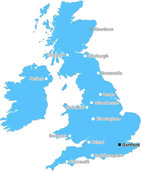
Dartford (DA13)
The DA13 postcode area is located in the Dartford postcode town region, within the county of Kent, and contains a total of 497 individual postcodes.
There are 34 electoral wards in the DA13 postcode area, including Belvedere, Bexley, Bexleyheath, Dartford, Erith, Gravesend, Greenhithe, Longfield, Sidcup, Swanscombe, Welling which come under the local authority of the Gravesham Council.
Combining the whole postcode region, 28% of people in DA13 are classed as having an AB social grade, (i.e. 'white-collar' middle-upper class), compared to 27% across the UK.
This does not mean that the people of DA13 are wealthier - or higher class - than average, but it can be an indication that the area may be prospering and desirable to live in.
The geographical area covered by the DA13 postcode district is located in the historic county of Kent, also known as the �Garden of England'. Covering an estimated 11.53 km� or 2856 acres, this postcode district serves the towns of Bean and Sutton-at-Hone, plus other neighbouring settlements including Swanscombe and Greenhithe.
The area largely serves as an outer suburb close to Dartford, with some notable landmarks situated in the district. The Bluewater Shopping Centre, one of the largest in the UK, is located within. There are also two golf courses that border the catchment � Swanley Park and Kingsdown.
Dartford train station, which is located 6.5 km away, serves the area, as well as the nearby Ebbsfleet International station. In addition to a number of bus routes, the area is also well served with motorways, including the M25, A2 and M2.
The majority of housing in the area consists of semi-detached and detached properties built in the late 20th century. The area has become popular with commuters, given its close proximity to London.
In terms of educational facilities, the area is served by Bean Primary School, St Columba's RC Primary School, The Wilmington Academy and The Leigh Academy secondary schools, along with choice of well-respected private schools nearby.
The DA13 postcode district is a popular area for recreation, especially for outdoor activities. With its easy access to the River Thames, there are plenty of opportunities for fishing, sailing and watersports. Additionally, nearby Bluewater gives access to the lakes at Swanscombe Peninsula, providing plenty of water activities such as wakeboarding. For those looking for a tranquil walk, nearby Shorne Wood Country Park offers some delightful wooded areas and a nature reserve. Other parks and green spaces in the area include Springhead Park and Swanscombe Riverside Park.
Furthermore, there are plenty of local shopping facilities including a shopping centre on Central Road and convenience stores located throughout the district.
All in all, the DA13 postcode offers a great mix of natural beauty and convenience, making it an attractive place to both live and visit.

Demographics

Kent

DA13 is located in the county of Kent, in England.
Kent has a total population of 1,820,400, making it the 6th largest county in the UK.
Kent has a total area of 1443 square miles, and a population density of 486 people per square kilometre. For comparison, Greater London has a density of 5,618 people/km2.
| Outward Code | DA13 |
| Postal Town | Dartford |
| MSOA Name | Gravesham 012 |
| LSOA Name | Gravesham 012D |
| County | Kent |
| Region | Kent |
| Country | England |
| Local Authority | Gravesham |
| Area Classification | Urban with Major Conurbation |
DA13 Electoral Wards
The postal region of DA13, includes the local towns, villages, electoral wards and stations of:
Dig even deeper into the DA13 postcode by clicking on a postcode below:
Click on an outward postal code below for more information about the area. Each 'outward' postcode give you a comprehensive list of all postcodes within the outward code area (DA) and estimated address.
Click on an 'outward' code for more information. For example, the outward postcode page 'EC2M' will give you an alphabetical list covering all postcodes located in the region, from 'EC2M 1BB' through to 'EC2M 7YA'.
Chris H
Saturday, April 6, 2024
We don't have any views of DA13 right now. If you live in DA13 or have visited it, please help us to help others by telling others what you think of this neighbourhood.
Add your view of DA13
People need your local expertise. If you live in DA13 or have first-hand knowledge of the neighbourhood, please consider sharing your views. It's completely anonymous - all we ask is for your initials.
Please tell us what you like about the DA13 postcode area, what you don't like, and what it's like to live or work here.
| LOCAL AMENITIES | |
| FAMILY FRIENDLY | |
| PARKING | |
| GREEN SPACES |
Local News Kent
Places for People acquires Rosewood Housing
The affordable homes provider was previously owned by housing developer Inland Homes.
Property WeekTT Group sells BT's old Southampton offices to consortium
BT's former Friary House office building has permission for residential conversion under permitted development rights.
Property WeekKent sign Swanepoel after Bartlett deal called off
South African all-rounder Beyers Swanepoel is to join Kent after Xavier Bartlett's deal falls through.
BBC NewsBuildings demolished to make way for town's fourth Costa branch
Two warehouse buildings have vanished as another Costa Coffee outlet moves closer to completion and opening.
Kent OnlineCharlton Athletic 0-0 Stevenage
Stevenage see their League One play-off hopes dented as a 0-0 draw at Charlton extends their winless run to seven matches.
BBC NewsStarbucks partner signs lease at Prologis Park Hemel Hempstead
Food Service Logisticshas agreed a 15-year lease at the161,134 sq ftdistribution centre.
Property WeekCrackdown and fines for 'nuisance drivers' and boy racers across towns
Nuisance motorists will be fined and be taken to court as part of a towns-wide clampdown on boy racers and anti-social drivers, a council has pledged.
Kent OnlineThames Water troubles swell as parent firm defaults
Holding company Kemble has told lenders that it has failed to meet a deadline for interest payments.
BBC NewsFrom the Postcode Area blog

Deciphering Crime Rates - a Deep Dive Into UK Postcode Analysis
Ever wondered about the crime rate in your UK postcode? You're not alone. We've dug deep into the data, uncovering trends and patterns that'll make your head spin.

Death of the High Street?
The BBC reports that despite councils' attempts to kurb them, the UK's high streets have seen a huge growth in fast food outlets. Could this mark the death knell for the Great British high street, and what can we do about it to halt its decline?

Discrimination by Postcode
You really couldn't make it up, could you? Some of the country's most vulnerable people are missing out on their weekly £25 Cold Weather Payment, just because the system that's in operation is discriminating against them because payments are based on postcode, rather than geographic location.

The Redesign is Underway
Well, the current website was absolutely in dire need of a good redesign - from the ground up. So I set out to pull it all apart and get it up and running again to become the most comprehensive guide to every postcode in the UK. And it's been a long, tough job from start to finish - and quite possibly the biggest project I've ever undertaken.
SOCIAL GRADES
According to census records, 28% of people here have a social grade of AB (highest), compared to the national average of 27%.