darlington DL13 Postcodes
Spending a fortune on conveyancing?

Compare instant, low-cost online quotes from trusted conveyancing solicitors.
Backed by experts, our no-obligation service searches through the best conveyancing quotes on the market to save you time and money.
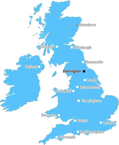
Darlington (DL13)
The DL13 postcode area is located in the Darlington postcode town region, within the county of Durham, and contains a total of 1058 individual postcodes.
There are 99 electoral wards in the DL13 postcode area, including Barnard Castle, Bedale, Bishop Auckland, Catterick Garrison, Crook, Darlington, Ferryhill, Hawes, Leyburn, Newton Aycliffe, Northallerton, Richmond, Shildon, Spennymoor which come under the local authority of the County Durham Council.
Combining the whole postcode region, 20% of people in DL13 are classed as having an AB social grade, (i.e. 'white-collar' middle-upper class), compared to 27% across the UK.
This does not mean that the people of DL13 are poorer than other areas, but it may give an indication that there are areas of deprivation.
DL13 is a postcode district based in Darlington in the North East of England. It is part of the Darlington postcode area and covers the villages of Sedgefield, Ferryhill and Chilton. It also includes the towns of Dalton and Elton, as well as the suburbs of Bank Top and Carmel.
The DL13 postcode district has an approximate population of 17,000 people living over an area of 54 square kilometres. It is bordered by the DL12 and DL14 postcodes, as well as several other postcode districts in the Durham and Teesdale areas.
The area served by the DL13 postcode is largely rural, mainly consisting of rolling hills and green fields. The small villages within its boundaries have a combination of traditional stone houses and more modern properties. There are a number of quaint local pubs, village shops and a few small businesses to be found in the area.
The DL13 postcode falls within the Hamilton district of the Darlington Borough Council. It is split by three parliamentary constituencies: Teesdale, Sedgefield and Durham North West.
The area boasts a number of leisure facilities, including the Barnard Castle Golf Club and the Sedgefield and Elton Country Parks. There are also several historic sites, such as the nearby Raby Castle and the 15th century Aycliffe Church.
The DL13 postcode district is home to an array of amenities, such as supermarkets, convenience stores, cafes, estate agencies and banks as well as a number of renowned schools and colleges. It is well connected to the wider area, with several major roads running through it, including A689 and A167. Regular bus links are available to nearby towns and cities, while Darlington main railway station is just 11 miles away.

Demographics
Durham

DL13 is located in the county of Durham, in England.
Durham has a total population of 0, making it the largest county in the UK.
Durham has a total area of square miles, and a population density of people per square kilometre. For comparison, Greater London has a density of 5,618 people/km2.
| Outward Code | DL13 |
| Postal Town | Darlington |
| MSOA Name | County Durham 042 |
| LSOA Name | County Durham 042A |
| County | Durham |
| Region | Durham |
| Country | England |
| Local Authority | County Durham |
| Area Classification | Largely Rural (rural including hub towns 50-79%) |
DL13 Electoral Wards
The postal region of DL13, includes the local towns, villages, electoral wards and stations of:
Dig even deeper into the DL13 postcode by clicking on a postcode below:
Click on an outward postal code below for more information about the area. Each 'outward' postcode give you a comprehensive list of all postcodes within the outward code area (DL) and estimated address.
Click on an 'outward' code for more information. For example, the outward postcode page 'EC2M' will give you an alphabetical list covering all postcodes located in the region, from 'EC2M 1BB' through to 'EC2M 7YA'.
Chris H
Thursday, May 9, 2024
We don't have any views of DL13 right now. If you live in DL13 or have visited it, please help us to help others by telling others what you think of this neighbourhood.
Add your view of DL13
People need your local expertise. If you live in DL13 or have first-hand knowledge of the neighbourhood, please consider sharing your views. It's completely anonymous - all we ask is for your initials.
Please tell us what you like about the DL13 postcode area, what you don't like, and what it's like to live or work here.
| LOCAL AMENITIES | |
| FAMILY FRIENDLY | |
| PARKING | |
| GREEN SPACES |
Local News County Durham
Eurovision Song Contest 2024: How will voting work?
This year's Eurovision Song Contest begins in Malm, Sweden this week and this is how you can vote for your favourite act.
Northern EchoTruck windscreen smashed by rock thrown onto A66 at Middlesbrough
A truck driver was lucky to walk away uninjured after a brick thrown at his lorry from a bridge over the A66 smashed his windscreen.
Northern EchoA Tom McGuinnesss under the hammer - along with some potato flasks
FOUR paintings by south Durham mining artist Tom McGuinness are to go under the hammer in North Yorkshire next month.
Northern EchoRedcar & Cleveland Council agree option to lease former Coatham Bowl
Redcar & Cleveland Borough Council have finalised the option to lease the former Coatham Bowl site to Coatham Arena Limited [CAL] for the development of a 5,000-capacity multi-purpose indoor Arena.
Northern EchoHSE issues Crown Censure to MoD after death of soldier
The Health and Safety Executive (HSE) has today (Wednesday 8 May) issued the Ministry of Defence (MoD) with a Crown Censure following the death of a soldier.
Northern EchoFour reasons why County Durham is the culture county'
In spring of 2022, County Durham made history when it was announced as the first ever county to make the shortlist to be UK City of Culture.
Northern EchoInvestigation into Chester-le-Street fly-tipping incident
An investigation has been launched into a fly-tipping incident on the public bridleway near Drum Industrial Estate in Chester-le-Street
Northern EchoNorth East weather: Temperatures to reach 21C this weekend
According to the Met Office's long-range forecast, conditions are expected to turn more changeable after this weekend
Northern EchoFrom the Postcode Area blog

Deciphering Crime Rates - a Deep Dive Into UK Postcode Analysis
Ever wondered about the crime rate in your UK postcode? You're not alone. We've dug deep into the data, uncovering trends and patterns that'll make your head spin.

Death of the High Street?
The BBC reports that despite councils' attempts to kurb them, the UK's high streets have seen a huge growth in fast food outlets. Could this mark the death knell for the Great British high street, and what can we do about it to halt its decline?

Discrimination by Postcode
You really couldn't make it up, could you? Some of the country's most vulnerable people are missing out on their weekly £25 Cold Weather Payment, just because the system that's in operation is discriminating against them because payments are based on postcode, rather than geographic location.

The Redesign is Underway
Well, the current website was absolutely in dire need of a good redesign - from the ground up. So I set out to pull it all apart and get it up and running again to become the most comprehensive guide to every postcode in the UK. And it's been a long, tough job from start to finish - and quite possibly the biggest project I've ever undertaken.
SOCIAL GRADES
According to census records, 20% of people here have a social grade of AB (highest), compared to the national average of 27%.