croydon CR0 Postcodes
Spending a fortune on conveyancing?

Compare instant, low-cost online quotes from trusted conveyancing solicitors.
Backed by experts, our no-obligation service searches through the best conveyancing quotes on the market to save you time and money.
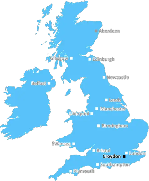
Croydon (CR0)
The CR0 postcode area is located in the Croydon postcode town region, within the county of Greater London, and contains a total of 2750 individual postcodes.
There are 36 electoral wards in the CR0 postcode area, including Caterham, Coulsdon, Croydon, Kenley, Mitcham, Purley, South Croydon, Thornton Heath, Warlingham, Whyteleafe which come under the local authority of the Croydon Council.
Combining the whole postcode region, 21% of people in CR0 are classed as having an AB social grade, (i.e. 'white-collar' middle-upper class), compared to 27% across the UK.
This does not mean that the people of CR0 are poorer than other areas, but it may give an indication that there are areas of deprivation.
CR0 is a postcode district located in the Croydon area of London. The postcode district covers a large part of south and east Croydon, extending from Selhurst in the north to Coulsdon in the south. It also includes Waddon, part of Thornton Heath and parts of Shirley and Addiscombe. It also covers businesses at the Purley Way Retail Park.
CR0 is also home to some of the best attractions in London, including the gorgeous Croham Hurst Woods, an ancient 6acre wood, and Croydon Airport, one of the oldest airports in the world. There is also the South Norwood Country Park, with its lake and exciting activities to take part in.
CR0 is a popular shopping and leisure centre, with the Whitgift Centre, possibly the largest shopping centre in South London, and Centrale, the other shopping centre in the postcode district, where you can find a wide array of different stores, restaurants and cafes. Moreover, Croydon has some of the best entertainment venues in the city, including The Grand Theatre, an Edwardian palace of entertainment, and the Fairfield Halls, featuring modern arts and theatre facilities.
The area is also home to some of the most stunning views in London. Crystal Palace Park in the north of the postcode district has breathtaking views of the city skyline and the nearby Crystal Palace transmission tower. In terms of education, CRO has a range of primary and secondary schools, including the highly rated Addington High School, performing arts school Quest Academy, and Archbishop Tenison's, an independent Catholic school.
The postcode district is well-connected to the rest of London, featuring three train stations, East Croydon, South Croydon and Waddon, as well as two Tramlink stops along the line from Wimbledon to Beckenham. The area is also served by a number of buses, including the X26 bus from Heathrow Airport to Purley.
CR0 is a vibrant area with plenty of things to see and do. With its mix of historical attractions, shopping centres, parks, entertainment venues, and schools, CRO is a great place to live.

Demographics
Greater London

CR0 is located in the county of Greater London, in England.
Greater London has a total population of 8,778,500, making it the 1st largest county in the UK.
Greater London has a total area of 606 square miles, and a population density of 5594 people per square kilometre. For comparison, Greater London has a density of 5,618 people/km2.
| Outward Code | CR0 |
| Postal Town | Croydon |
| MSOA Name | Croydon 036 |
| LSOA Name | Croydon 036B |
| County | Greater London |
| Region | Greater London |
| Country | England |
| Local Authority | Croydon |
| Area Classification | Urban with Major Conurbation |
CR0 Electoral Wards
The postal region of CR0, includes the local towns, villages, electoral wards and stations of:
Dig even deeper into the CR0 postcode by clicking on a postcode below:
Click on an outward postal code below for more information about the area. Each 'outward' postcode give you a comprehensive list of all postcodes within the outward code area (CR) and estimated address.
Click on an 'outward' code for more information. For example, the outward postcode page 'EC2M' will give you an alphabetical list covering all postcodes located in the region, from 'EC2M 1BB' through to 'EC2M 7YA'.
Chris H
Saturday, April 6, 2024
We don't have any views of CR0 right now. If you live in CR0 or have visited it, please help us to help others by telling others what you think of this neighbourhood.
Add your view of CR0
People need your local expertise. If you live in CR0 or have first-hand knowledge of the neighbourhood, please consider sharing your views. It's completely anonymous - all we ask is for your initials.
Please tell us what you like about the CR0 postcode area, what you don't like, and what it's like to live or work here.
| LOCAL AMENITIES | |
| FAMILY FRIENDLY | |
| PARKING | |
| GREEN SPACES |
Local News Surrey
CCTV appeal after gang steal 3k of perfume from Reigate Jo Malone shop
Police have released CCTV images of three men they want to identify as part of the investigation
Get SurreySurrey County Council gets new boss who pledges to help the 'most vulnerable'
Terrence was Chief Executive of another council in another area for 25 years
Get SurreyNew plans for beauty spot near Surrey branded 'huge disappointment'
The 'Hyde Park sized' conservation area, which was planned to act as a haven for at-risk wildlife, has been subject to much controversy
Get Surrey'Possible human remains' discovered in park on Surrey border
Police said the possible remains will be sent away for a full analysis
Get SurreyPolice find new Guildford pub bombing evidence but say they will not investigate
New evidence on the Guildford pub bombings has emerged 50 years after the IRA detonated two devices in the town
Get SurreyNew water quality lab to monitor river
The facility will be called the Water Rangers Community Water Lab.
BBC NewsInside the stunning 1.5m Dorking barn with garden that looks like tropical resort
The property is nestled within the countryside
Get SurreyResidents of closing care unit yet to get new home
Council working to find new accommodation for six residents of Jutland Place which is closing.
BBC NewsFrom the Postcode Area blog

Deciphering Crime Rates - a Deep Dive Into UK Postcode Analysis
Ever wondered about the crime rate in your UK postcode? You're not alone. We've dug deep into the data, uncovering trends and patterns that'll make your head spin.

Death of the High Street?
The BBC reports that despite councils' attempts to kurb them, the UK's high streets have seen a huge growth in fast food outlets. Could this mark the death knell for the Great British high street, and what can we do about it to halt its decline?

Discrimination by Postcode
You really couldn't make it up, could you? Some of the country's most vulnerable people are missing out on their weekly £25 Cold Weather Payment, just because the system that's in operation is discriminating against them because payments are based on postcode, rather than geographic location.

The Redesign is Underway
Well, the current website was absolutely in dire need of a good redesign - from the ground up. So I set out to pull it all apart and get it up and running again to become the most comprehensive guide to every postcode in the UK. And it's been a long, tough job from start to finish - and quite possibly the biggest project I've ever undertaken.
SOCIAL GRADES
According to census records, 21% of people here have a social grade of AB (highest), compared to the national average of 27%.