crewe CW5 Postcodes
Spending a fortune on conveyancing?

Compare instant, low-cost online quotes from trusted conveyancing solicitors.
Backed by experts, our no-obligation service searches through the best conveyancing quotes on the market to save you time and money.
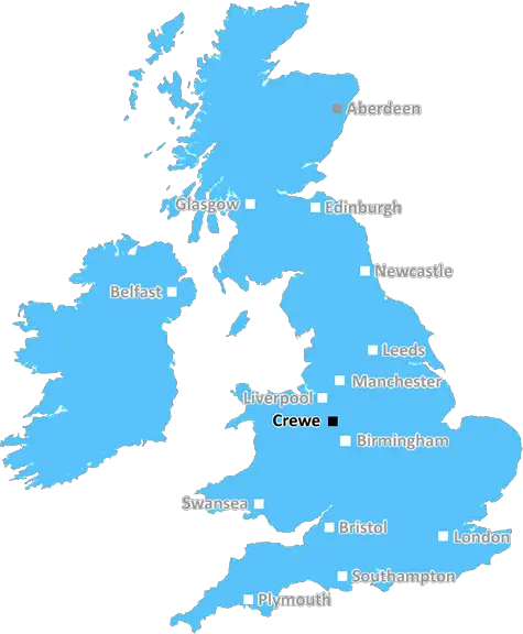
Crewe (CW5)
The CW5 postcode area is located in the Crewe postcode town region, within the county of Cheshire, and contains a total of 1192 individual postcodes.
There are 99 electoral wards in the CW5 postcode area, including Congleton, Crewe, Middlewich, Nantwich, Northwich, Sandbach, Tarporley, Winsford which come under the local authority of the Cheshire East Council.
Combining the whole postcode region, 33% of people in CW5 are classed as having an AB social grade, (i.e. 'white-collar' middle-upper class), compared to 27% across the UK.
This does not mean that the people of CW5 are wealthier - or higher class - than average, but it can be an indication that the area may be prospering and desirable to live in.
CW5 postcode denotes an area within the Cheshire West and Chester borough of North West England. The postal town of the CW5 postcode is Nantwich. It is one of seven postcodes in the CW postal district. It is adjacent to the postal area of CW1-CW4 and also serves the areas of Barony Park, Burland, Buttley Hill, Cowper, Crewe, Elworth, Heatley, Holmes Chapel, Hulme, Macclesfield Canal, Newcastle Road, Preston on the Hill, Ravensmeer, Shavington, Spen Green, Stapeley, Summerfield, Tabley Green, Walton Brook, Wimblebury, Wincle, Wrenbury, Wrinehill and Wybunbury.
The language spoken in the area is mainly English, with some Welsh also spoken in areas closer to the Welsh border. The area has a population of approximately fourteen thousand, with the average age being thirty-six. The majority of housing is detached or semi-detached, with terraced and cluster properties forming the second highest category. Many inhabitants of the CW5 postcode hold a Certificate of Higher Education or equivalent qualification, with the majority of people employed in skilled trades and in professional roles.
All of the towns in the CW5 postcode have a range of amenities, including shops and banks, pubs and restaurants, churches, schools and libraries. The larger towns are the home to more traditional tourist attractions such as museums, galleries and leisure centres. Nantwich Museum, Calveley Mill and the Wrenbury Wood Nature Reserve are popular tourist attractions, as is the William Adams & Sons Stud farm in Burland.
In terms of leisure activities, there are numerous walking and cycling routes, with the Sandstone Trail from Northwich to Whitchurch passing through the postcode area. The Trent and Mersey Canal runs close by, with boat trips along the canal and fishing spots in abundance. The area is also known for its close proximity to Carden Enterprises, with numerous smaller farmers markets and farmers fields found in the locality.

Demographics
Cheshire

CW5 is located in the county of Cheshire, in England.
Cheshire has a total population of 1,048,100, making it the 19th largest county in the UK.
Cheshire has a total area of 904 square miles, and a population density of 447 people per square kilometre. For comparison, Greater London has a density of 5,618 people/km2.
| Outward Code | CW5 |
| Postal Town | Crewe |
| MSOA Name | Cheshire East 047 |
| LSOA Name | Cheshire East 047A |
| County | Cheshire |
| Region | Cheshire |
| Country | England |
| Local Authority | Cheshire East |
| Area Classification | Urban with Significant Rural (rural including hub towns 26-49%) |
CW5 Electoral Wards
The postal region of CW5, includes the local towns, villages, electoral wards and stations of:
Dig even deeper into the CW5 postcode by clicking on a postcode below:
Click on an outward postal code below for more information about the area. Each 'outward' postcode give you a comprehensive list of all postcodes within the outward code area (CW) and estimated address.
Click on an 'outward' code for more information. For example, the outward postcode page 'EC2M' will give you an alphabetical list covering all postcodes located in the region, from 'EC2M 1BB' through to 'EC2M 7YA'.
Chris H
Monday, April 8, 2024
We don't have any views of CW5 right now. If you live in CW5 or have visited it, please help us to help others by telling others what you think of this neighbourhood.
Add your view of CW5
People need your local expertise. If you live in CW5 or have first-hand knowledge of the neighbourhood, please consider sharing your views. It's completely anonymous - all we ask is for your initials.
Please tell us what you like about the CW5 postcode area, what you don't like, and what it's like to live or work here.
| LOCAL AMENITIES | |
| FAMILY FRIENDLY | |
| PARKING | |
| GREEN SPACES |
From the Postcode Area blog

Deciphering Crime Rates - a Deep Dive Into UK Postcode Analysis
Ever wondered about the crime rate in your UK postcode? You're not alone. We've dug deep into the data, uncovering trends and patterns that'll make your head spin.

Death of the High Street?
The BBC reports that despite councils' attempts to kurb them, the UK's high streets have seen a huge growth in fast food outlets. Could this mark the death knell for the Great British high street, and what can we do about it to halt its decline?

Discrimination by Postcode
You really couldn't make it up, could you? Some of the country's most vulnerable people are missing out on their weekly £25 Cold Weather Payment, just because the system that's in operation is discriminating against them because payments are based on postcode, rather than geographic location.

The Redesign is Underway
Well, the current website was absolutely in dire need of a good redesign - from the ground up. So I set out to pull it all apart and get it up and running again to become the most comprehensive guide to every postcode in the UK. And it's been a long, tough job from start to finish - and quite possibly the biggest project I've ever undertaken.
SOCIAL GRADES
According to census records, 33% of people here have a social grade of AB (highest), compared to the national average of 27%.