crewe CW10 Postcodes
Spending a fortune on conveyancing?

Compare instant, low-cost online quotes from trusted conveyancing solicitors.
Backed by experts, our no-obligation service searches through the best conveyancing quotes on the market to save you time and money.
Crewe (CW10)
The CW10 postcode area is located in the Crewe postcode town region, within the county of Cheshire, and contains a total of 546 individual postcodes.
There are 24 electoral wards in the CW10 postcode area, including Congleton, Crewe, Middlewich, Nantwich, Northwich, Sandbach, Tarporley, Winsford which come under the local authority of the Cheshire East Council.
Combining the whole postcode region, 28% of people in CW10 are classed as having an AB social grade, (i.e. 'white-collar' middle-upper class), compared to 27% across the UK.
This does not mean that the people of CW10 are wealthier - or higher class - than average, but it can be an indication that the area may be prospering and desirable to live in.
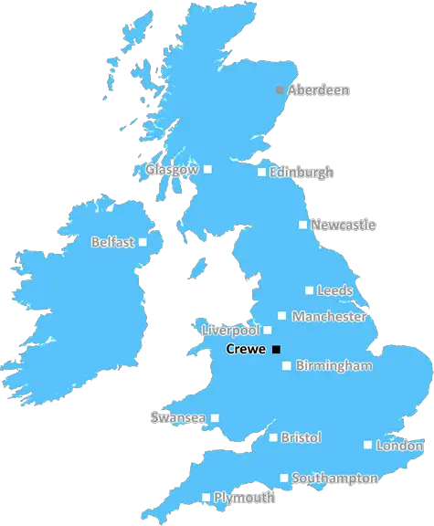
CW10 is the postcode for the Crewe district in the United Kingdom. This area covers the southeast of the Cheshire East region, including parts of Crewe, Walgson, Edleston and Cranage.
The postcode is mainly residential, with homes ranging from terraced to detached properties. It is also never too far away from the hustle and bustle of city life, with Crewe itself being very close. Public transport is conveniently located, with bus routes, a railway station and a non-stop expressway all in the area.
Shops in Crewe range from small convenience stores to large supermarkets and department stores. For those looking for something special, there are also a number of independent boutiques, galleries and specialist shops located in the area.
There are also plenty of places to get a bite to eat, with everything from pubs to cafes and to takeaways. Further out of the city centre there is also a great selection of restaurants and places to eat.
The area is very well catered for when it comes to leisure activities. There is a range of sports activities available, such as tennis, golf and swimming. There are also some lovely organic farms in the area for those who are looking for a bit of a rural experience.
CW10 is well connected, with plenty of public transport links and easy access to both the M6 and M56 motorways. It also has some great rural walks, for those who enjoy getting outside and exploring the countryside.
Education is well catered for in the area, with a number of excellent primary and secondary schools, top universities and colleges. Crewe also has its own library, which is well stocked with literature, DVDs and other resources.
This postcode area enjoys a great variety of facilities, with plenty of amenities close by for everyday living. Its proximity to the city centre and its excellent transport links make it a convenient area to live in and one that is sure to meet many families' needs.

Demographics
Cheshire

CW10 is located in the county of Cheshire, in England.
Cheshire has a total population of 1,048,100, making it the 19th largest county in the UK.
Cheshire has a total area of 904 square miles, and a population density of 447 people per square kilometre. For comparison, Greater London has a density of 5,618 people/km2.
| Outward Code | CW10 |
| Postal Town | Crewe |
| MSOA Name | Cheshire East 024 |
| LSOA Name | Cheshire East 024C |
| County | Cheshire |
| Region | Cheshire |
| Country | England |
| Local Authority | Cheshire East |
| Area Classification | Urban with Significant Rural (rural including hub towns 26-49%) |
CW10 Electoral Wards
The postal region of CW10, includes the local towns, villages, electoral wards and stations of:
Dig even deeper into the CW10 postcode by clicking on a postcode below:
Click on an outward postal code below for more information about the area. Each 'outward' postcode give you a comprehensive list of all postcodes within the outward code area (CW) and estimated address.
Click on an 'outward' code for more information. For example, the outward postcode page 'EC2M' will give you an alphabetical list covering all postcodes located in the region, from 'EC2M 1BB' through to 'EC2M 7YA'.
Chris H
Saturday, April 6, 2024
We don't have any views of CW10 right now. If you live in CW10 or have visited it, please help us to help others by telling others what you think of this neighbourhood.
Add your view of CW10
People need your local expertise. If you live in CW10 or have first-hand knowledge of the neighbourhood, please consider sharing your views. It's completely anonymous - all we ask is for your initials.
Please tell us what you like about the CW10 postcode area, what you don't like, and what it's like to live or work here.
| LOCAL AMENITIES | |
| FAMILY FRIENDLY | |
| PARKING | |
| GREEN SPACES |
From the Postcode Area blog

Deciphering Crime Rates - a Deep Dive Into UK Postcode Analysis
Ever wondered about the crime rate in your UK postcode? You're not alone. We've dug deep into the data, uncovering trends and patterns that'll make your head spin.

Death of the High Street?
The BBC reports that despite councils' attempts to kurb them, the UK's high streets have seen a huge growth in fast food outlets. Could this mark the death knell for the Great British high street, and what can we do about it to halt its decline?

Discrimination by Postcode
You really couldn't make it up, could you? Some of the country's most vulnerable people are missing out on their weekly £25 Cold Weather Payment, just because the system that's in operation is discriminating against them because payments are based on postcode, rather than geographic location.

The Redesign is Underway
Well, the current website was absolutely in dire need of a good redesign - from the ground up. So I set out to pull it all apart and get it up and running again to become the most comprehensive guide to every postcode in the UK. And it's been a long, tough job from start to finish - and quite possibly the biggest project I've ever undertaken.
SOCIAL GRADES
According to census records, 28% of people here have a social grade of AB (highest), compared to the national average of 27%.