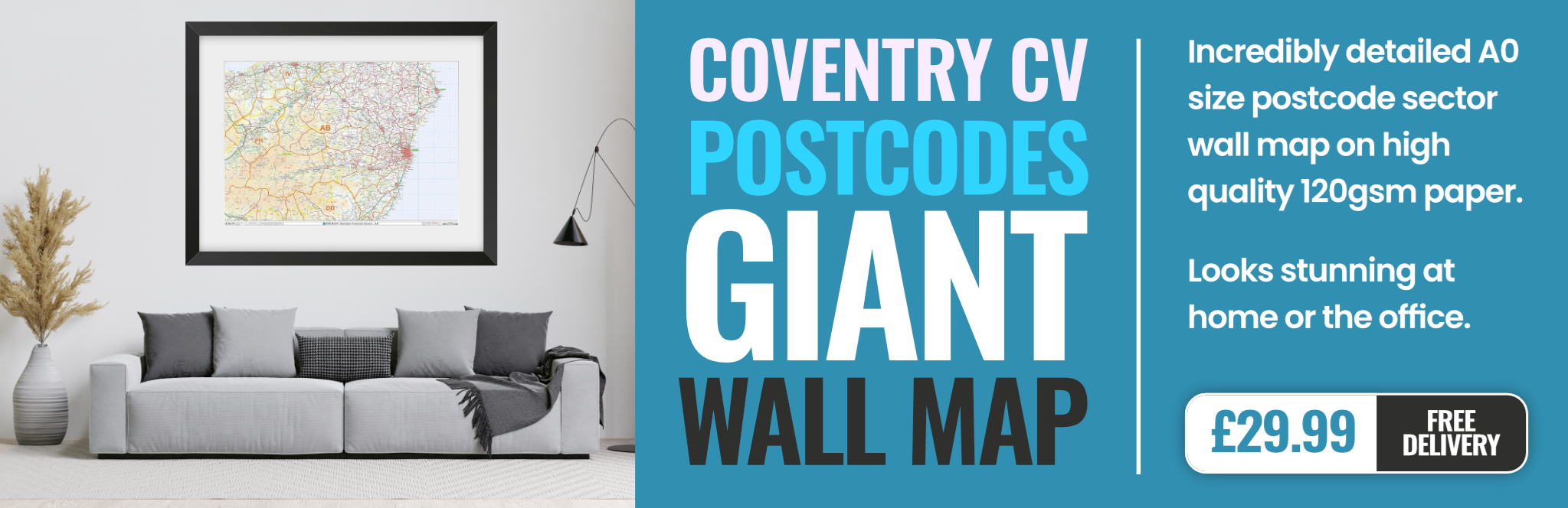
coventry CV4 Postcodes
Spending a fortune on conveyancing?

Compare instant, low-cost online quotes from trusted conveyancing solicitors.
Backed by experts, our no-obligation service searches through the best conveyancing quotes on the market to save you time and money.
Coventry (CV4)
The CV4 postcode area is located in the Coventry postcode town region, within the county of West Midlands, and contains a total of 897 individual postcodes.
There are 14 electoral wards in the CV4 postcode area, including Atherstone, Bedworth, Coventry, Kenilworth, Leamington Spa, Nuneaton, Rugby, Shipston-On-Stour, Southam, Stratford-Upon-Avon, Warwick which come under the local authority of the Coventry Council.
Combining the whole postcode region, 25% of people in CV4 are classed as having an AB social grade, (i.e. 'white-collar' middle-upper class), compared to 27% across the UK.
This does not mean that the people of CV4 are poorer than other areas, but it may give an indication that there are areas of deprivation.
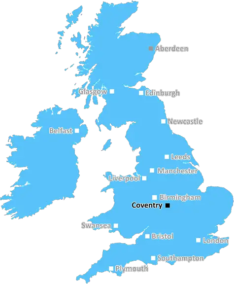
CV4 is a postcode in Coventry, a large city in the West Midlands region of England. The area is bordered by the North Warwickshire and Coventry border to the north, the Birmingham border to the east, and the Coventry border to the south and west. It is served by the Coventry University Campus to the north, and by the Coventry Airport to the south.
The CV4 area is well connected with the local road network, with the A45, A46 and A4500 all providing easy access into and out of the district. There is also a number of bus services providing transport links to the surrounding area, including the National Express Coventry to Birmingham service.
There are a number of residential areas within the CV4 area, including Canley, Tile Hill, Radford, Earlsdon, Moor End and Chapelfields. Each of these areas has its own local amenities, with supermarkets, neighbourhood shops, and hair and beauty salons among them. There are also several parks as well as the Coventry University Campus.
The CV4 region's local economy is mostly based on health services, education, retail, and manufacturing. Several companies are based in the area, including the UK's largest independent wholesaler of computer hardware and software, CCS Technology.
The CV4 area is an ethnically diverse area, with over 50% of the population belonging to minority ethnic groups. Furthermore, there is high demand for housing in the area, making it a popular choice among families and young professionals alike.
In terms of schools, the area is served by Coventry University's primary and secondary schools, as well as several other local state and independent schools. These include Longford Primary, Broad Heath Primary and Tile Hill Wood Secondary.
The CV4 postcode offers a range of local leisure opportunities, including the University of Coventry Sports Centre, which houses a range of indoor and outdoor sports and activities. There is also the Alan Higgs Leisure Centre, which provides everything from swimming pools to a climbing wall.
TheCV4 postcode is an ideal place to live for those looking for a vibrant and densely populated area, with a range of facilities in close proximity. This district is home to a variety of ethnicities and backgrounds and is a desirable place to settle down for both local people and those from further afield.

Demographics
West Midlands

CV4 is located in the county of West Midlands, in England.
West Midlands has a total population of 2,864,900, making it the 2nd largest county in the UK.
West Midlands has a total area of 348 square miles, and a population density of 3177 people per square kilometre. For comparison, Greater London has a density of 5,618 people/km2.
| Outward Code | CV4 |
| Postal Town | Coventry |
| MSOA Name | Coventry 031 |
| LSOA Name | Coventry 031C |
| County | West Midlands |
| Region | West Midlands |
| Country | England |
| Local Authority | Coventry |
| Area Classification | Urban with City and Town |
CV4 Electoral Wards
The postal region of CV4, includes the local towns, villages, electoral wards and stations of:
Dig even deeper into the CV4 postcode by clicking on a postcode below:
Click on an outward postal code below for more information about the area. Each 'outward' postcode give you a comprehensive list of all postcodes within the outward code area (CV) and estimated address.
Click on an 'outward' code for more information. For example, the outward postcode page 'EC2M' will give you an alphabetical list covering all postcodes located in the region, from 'EC2M 1BB' through to 'EC2M 7YA'.
Chris H
Sunday, April 7, 2024
We don't have any views of CV4 right now. If you live in CV4 or have visited it, please help us to help others by telling others what you think of this neighbourhood.
Add your view of CV4
People need your local expertise. If you live in CV4 or have first-hand knowledge of the neighbourhood, please consider sharing your views. It's completely anonymous - all we ask is for your initials.
Please tell us what you like about the CV4 postcode area, what you don't like, and what it's like to live or work here.
| LOCAL AMENITIES | |
| FAMILY FRIENDLY | |
| PARKING | |
| GREEN SPACES |
Local News West Midlands
Staffordshire manor house among more than 190 lots in Bond Wolfe March sale
The freehold manor house in Staffordshire guided at 1.76m-plus has potential for redevelopment.
Property WeekIntegritas partners with Homes for Students for Newcastle scheme
The development, Deakin's Yard, will comprise a total of 273 student accommodation units.
Property WeekYusen Logistics takes 1.2m sq ft at SEGRO Logistics Park Northampton
Global supply chain logistics firm becomes first tenant to sign for the development.
Property WeekWoodbourne's 360m plans for Birmingham's tallest tower move closer
The developer has signed a Section 106 agreement with city council.
Property WeekCouncil approves MIRA Technology Park expansion in Midlands
Midlands scheme will comprise 2.3m sq ft of manufacturing and industrial facilities.
Property WeekSama secures 500m investment to deliver regional pipeline
The funding will help support the delivery of nearly 900 PBSA beds and 630 homes.
Property WeekOwners of The Crooked House ordered to rebuild Britain's wonkiest pub
Local council orders pub to be restored after its demolition last year caused national outrage.
Property WeekHousing Ombudsman flags up severe maladministration by Birmingham Council
Housing watchdog lists damp and mould among six major findings of maladministration by the local authority landlord.
Property WeekFrom the Postcode Area blog

Deciphering Crime Rates - a Deep Dive Into UK Postcode Analysis
Ever wondered about the crime rate in your UK postcode? You're not alone. We've dug deep into the data, uncovering trends and patterns that'll make your head spin.

Death of the High Street?
The BBC reports that despite councils' attempts to kurb them, the UK's high streets have seen a huge growth in fast food outlets. Could this mark the death knell for the Great British high street, and what can we do about it to halt its decline?

Discrimination by Postcode
You really couldn't make it up, could you? Some of the country's most vulnerable people are missing out on their weekly £25 Cold Weather Payment, just because the system that's in operation is discriminating against them because payments are based on postcode, rather than geographic location.

The Redesign is Underway
Well, the current website was absolutely in dire need of a good redesign - from the ground up. So I set out to pull it all apart and get it up and running again to become the most comprehensive guide to every postcode in the UK. And it's been a long, tough job from start to finish - and quite possibly the biggest project I've ever undertaken.
SOCIAL GRADES
According to census records, 25% of people here have a social grade of AB (highest), compared to the national average of 27%.