kingston-upon-thames KT11 Postcodes
Spending a fortune on conveyancing?

Compare instant, low-cost online quotes from trusted conveyancing solicitors.
Backed by experts, our no-obligation service searches through the best conveyancing quotes on the market to save you time and money.
Kingston Upon Thames (KT11)
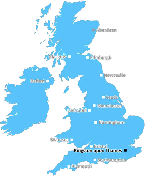
The KT11 postcode area is located in the Kingston Upon Thames postcode town region, within the county of Surrey, and contains a total of 802 individual postcodes.
There are 11 electoral wards in the KT11 postcode area, including Addlestone, Ashtead, Chertsey, Chessington, Cobham, East Molesey, Epsom, Esher, Kingston Upon Thames, Leatherhead, New Malden, Surbiton, Tadworth, Thames Ditton, Walton-On-Thames, West Byfleet, West Molesey, Weybridge, Worcester Park which come under the local authority of the Elmbridge Council.
Combining the whole postcode region, 49% of people in KT11 are classed as having an AB social grade, (i.e. 'white-collar' middle-upper class), compared to 27% across the UK.
This does not mean that the people of KT11 are wealthier - or higher class - than average, but it can be an indication that the area may be prospering and desirable to live in.
KT11 is a postcode district in the Surrey county of the United Kingdom. It is located roughly 20 miles southwest of central London and is part of the Kingston upon Thames post town. The KT11 postcode covers parts of the towns Cobham, Oxshott and Stoke d'Abernon. It is also in close proximity to the village of Fetcham, which is part of the Leatherhead post town.
KT11 primarily serves the affluent commuter belt towns in the area. It lies just to the south of the A3 motorway, enabling easy access to London and Portsmouth. The postcode area is also served by two railway stations, Cobham & Stoke d'Abernon and Oxshott, providing fast connections to London Waterloo.
The KT11 postcode has many residential and commercial areas. Of the residential areas, some of the more notable neighbourhoods within the area are The Warren, a mostly residential and small business area in Cobham and Ferndale, mostly large family homes located on the border of Oxshott and Cobham. Meanwhile, Lansdowne is an affluent residential area on the north side of Oxshott. In terms of commercial areas, Oxshott Business Village is home to many media and advertising companies, along with financial firms, while Cobham Business Park features a number of international businesses.
Local facilities in the area are plentiful, with many shops and restaurants in Cobham and Oxshott such as Waitrose, Eight Hundred Estates, White Stuff, The Bell Inn and Mojave. Cobham also has a large leisure centre with health club and pool, while there are plenty of parks and woods in the area such as Ashley Park, The Firs and Oxshott Heath. These feature recreational trails, golf courses and nature reserves.
In terms of education, there are a number of both primary and secondary schools within the postcode district. These include St Andrew's School, ACS International Schools, Reeds School, Holy Family Catholic Primary School, and Coombe Hill Junior School, among others.
TheKT11 postcode is an ideal place for young families, professionals and businesses due to its abundance of amenities, transport links and leisure activities available.

Demographics

Surrey

KT11 is located in the county of Surrey, in England.
Surrey has a total population of 1,176,500, making it the 13th largest county in the UK.
Surrey has a total area of 642 square miles, and a population density of 707 people per square kilometre. For comparison, Greater London has a density of 5,618 people/km2.
| Outward Code | KT11 |
| Postal Town | Kingston Upon Thames |
| MSOA Name | Elmbridge 017 |
| LSOA Name | Elmbridge 017C |
| County | Surrey |
| Region | Surrey |
| Country | England |
| Local Authority | Elmbridge |
| Area Classification | Urban with Major Conurbation |
KT11 Electoral Wards
The postal region of KT11, includes the local towns, villages, electoral wards and stations of:
Dig even deeper into the KT11 postcode by clicking on a postcode below:
Click on an outward postal code below for more information about the area. Each 'outward' postcode give you a comprehensive list of all postcodes within the outward code area (KT) and estimated address.
Click on an 'outward' code for more information. For example, the outward postcode page 'EC2M' will give you an alphabetical list covering all postcodes located in the region, from 'EC2M 1BB' through to 'EC2M 7YA'.
Chris H
Sunday, April 7, 2024
We don't have any views of KT11 right now. If you live in KT11 or have visited it, please help us to help others by telling others what you think of this neighbourhood.
Add your view of KT11
People need your local expertise. If you live in KT11 or have first-hand knowledge of the neighbourhood, please consider sharing your views. It's completely anonymous - all we ask is for your initials.
Please tell us what you like about the KT11 postcode area, what you don't like, and what it's like to live or work here.
| LOCAL AMENITIES | |
| FAMILY FRIENDLY | |
| PARKING | |
| GREEN SPACES |
Local News Surrey
Police find man missing since Easter Sunday
Liam has connections to Kensington and Notting Hill
Get SurreySurrey weather latest as 'mini heatwave' forecast this weekend with temperature of 19C
Guildford, Dorking and Staines to see temperatures in the high teens
Get SurreyM25 driver rushed to hospital after car crashed into barrier and rolled down embankment closing motorway
There is currently a full closure of all four lanes of the M25 anticlockwise between J6 and J5.
Get SurreySteel takes 5-25 as Surrey bowl out Lancashire
Defending champions Surrey dismiss Lancashire for 202 as Cam Steel and Dan Lawrence both return career-best bowling figures.
BBC NewsThe cheapest Surrey postcode to buy a home which is still 100k more than UK average
Nowhere in Surrey had an average house price that was equal to or less than the UK average
Get SurreyCrackdown on boat owners moored on River Thames
The Environment Agency brought civil trespass proceedings against long-stay boaters in West Molesey.
BBC NewsCCTV appeal after gang steal 3k of perfume from Reigate Jo Malone shop
Police have released CCTV images of three men they want to identify as part of the investigation
Get SurreyLeatherhead station knifepoint phone robbery prompts police CCTV appeal
Officers believe the man and woman pictured may be able to help with the investigation
Get SurreyFrom the Postcode Area blog

Deciphering Crime Rates - a Deep Dive Into UK Postcode Analysis
Ever wondered about the crime rate in your UK postcode? You're not alone. We've dug deep into the data, uncovering trends and patterns that'll make your head spin.

Death of the High Street?
The BBC reports that despite councils' attempts to kurb them, the UK's high streets have seen a huge growth in fast food outlets. Could this mark the death knell for the Great British high street, and what can we do about it to halt its decline?

Discrimination by Postcode
You really couldn't make it up, could you? Some of the country's most vulnerable people are missing out on their weekly £25 Cold Weather Payment, just because the system that's in operation is discriminating against them because payments are based on postcode, rather than geographic location.

The Redesign is Underway
Well, the current website was absolutely in dire need of a good redesign - from the ground up. So I set out to pull it all apart and get it up and running again to become the most comprehensive guide to every postcode in the UK. And it's been a long, tough job from start to finish - and quite possibly the biggest project I've ever undertaken.
SOCIAL GRADES
According to census records, 49% of people here have a social grade of AB (highest), compared to the national average of 27%.