chester CH64 Postcodes
Spending a fortune on conveyancing?

Compare instant, low-cost online quotes from trusted conveyancing solicitors.
Backed by experts, our no-obligation service searches through the best conveyancing quotes on the market to save you time and money.
Chester (CH64)
The CH64 postcode area is located in the Chester postcode town region, within the county of Cheshire, and contains a total of 755 individual postcodes.
There are 15 electoral wards in the CH64 postcode area, including Bagillt, Birkenhead, Buckley, Chester, Deeside, Ellesmere Port, Flint, Holywell, Mold, Neston, Prenton, Wallasey, Wirral which come under the local authority of the Cheshire West and Chester Council.
Combining the whole postcode region, 35% of people in CH64 are classed as having an AB social grade, (i.e. 'white-collar' middle-upper class), compared to 27% across the UK.
This does not mean that the people of CH64 are wealthier - or higher class - than average, but it can be an indication that the area may be prospering and desirable to live in.
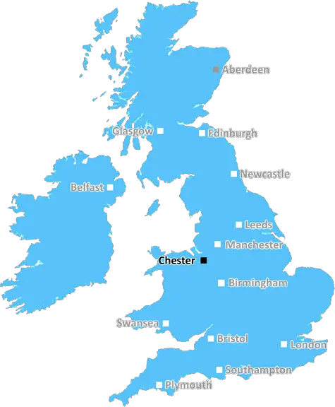
The CH64 postcode is an area within the Chester district, which is located in Cheshire. It covers a mainly rural area, including the villages of Childer Thornton, Backford and Hargrave. The postcode is covered by two local authority wards - Weaver and Sutton. It lies south-west of the city of Chester, with easy access to the local towns of Ellesmere Port, Neston and Parkgate.
The CH64 postcode includes the villages of Childer Thornton, Backford and Hargrave. These village are primarily residential areas, with a history dating back to the 16th century. Local amenities include a selection of shops and pubs, as well as churches and a community centre. Childer Thornton is home to a prestigious private school, Kingsmead School, and a stunning Victorian sandstone parish church, St Michael and All Angels.
The CH64 postcode is close to some popular attractions, such as Ness Botanic Gardens, Lady Heyes Craft Centre, Hooton Park Trust and the National Waterways Museum. The area is great for those looking for a peaceful retreat, with a wealth of natural beauty, open countryside and woodland areas, as well as a number of canal and riverside locations.
The CH64 postcode also has a variety of transport links, with an hourly service to both Chester and Liverpool via the M53 motorway, as well as quick access to frequent rail services into Chester and Manchester from Ellesmere Port railway station.
When it comes to leisure activities, the area is well served with leisure and sports facilities, including the Cheshire County Sports Club, golf courses, tennis courts and bowling greens. There are also a number of popular parks and open green spaces for those seeking a relaxing break. The area also hosts a wide variety of events throughout the year, such as the Tarvin Antiques Fair and the popular River Dee riverboat tours, as well as a variety of markets and festivals.
All in all, the CH64 postcode offers a great combination of rural living, natural beauty, leisure activities and plenty of transport links, making it a popular choice for people from all walks of life.

Demographics
Cheshire

CH64 is located in the county of Cheshire, in England.
Cheshire has a total population of 1,048,100, making it the 19th largest county in the UK.
Cheshire has a total area of 904 square miles, and a population density of 447 people per square kilometre. For comparison, Greater London has a density of 5,618 people/km2.
| Outward Code | CH64 |
| Postal Town | Chester |
| MSOA Name | Cheshire West and Chester 001 |
| LSOA Name | Cheshire West and Chester 001A |
| County | Cheshire |
| Region | Cheshire |
| Country | England |
| Local Authority | Cheshire West and Chester |
| Area Classification | Urban with Significant Rural (rural including hub towns 26-49%) |
CH64 Electoral Wards
The postal region of CH64, includes the local towns, villages, electoral wards and stations of:
Dig even deeper into the CH64 postcode by clicking on a postcode below:
Click on an outward postal code below for more information about the area. Each 'outward' postcode give you a comprehensive list of all postcodes within the outward code area (CH) and estimated address.
Click on an 'outward' code for more information. For example, the outward postcode page 'EC2M' will give you an alphabetical list covering all postcodes located in the region, from 'EC2M 1BB' through to 'EC2M 7YA'.
JNC, Chester
Wednesday, March 10, 2021
We like the friendly attitude of people in the town and the benefit of not having `through traffic`. We don`t like the lack of emergency services in the area, in particular Fire Service and Ambulance. We are aware of a Police presence by virtue of the cars parked behind the town hall where there is access to `police` via a wall phone but no face to face contact. We do not enjoy only an hourly service by bus to Chester which does not provide a facility if we stay later on in the City. Sceptical at the moment of having access to our marshes closed to provide a pathway or is it a high speed cycle track !
Add your view of CH64
People need your local expertise. If you live in CH64 or have first-hand knowledge of the neighbourhood, please consider sharing your views. It's completely anonymous - all we ask is for your initials.
Please tell us what you like about the CH64 postcode area, what you don't like, and what it's like to live or work here.
| LOCAL AMENITIES | |
| FAMILY FRIENDLY | |
| PARKING | |
| GREEN SPACES |
From the Postcode Area blog

Deciphering Crime Rates - a Deep Dive Into UK Postcode Analysis
Ever wondered about the crime rate in your UK postcode? You're not alone. We've dug deep into the data, uncovering trends and patterns that'll make your head spin.

Death of the High Street?
The BBC reports that despite councils' attempts to kurb them, the UK's high streets have seen a huge growth in fast food outlets. Could this mark the death knell for the Great British high street, and what can we do about it to halt its decline?

Discrimination by Postcode
You really couldn't make it up, could you? Some of the country's most vulnerable people are missing out on their weekly £25 Cold Weather Payment, just because the system that's in operation is discriminating against them because payments are based on postcode, rather than geographic location.

The Redesign is Underway
Well, the current website was absolutely in dire need of a good redesign - from the ground up. So I set out to pull it all apart and get it up and running again to become the most comprehensive guide to every postcode in the UK. And it's been a long, tough job from start to finish - and quite possibly the biggest project I've ever undertaken.
SOCIAL GRADES
According to census records, 35% of people here have a social grade of AB (highest), compared to the national average of 27%.