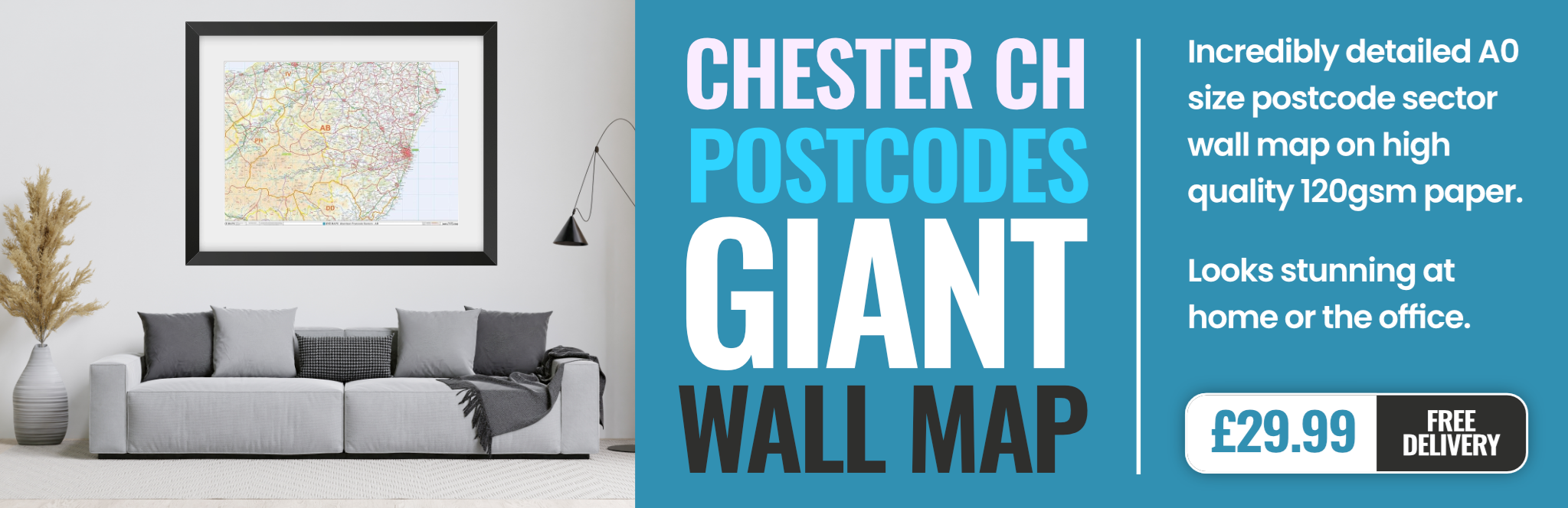
chester CH2 Postcodes
Spending a fortune on conveyancing?

Compare instant, low-cost online quotes from trusted conveyancing solicitors.
Backed by experts, our no-obligation service searches through the best conveyancing quotes on the market to save you time and money.
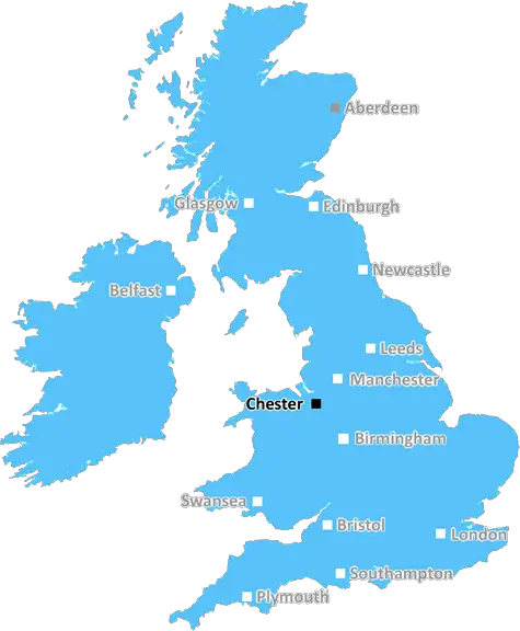
Chester (CH2)
The CH2 postcode area is located in the Chester postcode town region, within the county of Cheshire, and contains a total of 1014 individual postcodes.
There are 35 electoral wards in the CH2 postcode area, including Bagillt, Birkenhead, Buckley, Chester, Deeside, Ellesmere Port, Flint, Holywell, Mold, Neston, Prenton, Wallasey, Wirral which come under the local authority of the Cheshire West and Chester Council.
Combining the whole postcode region, 29% of people in CH2 are classed as having an AB social grade, (i.e. 'white-collar' middle-upper class), compared to 27% across the UK.
This does not mean that the people of CH2 are wealthier - or higher class - than average, but it can be an indication that the area may be prospering and desirable to live in.
The CH2 postcode, located in the Chester district of Cheshire, England, is home to some of the most attractive areas in the county. This area is characterised by a combination of quaint, historical buildings, modern residential and business units, and a wide variety of shops, restaurants, and leisure activities.
The postcode area is bordered to the north by the River Dee, providing a picturesque backdrop for many of the attractions. The city centre itself is located within the CH2 postcode, with its impressive collection of shops, services, and activities.
The main shopping areas of the city centre are linked by two main promenades, providing access to a number of high-street stores, boutiques, and restaurants. The area also provides access to a number of city parks, providing a wide variety of leisure activities for local residents.
One of the most attractive features of the area is the fact that the postcode covers historic areas such as the town centre of Chester. Local residents here are able to enjoy easy access to a stunning cathedral, the city walls, and the popular Roman amphitheatre.
Other popular attractions in the vicinity of the CH2 postcode include the world-famous Chester Races, the Chester Zoo, and the Museum of Science and Industry.
The area is well connected to the rest of the country via the M56 motorway, giving easy access to major cities such as Manchester and Liverpool. Regular bus and train services are also available from the city centre to other parts of the region.
Education is provided by a variety of primary and secondary schools within the postcode area. The University of Chester is also located here, providing higher education opportunities to local residents.
The area also caters for a wide range of other activities, including numerous cafes, bars, and restaurants. It is also a popular destination for business activities due to its proximity to Manchester Airport, one of the largest in Europe.
TheCH2 postcode in the Chester district of Cheshire, England, provides a wealth of opportunities to its local residents. With its mix of cultural attractions, shopping, restaurants, leisure activities, and education opportunities, there is something for everyone in this beautiful area.

Demographics
Cheshire

CH2 is located in the county of Cheshire, in England.
Cheshire has a total population of 1,048,100, making it the 19th largest county in the UK.
Cheshire has a total area of 904 square miles, and a population density of 447 people per square kilometre. For comparison, Greater London has a density of 5,618 people/km2.
| Outward Code | CH2 |
| Postal Town | Chester |
| MSOA Name | Cheshire West and Chester 034 |
| LSOA Name | Cheshire West and Chester 034C |
| County | Cheshire |
| Region | Cheshire |
| Country | England |
| Local Authority | Cheshire West and Chester |
| Area Classification | Urban with Significant Rural (rural including hub towns 26-49%) |
CH2 Electoral Wards
The postal region of CH2, includes the local towns, villages, electoral wards and stations of:
Dig even deeper into the CH2 postcode by clicking on a postcode below:
Click on an outward postal code below for more information about the area. Each 'outward' postcode give you a comprehensive list of all postcodes within the outward code area (CH) and estimated address.
Click on an 'outward' code for more information. For example, the outward postcode page 'EC2M' will give you an alphabetical list covering all postcodes located in the region, from 'EC2M 1BB' through to 'EC2M 7YA'.
Chris H
Saturday, April 6, 2024
We don't have any views of CH2 right now. If you live in CH2 or have visited it, please help us to help others by telling others what you think of this neighbourhood.
Add your view of CH2
People need your local expertise. If you live in CH2 or have first-hand knowledge of the neighbourhood, please consider sharing your views. It's completely anonymous - all we ask is for your initials.
Please tell us what you like about the CH2 postcode area, what you don't like, and what it's like to live or work here.
| LOCAL AMENITIES | |
| FAMILY FRIENDLY | |
| PARKING | |
| GREEN SPACES |
From the Postcode Area blog

Deciphering Crime Rates - a Deep Dive Into UK Postcode Analysis
Ever wondered about the crime rate in your UK postcode? You're not alone. We've dug deep into the data, uncovering trends and patterns that'll make your head spin.

Death of the High Street?
The BBC reports that despite councils' attempts to kurb them, the UK's high streets have seen a huge growth in fast food outlets. Could this mark the death knell for the Great British high street, and what can we do about it to halt its decline?

Discrimination by Postcode
You really couldn't make it up, could you? Some of the country's most vulnerable people are missing out on their weekly £25 Cold Weather Payment, just because the system that's in operation is discriminating against them because payments are based on postcode, rather than geographic location.

The Redesign is Underway
Well, the current website was absolutely in dire need of a good redesign - from the ground up. So I set out to pull it all apart and get it up and running again to become the most comprehensive guide to every postcode in the UK. And it's been a long, tough job from start to finish - and quite possibly the biggest project I've ever undertaken.
SOCIAL GRADES
According to census records, 29% of people here have a social grade of AB (highest), compared to the national average of 27%.