cardiff CF36 Postcodes
Spending a fortune on conveyancing?

Compare instant, low-cost online quotes from trusted conveyancing solicitors.
Backed by experts, our no-obligation service searches through the best conveyancing quotes on the market to save you time and money.
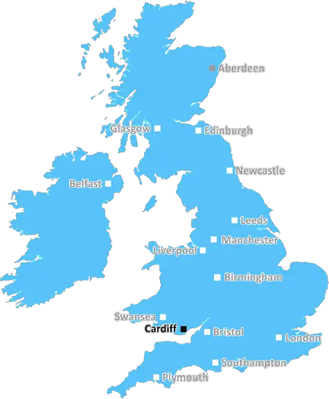
Cardiff (CF36)
The CF36 postcode area is located in the Cardiff postcode town region, within the county of Glamorgan, and contains a total of 539 individual postcodes.
There are 6 electoral wards in the CF36 postcode area, including Aberdare, Bargoed, Barry, Bridgend, Caerphilly, Cardiff, Cowbridge, Dinas Powys, Ferndale, Hengoed, Llantwit Major, Maesteg, Merthyr Tydfil, Mountain Ash, Penarth, Pentre, Pontyclun, Pontypridd, Porth, Porthcawl, Tonypandy, Treharris, Treorchy which come under the local authority of the Bridgend Council.
Combining the whole postcode region, 25% of people in CF36 are classed as having an AB social grade, (i.e. 'white-collar' middle-upper class), compared to 27% across the UK.
This does not mean that the people of CF36 are poorer than other areas, but it may give an indication that there are areas of deprivation.
CF36 postcode is a postcode in the Bridgend district in Wales. It falls within a section known as �The Vale of Glamorgan', and covers an area of some 26 square miles in and around Porthcawl and the other small towns of Nottage, Pyle, Kenfig Hill, and Margam.
CF36 is a mainly coastal postcode, located to the southwest of Porthcawl and the Kenfig National Nature Reserve. The Kenfig Burrows Nature Reserve is the largest dune system in south Wales and is home to a number of rare species, including rare lizards and invertebrates. The postcode also covers an area of reed beds, extensive sand flats and freshwater lakes, providing important habitats for many birds.
A number of settlements lie within the CF36 postcode, most significantly Porthcawl, a popular Welsh seaside resort. The area is well known for its beautiful beaches and many attractions, including sandy dunes, a sand-sculpting festival, and a revived pier with its attractions and cafes. Other settlements in the CF36 area include Nottage, Pyle, Margam and Kenfig Hill.
Nearby places to visit include the Margam Country Park and Orangery, the Aberavon Seafront and the Afan Forest Park, both of which are popular with walkers, cyclists and horse riders. The nearby Afan Valley Adventure Centre offers a variety of outdoor activities, such as go-karting and paintballing.
Porthcawl is the major hub of the postcode district, and is the centre for the small towns of Nottage, Pyle, Kenfig Hill and Margam. The main shopping streets in Porthcawl are John Street and The Old Patagonian, where a range of high street and independent shops can be found. Other amenities offered in the postcode area include a variety of bars, restaurants and cafes, supermarkets, banks, libraries, post offices, and a number of hairdressers, beauty salons, and gyms.
The Bridgend railway station is located on the main South Wales coast line, and trains from Porthcawl run regularly from Cardiff to Swansea.
CF36 postcode is a great place to live, and provides an ideal base from which to explore the natural beauty of this part of Wales. The area is steeped in history and culture, making it a rewarding destination to visit.

Demographics
Glamorgan

CF36 is located in the county of Glamorgan, in Wales.
Glamorgan has a total population of 0, making it the largest county in the UK.
Glamorgan has a total area of square miles, and a population density of people per square kilometre. For comparison, Greater London has a density of 5,618 people/km2.
| Outward Code | CF36 |
| Postal Town | Cardiff |
| MSOA Name | Bridgend 018 |
| LSOA Name | Bridgend 018C |
| County | Glamorgan |
| Region | Glamorgan |
| Country | Wales |
| Local Authority | Bridgend |
| Area Classification | Unclassified |
CF36 Electoral Wards
The postal region of CF36, includes the local towns, villages, electoral wards and stations of:
Dig even deeper into the CF36 postcode by clicking on a postcode below:
Click on an outward postal code below for more information about the area. Each 'outward' postcode give you a comprehensive list of all postcodes within the outward code area (CF) and estimated address.
Click on an 'outward' code for more information. For example, the outward postcode page 'EC2M' will give you an alphabetical list covering all postcodes located in the region, from 'EC2M 1BB' through to 'EC2M 7YA'.
Chris H
Thursday, April 25, 2024
We don't have any views of CF36 right now. If you live in CF36 or have visited it, please help us to help others by telling others what you think of this neighbourhood.
Add your view of CF36
People need your local expertise. If you live in CF36 or have first-hand knowledge of the neighbourhood, please consider sharing your views. It's completely anonymous - all we ask is for your initials.
Please tell us what you like about the CF36 postcode area, what you don't like, and what it's like to live or work here.
| LOCAL AMENITIES | |
| FAMILY FRIENDLY | |
| PARKING | |
| GREEN SPACES |
From the Postcode Area blog

Deciphering Crime Rates - a Deep Dive Into UK Postcode Analysis
Ever wondered about the crime rate in your UK postcode? You're not alone. We've dug deep into the data, uncovering trends and patterns that'll make your head spin.

Death of the High Street?
The BBC reports that despite councils' attempts to kurb them, the UK's high streets have seen a huge growth in fast food outlets. Could this mark the death knell for the Great British high street, and what can we do about it to halt its decline?

Discrimination by Postcode
You really couldn't make it up, could you? Some of the country's most vulnerable people are missing out on their weekly £25 Cold Weather Payment, just because the system that's in operation is discriminating against them because payments are based on postcode, rather than geographic location.

The Redesign is Underway
Well, the current website was absolutely in dire need of a good redesign - from the ground up. So I set out to pull it all apart and get it up and running again to become the most comprehensive guide to every postcode in the UK. And it's been a long, tough job from start to finish - and quite possibly the biggest project I've ever undertaken.
SOCIAL GRADES
According to census records, 25% of people here have a social grade of AB (highest), compared to the national average of 27%.