canterbury CT5 Postcodes
Spending a fortune on conveyancing?

Compare instant, low-cost online quotes from trusted conveyancing solicitors.
Backed by experts, our no-obligation service searches through the best conveyancing quotes on the market to save you time and money.
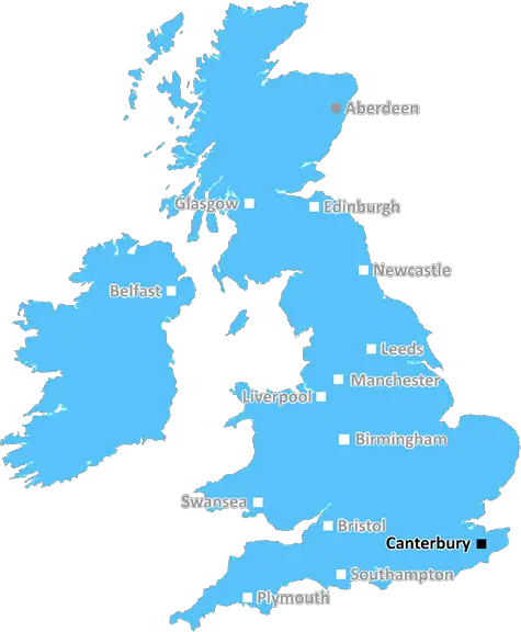
Canterbury (CT5)
The CT5 postcode area is located in the Canterbury postcode town region, within the county of Kent, and contains a total of 1283 individual postcodes.
There are 11 electoral wards in the CT5 postcode area, including Birchington, Broadstairs, Canterbury, Deal, Dover, Folkestone, Herne Bay, Hythe, Margate, Ramsgate, Sandwich, Westgate-On-Sea, Whitstable which come under the local authority of the Canterbury Council.
Combining the whole postcode region, 26% of people in CT5 are classed as having an AB social grade, (i.e. 'white-collar' middle-upper class), compared to 27% across the UK.
This does not mean that the people of CT5 are poorer than other areas, but it may give an indication that there are areas of deprivation.
The CT5 postcode is located in the Canterbury district of Kent, England. It is the 5th postcode out of the 17 that cover this area and its boundaries encompass Whitstable, Swalecliffe, Tankerton, Seasalter, Bridge, Upstreet, and Eham.
The CT5 postcode is a popular destination among tourists who come to enjoy the stunning landscapes along this stretch of coastline, including the famous White Cliffs of Dover. It is also close to the picturesque city of Canterbury and has easy access to Margate, Herne Bay and Ramsgate.
There are several attractions in the postcode, including the Tankerton Slopes with its charming beach huts, the Whitstable Oyster Company and the Tankerton Arms. The area also has an abundance of outdoor activities on offer, such as walking and cycling trails, golf courses, beaches and sailing havens.
The host of schools in the area cater for the needs of students from ages 4-18, and higher education is available at Canterbury Christ Church University and East Kent College. Additionally, there are post offices, banks, supermarkets and independent shops throughout the postcode.
Transport links in the area are excellent, with a direct train line from Whitstable to London Victoria, and two bus routes taking passengers to Canterbury and Margate.
The average house price in the CT5 postcode is �412,788, making it one of the more affluent areas in the Canterbury district. The area offers a diverse range of homes, from traditional terraced houses to 3 bedroom semi-detached properties and luxurious detached homes with sea views.

Demographics

Kent

CT5 is located in the county of Kent, in England.
Kent has a total population of 1,820,400, making it the 6th largest county in the UK.
Kent has a total area of 1443 square miles, and a population density of 486 people per square kilometre. For comparison, Greater London has a density of 5,618 people/km2.
| Outward Code | CT5 |
| Postal Town | Canterbury |
| MSOA Name | Canterbury 008 |
| LSOA Name | Canterbury 008C |
| County | Kent |
| Region | Kent |
| Country | England |
| Local Authority | Canterbury |
| Area Classification | Urban with City and Town |
CT5 Electoral Wards
The postal region of CT5, includes the local towns, villages, electoral wards and stations of:
Dig even deeper into the CT5 postcode by clicking on a postcode below:
Click on an outward postal code below for more information about the area. Each 'outward' postcode give you a comprehensive list of all postcodes within the outward code area (CT) and estimated address.
Click on an 'outward' code for more information. For example, the outward postcode page 'EC2M' will give you an alphabetical list covering all postcodes located in the region, from 'EC2M 1BB' through to 'EC2M 7YA'.
Chris H
Sunday, April 7, 2024
We don't have any views of CT5 right now. If you live in CT5 or have visited it, please help us to help others by telling others what you think of this neighbourhood.
Add your view of CT5
People need your local expertise. If you live in CT5 or have first-hand knowledge of the neighbourhood, please consider sharing your views. It's completely anonymous - all we ask is for your initials.
Please tell us what you like about the CT5 postcode area, what you don't like, and what it's like to live or work here.
| LOCAL AMENITIES | |
| FAMILY FRIENDLY | |
| PARKING | |
| GREEN SPACES |
Local News Kent
Johnson & Johnson signs lease at Tempo in Maidenhead
The pharmaceuticals giantwill move staff from its Thames Valley campuses in High Wycombe and Pinewood to the L&G-owned building.
Property WeekLuton Airport operating company buys hangars of collapsed airline Monarch
Hangars can accommodate wide body jets up to the size of a Boeing 767.
Property WeekCrawley's The Create Building lands British Airways Holidays as tenant
The company has signed a lease for the top floor of the nine-storey tower.
Property WeekUK Space Agency primed for Harwell Campus landing
The government agency has taken around 10,500 sq ft of space in the Quad Two building.
Property WeekKent sign Swanepoel after Bartlett deal called off
South African all-rounder Beyers Swanepoel is to join Kent after Xavier Bartlett's deal falls through.
BBC NewsThames Water troubles swell as parent firm defaults
Holding company Kemble has told lenders that it has failed to meet a deadline for interest payments.
BBC NewsNewFlex opens new Cambridge workspace The Quad
NewFlex said the site isone of the UK's strongest out-of-London business destinations.
Property WeekPaddington hotel to go under the hammer for 16m at Strettons' April auction
The asset is among the highest-valued lots ever to be offered at an auction in the UK.
Property WeekFrom the Postcode Area blog

Deciphering Crime Rates - a Deep Dive Into UK Postcode Analysis
Ever wondered about the crime rate in your UK postcode? You're not alone. We've dug deep into the data, uncovering trends and patterns that'll make your head spin.

Death of the High Street?
The BBC reports that despite councils' attempts to kurb them, the UK's high streets have seen a huge growth in fast food outlets. Could this mark the death knell for the Great British high street, and what can we do about it to halt its decline?

Discrimination by Postcode
You really couldn't make it up, could you? Some of the country's most vulnerable people are missing out on their weekly £25 Cold Weather Payment, just because the system that's in operation is discriminating against them because payments are based on postcode, rather than geographic location.

The Redesign is Underway
Well, the current website was absolutely in dire need of a good redesign - from the ground up. So I set out to pull it all apart and get it up and running again to become the most comprehensive guide to every postcode in the UK. And it's been a long, tough job from start to finish - and quite possibly the biggest project I've ever undertaken.
SOCIAL GRADES
According to census records, 26% of people here have a social grade of AB (highest), compared to the national average of 27%.