bristol BS9 Postcodes
Spending a fortune on conveyancing?

Compare instant, low-cost online quotes from trusted conveyancing solicitors.
Backed by experts, our no-obligation service searches through the best conveyancing quotes on the market to save you time and money.
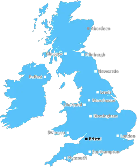
Bristol (BS9)
The BS9 postcode area is located in the Bristol postcode town region, within the county of , and contains a total of 1191 individual postcodes.
There are 16 electoral wards in the BS9 postcode area, including Axbridge, Banwell, Bristol, Cheddar, Clevedon, Wedmore, Weston-Super-Mare, Winscombe which come under the local authority of the Council.
Combining the whole postcode region, 47% of people in BS9 are classed as having an AB social grade, (i.e. 'white-collar' middle-upper class), compared to 27% across the UK.
This does not mean that the people of BS9 are wealthier - or higher class - than average, but it can be an indication that the area may be prospering and desirable to live in.
The BS9 postcode covers the Bristol city centre suburbs of Clifton, Clifton Down, Cotham, Hotwells, Sea Mills, Coombe Dingle, Stoke Bishop and Sneyd Park. It is serviced by 2 train stations: Bristol Temple Meads in the south-east and Montpelier in the north-east. The area is home to a diverse population, many of whom are students studying at the nearby University of Bristol.
BS9 offers the perfect blend of city living and greenery, with vast parks such as Durdham Downs, Blaise Castle and Clifton Down providing plenty of open space for locals to enjoy.
The postcode is home to a range of independent shops, eateries and cafes specialising in delicious, locally sourced produce. Additionally, the area is renowned for its vibrant art and culture scene, with open-air theatres, street art, galleries, museums, and a number of public art installations.
Clifton Suspension Bridge is a world-famous landmark found in the BS9 postcode, providing stunning views of the city and river. The postcode is also home to the iconic Queen Victoria statue, which stands tall in the middle of College Green and is a popular gathering point on sunny days.
The area is packed with great landmarks, independent businesses, lots of greenery, and residents from all walks of life, making the BS9 postcode a great place to call home.

Demographics


BS9 is located in the county of , in .
has a total population of 0, making it the largest county in the UK.
has a total area of square miles, and a population density of people per square kilometre. For comparison, Greater London has a density of 5,618 people/km2.
| Outward Code | BS9 |
| Postal Town | Bristol |
| MSOA Name | |
| LSOA Name | |
| County | |
| Region | |
| Country | |
| Local Authority | |
| Area Classification | Unclassified |
BS9 Electoral Wards
The postal region of BS9, includes the local towns, villages, electoral wards and stations of:
Dig even deeper into the BS9 postcode by clicking on a postcode below:
Click on an outward postal code below for more information about the area. Each 'outward' postcode give you a comprehensive list of all postcodes within the outward code area (BS) and estimated address.
Click on an 'outward' code for more information. For example, the outward postcode page 'EC2M' will give you an alphabetical list covering all postcodes located in the region, from 'EC2M 1BB' through to 'EC2M 7YA'.
Chris H
Sunday, April 7, 2024
We don't have any views of BS9 right now. If you live in BS9 or have visited it, please help us to help others by telling others what you think of this neighbourhood.
Add your view of BS9
People need your local expertise. If you live in BS9 or have first-hand knowledge of the neighbourhood, please consider sharing your views. It's completely anonymous - all we ask is for your initials.
Please tell us what you like about the BS9 postcode area, what you don't like, and what it's like to live or work here.
| LOCAL AMENITIES | |
| FAMILY FRIENDLY | |
| PARKING | |
| GREEN SPACES |
Local News Gloucestershire
Record sewage spills in county - Environment Agency
Storm overflows spilled for thousands of hours into rivers across the county in 2023, data shows.
BBC NewsHedgehog rescue centre appeals for volunteers
The Brockworth Hedgehog Rescue Centre says it needs help managing an influx of the creatures.
BBC NewsCrewe Alexandra 0-3 Forest Green Rovers
Forest Green stun promotion-chasing Crewe as Jordan Garrick strikes twice in a 3-0 win.
BBC NewsLeyton Orient 3-1 Cheltenham Town
Leyton Orient find their shooting boots to inflict a League One defeat on relegation-haunted Cheltenham.
BBC NewsCheltenham fans group increase shares in club
A Cheltenham Town fans group says they want to build "solid supporter ownership" after increasing their shares in the club.
BBC NewsRise in abuse towards councillors 'has to stop'
A Gloucester councillor said he had received death threats over leisure centre closures.
BBC NewsJones and Lewis extend Gloucester-Hartpury deals
Ireland and Wales internationals Neve Jones and Bethan Lewis sign new deals to stay with Gloucester-Hartpury, along with Carmen Castelluci.
BBC NewsTalks ongoing to ban coaches in Cotswolds village
Local firms are worried they will forfeit "millions" in sales if a coach ban is introduced.
BBC NewsFrom the Postcode Area blog

Deciphering Crime Rates - a Deep Dive Into UK Postcode Analysis
Ever wondered about the crime rate in your UK postcode? You're not alone. We've dug deep into the data, uncovering trends and patterns that'll make your head spin.

Death of the High Street?
The BBC reports that despite councils' attempts to kurb them, the UK's high streets have seen a huge growth in fast food outlets. Could this mark the death knell for the Great British high street, and what can we do about it to halt its decline?

Discrimination by Postcode
You really couldn't make it up, could you? Some of the country's most vulnerable people are missing out on their weekly £25 Cold Weather Payment, just because the system that's in operation is discriminating against them because payments are based on postcode, rather than geographic location.

The Redesign is Underway
Well, the current website was absolutely in dire need of a good redesign - from the ground up. So I set out to pull it all apart and get it up and running again to become the most comprehensive guide to every postcode in the UK. And it's been a long, tough job from start to finish - and quite possibly the biggest project I've ever undertaken.
SOCIAL GRADES
According to census records, 47% of people here have a social grade of AB (highest), compared to the national average of 27%.