bristol BS29 Postcodes
Spending a fortune on conveyancing?

Compare instant, low-cost online quotes from trusted conveyancing solicitors.
Backed by experts, our no-obligation service searches through the best conveyancing quotes on the market to save you time and money.
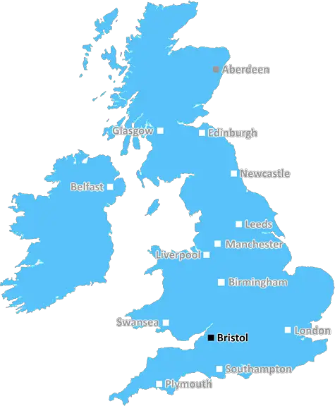
Bristol (BS29)
The BS29 postcode area is located in the Bristol postcode town region, within the county of Somerset, and contains a total of 127 individual postcodes.
There are 8 electoral wards in the BS29 postcode area, including Axbridge, Banwell, Bristol, Cheddar, Clevedon, Wedmore, Weston-Super-Mare, Winscombe which come under the local authority of the North Somerset Council.
Combining the whole postcode region, 25% of people in BS29 are classed as having an AB social grade, (i.e. 'white-collar' middle-upper class), compared to 27% across the UK.
This does not mean that the people of BS29 are poorer than other areas, but it may give an indication that there are areas of deprivation.
The BS29 postcode is located in the Bristol district in the UK. It covers several small towns and villages, including Hartcliffe, Bishopsworth, Hengrove, Headley Park, Ashton Gate, and Withywood.
The area has become increasingly popular because of its proximity to Bristol's city centre, the local amenities, and the wide range of leisure activities available to residents. It is also convenient to access all parts of the city, with excellent transport links to Bristol's main airports, as well as national rail and bus stations.
Hartcliffe is the largest town in the BS29 postcode, and is a largely residential area. It is served by a large supermarket, several smaller local shops, and a range of eateries. The neighbouring town of Bishopsworth has some traditional shops, a sports centre, and is home to an award-winning local pub.
The lively suburb of Hengrove is close to cinemas, bars, cafes, and family friendly parks and gardens. Headley Park has plenty of pubs and restaurants, and Ashton Gate is known for its vibrant culture, and its large student population. Withywood is a more rural area, home to some of the region's best walking and cycling routes.
BS29 is also home to some of Bristol's best schools, colleges, and universities, including Bristol City College, the City of Bristol College, and the University of the West of England (UWE). There is also a range of state and independent schools in the area, as well as a healthcare centre.
Although this postcode area is known for its great amenities, it has had its fair share of social and economic challenges. Much of the housing is made up of low-cost social housing, and the unemployment rate is slightly higher than the national average. However, with continued investment in housing and infrastructure, the area is likely to be further developed in the future.

Demographics

Somerset

BS29 is located in the county of Somerset, in England.
Somerset has a total population of 948,900, making it the 22nd largest county in the UK.
Somerset has a total area of 1610 square miles, and a population density of 227 people per square kilometre. For comparison, Greater London has a density of 5,618 people/km2.
| Outward Code | BS29 |
| Postal Town | Bristol |
| MSOA Name | North Somerset 023 |
| LSOA Name | North Somerset 023B |
| County | Somerset |
| Region | Somerset |
| Country | England |
| Local Authority | North Somerset |
| Area Classification | Urban with Significant Rural (rural including hub towns 26-49%) |
BS29 Electoral Wards
The postal region of BS29, includes the local towns, villages, electoral wards and stations of:
Dig even deeper into the BS29 postcode by clicking on a postcode below:
Click on an outward postal code below for more information about the area. Each 'outward' postcode give you a comprehensive list of all postcodes within the outward code area (BS) and estimated address.
Click on an 'outward' code for more information. For example, the outward postcode page 'EC2M' will give you an alphabetical list covering all postcodes located in the region, from 'EC2M 1BB' through to 'EC2M 7YA'.
Chris H
Wednesday, April 10, 2024
We don't have any views of BS29 right now. If you live in BS29 or have visited it, please help us to help others by telling others what you think of this neighbourhood.
Add your view of BS29
People need your local expertise. If you live in BS29 or have first-hand knowledge of the neighbourhood, please consider sharing your views. It's completely anonymous - all we ask is for your initials.
Please tell us what you like about the BS29 postcode area, what you don't like, and what it's like to live or work here.
| LOCAL AMENITIES | |
| FAMILY FRIENDLY | |
| PARKING | |
| GREEN SPACES |
Local News Somerset
Everything you need to know about the Avon and Somerset PCC election
Members of the public will be able to elect a candidate when polling open on 2 May.
BBC NewsEx sub-postmistress working two jobs to pay debts
Tracey Merritt says she "works two jobs" to cope with debt after the Post Office Horizon scandal.
BBC NewsStudent runs relay across the UK inspired by sister
Iris Hammond organised the Land's End to John O'Groats run to raise money for Down's syndrome charities.
BBC NewsSomerset sign seamer Pretorius for red-ball spell
Somerset sign South African seamer Migael Pretorius for six red-ball matches this season.
BBC NewsRecord numbers running out of cash every month
Debt advisors see more people than ever whose household costs are bigger than their income.
BBC NewsPark to be improved for people and wildlife
Revised plans include additional seating and planting trees and meadows in the park.
BBC NewsBell-Drummond & Denly tons as Kent & Somerset draw
Kent captain Daniel Bell-Drummond and Joe Denly both make tons as the hosts draw with Somerset at Canterbury.
BBC NewsPontins: Rundown & Ruined?
The serious state of disrepair at three Pontins Holiday Parks exposed.
BBC NewsFrom the Postcode Area blog

Deciphering Crime Rates - a Deep Dive Into UK Postcode Analysis
Ever wondered about the crime rate in your UK postcode? You're not alone. We've dug deep into the data, uncovering trends and patterns that'll make your head spin.

Death of the High Street?
The BBC reports that despite councils' attempts to kurb them, the UK's high streets have seen a huge growth in fast food outlets. Could this mark the death knell for the Great British high street, and what can we do about it to halt its decline?

Discrimination by Postcode
You really couldn't make it up, could you? Some of the country's most vulnerable people are missing out on their weekly £25 Cold Weather Payment, just because the system that's in operation is discriminating against them because payments are based on postcode, rather than geographic location.

The Redesign is Underway
Well, the current website was absolutely in dire need of a good redesign - from the ground up. So I set out to pull it all apart and get it up and running again to become the most comprehensive guide to every postcode in the UK. And it's been a long, tough job from start to finish - and quite possibly the biggest project I've ever undertaken.
SOCIAL GRADES
According to census records, 25% of people here have a social grade of AB (highest), compared to the national average of 27%.