bristol BS20 Postcodes
Spending a fortune on conveyancing?

Compare instant, low-cost online quotes from trusted conveyancing solicitors.
Backed by experts, our no-obligation service searches through the best conveyancing quotes on the market to save you time and money.
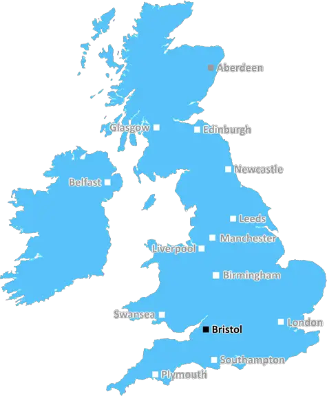
Bristol (BS20)
The BS20 postcode area is located in the Bristol postcode town region, within the county of Somerset, and contains a total of 1436 individual postcodes.
There are 18 electoral wards in the BS20 postcode area, including Axbridge, Banwell, Bristol, Cheddar, Clevedon, Wedmore, Weston-Super-Mare, Winscombe which come under the local authority of the North Somerset Council.
Combining the whole postcode region, 35% of people in BS20 are classed as having an AB social grade, (i.e. 'white-collar' middle-upper class), compared to 27% across the UK.
This does not mean that the people of BS20 are wealthier - or higher class - than average, but it can be an indication that the area may be prospering and desirable to live in.
The BS20 postcode covers the northern part of Portishead, including the neighbourhood of Easton-in-Gordano. It also includes the villages of Clapton-in-Gordano, Walton-in-Gordano and Portbury, as well as areas such as Pill and Avonmouth.
The postcode district is located in the North Somerset district of the South West region. It is in close proximity to the city of Bristol as well as the neighbouring cities of Bath, Weston-super-Mare and Wells.
This postcode district is mainly residential in nature, but also features light industry, particularly within Avonmouth. It is served by the national motorway network and is home to a busy industrial harbour.
There are also a number of popular and quite sizable green spaces in the BS20 area, such as Portishead Open Space and the Phoenix Health Walks. These green spaces provide great places for locals to enjoy exercising or just relaxing in the outdoors.
The majority of the BS20 area contains attractive residential areas that have seen a wide-scale redevelopment in recent years. This has taken the form of upmarket townhouses, social housing, and even marina developments with luxurious waterfront properties. The area also has good transport links to the nearby areas such as Clevedon, Nailsea, and nearby Bristol.
The BS20 postcode district also has a wide array of bars, restaurants, pubs, and entertainment facilities, such as The Playhouse Theatre and Pill Social Club, that can meet the requirements of any local residents or visiting guests.
Additionally, there are several good quality schools i.e. Gordano Secondary School, St Peter's Catholic College, and St Ann's Mead Primary School, that are located in the BS20 area.
The BS20 postcode is a great area for those seeking a more relaxed atmosphere with fantastic transport links and great leisure facilities. The area is highly sought after by young professionals and families alike, owing to the pleasant residential spaces, close proximity to Bristol and other surrounding areas and the various employment opportunities it provides.

Demographics

Somerset

BS20 is located in the county of Somerset, in England.
Somerset has a total population of 948,900, making it the 22nd largest county in the UK.
Somerset has a total area of 1610 square miles, and a population density of 227 people per square kilometre. For comparison, Greater London has a density of 5,618 people/km2.
| Outward Code | BS20 |
| Postal Town | Bristol |
| MSOA Name | North Somerset 004 |
| LSOA Name | North Somerset 004C |
| County | Somerset |
| Region | Somerset |
| Country | England |
| Local Authority | North Somerset |
| Area Classification | Urban with Significant Rural (rural including hub towns 26-49%) |
BS20 Electoral Wards
The postal region of BS20, includes the local towns, villages, electoral wards and stations of:
Dig even deeper into the BS20 postcode by clicking on a postcode below:
Click on an outward postal code below for more information about the area. Each 'outward' postcode give you a comprehensive list of all postcodes within the outward code area (BS) and estimated address.
Click on an 'outward' code for more information. For example, the outward postcode page 'EC2M' will give you an alphabetical list covering all postcodes located in the region, from 'EC2M 1BB' through to 'EC2M 7YA'.
Chris H
Monday, April 8, 2024
We don't have any views of BS20 right now. If you live in BS20 or have visited it, please help us to help others by telling others what you think of this neighbourhood.
Add your view of BS20
People need your local expertise. If you live in BS20 or have first-hand knowledge of the neighbourhood, please consider sharing your views. It's completely anonymous - all we ask is for your initials.
Please tell us what you like about the BS20 postcode area, what you don't like, and what it's like to live or work here.
| LOCAL AMENITIES | |
| FAMILY FRIENDLY | |
| PARKING | |
| GREEN SPACES |
Local News Gloucestershire
L1 & L2: Wins for Pompey, Derby and Carlisle; Wrexham beat Mansfield; Stockport go top
Follow live text commentary and score updates from League One and League Two.
BBC NewsLeyton Orient 3-1 Cheltenham Town
Leyton Orient find their shooting boots to inflict a League One defeat on relegation-haunted Cheltenham.
BBC NewsNo play possible at Durham & Derbyshire on day two
No play is possible at Durham against Hampshire and Derbyshire against Gloucestershire for a second straight day.
BBC NewsProtected bird dies after being shot with air rifle
Gloucestershire Police are investigating after a goshawk was killed in the Forest of Dean.
BBC NewsLeisure centre to receive 400k to improve pools
The fitting of solar panels to keep running costs down is among work that will take place.
BBC NewsCrewe Alexandra 0-3 Forest Green Rovers
Forest Green stun promotion-chasing Crewe as Jordan Garrick strikes twice in a 3-0 win.
BBC NewsViews sought over 20mph speed limit in Tetbury
Gloucestershire campaign group Tetbury 20's Plenty say that a 20mph speed limit is 'worth it'
BBC NewsRoad closed after elderly woman hit by car
A woman is being treated for serious injuries after being struck by a car in Lechlade.
BBC NewsFrom the Postcode Area blog

Deciphering Crime Rates - a Deep Dive Into UK Postcode Analysis
Ever wondered about the crime rate in your UK postcode? You're not alone. We've dug deep into the data, uncovering trends and patterns that'll make your head spin.

Death of the High Street?
The BBC reports that despite councils' attempts to kurb them, the UK's high streets have seen a huge growth in fast food outlets. Could this mark the death knell for the Great British high street, and what can we do about it to halt its decline?

Discrimination by Postcode
You really couldn't make it up, could you? Some of the country's most vulnerable people are missing out on their weekly £25 Cold Weather Payment, just because the system that's in operation is discriminating against them because payments are based on postcode, rather than geographic location.

The Redesign is Underway
Well, the current website was absolutely in dire need of a good redesign - from the ground up. So I set out to pull it all apart and get it up and running again to become the most comprehensive guide to every postcode in the UK. And it's been a long, tough job from start to finish - and quite possibly the biggest project I've ever undertaken.
SOCIAL GRADES
According to census records, 35% of people here have a social grade of AB (highest), compared to the national average of 27%.