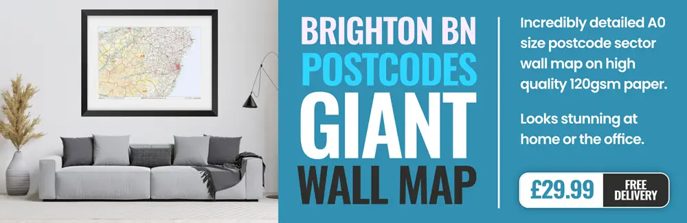
brighton BN42 Postcodes
Spending a fortune on conveyancing?

Compare instant, low-cost online quotes from trusted conveyancing solicitors.
Backed by experts, our no-obligation service searches through the best conveyancing quotes on the market to save you time and money.
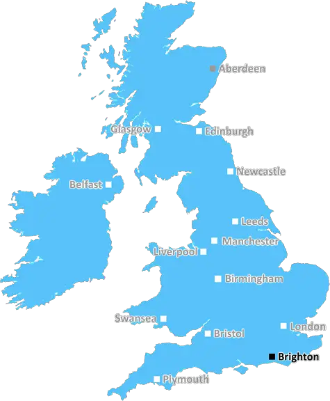
Brighton (BN42)
The BN42 postcode area is located in the Brighton postcode town region, within the county of West Sussex, and contains a total of 291 individual postcodes.
There are 5 electoral wards in the BN42 postcode area, including Arundel, Brighton, Eastbourne, Hailsham, Hassocks, Henfield, Hove, Lancing, Lewes, Littlehampton, Newhaven, Peacehaven, Pevensey, Polegate, Seaford, Shoreham-By-Sea, Steyning, Worthing which come under the local authority of the Adur Council.
Combining the whole postcode region, 18% of people in BN42 are classed as having an AB social grade, (i.e. 'white-collar' middle-upper class), compared to 27% across the UK.
This does not mean that the people of BN42 are poorer than other areas, but it may give an indication that there are areas of deprivation.
BN42 is a postcode in the city of Brighton and Hove in East Sussex, United Kingdom. It covers the city's Eastbourne Valley area, which is located at the eastern end of Brighton's main shopping area. BN42 includes Moulsecoomb, East Moulsecoomb and Bevendean neighbourhoods, which all offer good transport links and access to public services, such as health and education. As a result, BN42 is a popular area for students and young professionals.
The population of BN42 is around 4,300 and the area is highly diverse with residents from a range of backgrounds. There are plenty of things to keep residents busy, including Brighton Park, Preston Park and Witcham Park. The postcode is also home to popular amenities, such as Preston Park railway station, the University of Brighton and the University of Sussex.
Property prices in BN42 are relatively low compared to other nearby postcodes, making it a popular choice for first-time buyers and those looking for an affordable place to live. Housing stock ranges from one-bedroom flats to large detached homes and includes a number of modern developments like The Oberons, Brightwell Quay and East Brighton Village.
BN42 is well-served by public transport, with direct bus and rail links to other parts of Brighton, as well as nearby towns like Lewes, Hove and Worthing. The district is also just a stone's throw from the coast, offering an agreeable mix of urban and coastal environments. It's a great place to live, given its stunning parks, good transport and a great choice of amenities.

Demographics
West Sussex

BN42 is located in the county of West Sussex, in England.
West Sussex has a total population of 843,800, making it the 28th largest county in the UK.
West Sussex has a total area of 770 square miles, and a population density of 423 people per square kilometre. For comparison, Greater London has a density of 5,618 people/km2.
| Outward Code | BN42 |
| Postal Town | Brighton |
| MSOA Name | Adur 004 |
| LSOA Name | Adur 004A |
| County | West Sussex |
| Region | West Sussex |
| Country | England |
| Local Authority | Adur |
| Area Classification | Urban with City and Town |
BN42 Electoral Wards
The postal region of BN42, includes the local towns, villages, electoral wards and stations of:
Dig even deeper into the BN42 postcode by clicking on a postcode below:
Click on an outward postal code below for more information about the area. Each 'outward' postcode give you a comprehensive list of all postcodes within the outward code area (BN) and estimated address.
Click on an 'outward' code for more information. For example, the outward postcode page 'EC2M' will give you an alphabetical list covering all postcodes located in the region, from 'EC2M 1BB' through to 'EC2M 7YA'.
Chris H
Monday, April 8, 2024
We don't have any views of BN42 right now. If you live in BN42 or have visited it, please help us to help others by telling others what you think of this neighbourhood.
Add your view of BN42
People need your local expertise. If you live in BN42 or have first-hand knowledge of the neighbourhood, please consider sharing your views. It's completely anonymous - all we ask is for your initials.
Please tell us what you like about the BN42 postcode area, what you don't like, and what it's like to live or work here.
| LOCAL AMENITIES | |
| FAMILY FRIENDLY | |
| PARKING | |
| GREEN SPACES |
Local News Sussex
Haines ton helps Sussex hit back against Northants
Tom Haines hits 133 as Sussex reach 351-6 to all but cancel out Northants' first-innings score of 371.
BBC NewsProcter leads Northants batting effort at Sussex
Northamptonshire battle to 292-7 on the second day of their County Championship game against Sussex.
BBC NewsHardest Geezer: Runner completes Africa challenge
The extreme challenge began at South Africa's most southerly point on 22 April, 2023.
BBC NewsArsenal beat Brighton to move top of Premier League
Arsenal maintained their pursuit of a first Premier League title for 20 years as they moved top of the table with an impressive away victory over Brighton.
BBC NewsCritical incident at hospital stood down
Visiting at Chichester's St Richard's Hospital remains suspended following a norovirus outbreak.
BBC NewsFormer Brighton player Kinnear dies aged 77
Former Wimbledon and Newcastle United manager Joe Kinnear dies at the age of 77, his family announces.
BBC NewsBrighton Marathon runners cross the finish line
Three-time London Marathon winner Paula Radcliffe signalled the start of the event on Sunday.
BBC NewsTeenage driver dies after car goes into ditch
Police are appealing for witnesses to a fatal traffic incident on Wartling Road, Pevensey, on Friday.
BBC NewsFrom the Postcode Area blog

Deciphering Crime Rates - a Deep Dive Into UK Postcode Analysis
Ever wondered about the crime rate in your UK postcode? You're not alone. We've dug deep into the data, uncovering trends and patterns that'll make your head spin.

Death of the High Street?
The BBC reports that despite councils' attempts to kurb them, the UK's high streets have seen a huge growth in fast food outlets. Could this mark the death knell for the Great British high street, and what can we do about it to halt its decline?

Discrimination by Postcode
You really couldn't make it up, could you? Some of the country's most vulnerable people are missing out on their weekly £25 Cold Weather Payment, just because the system that's in operation is discriminating against them because payments are based on postcode, rather than geographic location.

The Redesign is Underway
Well, the current website was absolutely in dire need of a good redesign - from the ground up. So I set out to pull it all apart and get it up and running again to become the most comprehensive guide to every postcode in the UK. And it's been a long, tough job from start to finish - and quite possibly the biggest project I've ever undertaken.
SOCIAL GRADES
According to census records, 18% of people here have a social grade of AB (highest), compared to the national average of 27%.