brighton BN26 Postcodes
Spending a fortune on conveyancing?

Compare instant, low-cost online quotes from trusted conveyancing solicitors.
Backed by experts, our no-obligation service searches through the best conveyancing quotes on the market to save you time and money.
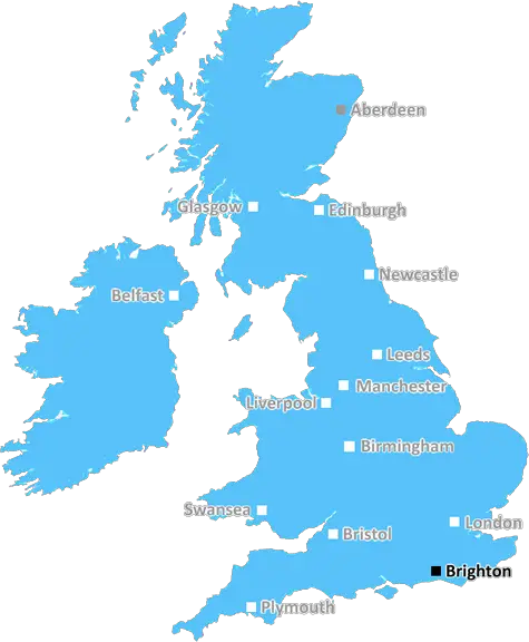
Brighton (BN26)
The BN26 postcode area is located in the Brighton postcode town region, within the county of East Sussex, and contains a total of 630 individual postcodes.
There are 32 electoral wards in the BN26 postcode area, including Arundel, Brighton, Eastbourne, Hailsham, Hassocks, Henfield, Hove, Lancing, Lewes, Littlehampton, Newhaven, Peacehaven, Pevensey, Polegate, Seaford, Shoreham-By-Sea, Steyning, Worthing which come under the local authority of the Wealden Council.
Combining the whole postcode region, 22% of people in BN26 are classed as having an AB social grade, (i.e. 'white-collar' middle-upper class), compared to 27% across the UK.
This does not mean that the people of BN26 are poorer than other areas, but it may give an indication that there are areas of deprivation.
The BN26 postcode is a six-character alphanumeric postcode for the district of East Sussex in the South East of England. It is part of the Lewes postcode area which is composed of 13 postcode districts and covers the town of Lewes and its surrounding areas.
BN26 covers an extensive area on the south side of the Ouse, including Isfield, Fletching and Chailey, and stretches out to Rodmell and Piddinghoe in the east. The area is predominantly rural, with some beautiful countryside that includes green fields, rolling hills and winding country roads.
The town of Lewes has a long history and is best known for being the county town of East Sussex and its annually celebrated bonfire night. There are quaint streets full of shops, national trusts sites, beautiful nature reserves, castles and historic architecture to explore.
BN26 postcodes have been around since 1974 and cover a part of the South Downs National Park, including towns such as Newick, Rottingdean and Barcombe. There are a few major roads running through the postcode including the A23, A26, A27 and A272.
Public transport links are provided by the railway station located in Lewes which connects to London Victoria Station, and by bus services that run to Eastbourne from numerous locations. For those who want to travel further, Gatwick Airport is a 40 minute drive away.
Education in the BN26 postcode is varied, with everything from pre-schools and voluntary aided primary schools to academies and large grammar schools in the mix. There are also a number of adult education courses and independent schools available for those seeking higher education.
The area is mainly rural, so employment opportunities are in the agricultural and tourism industries, although there are also a growing number of digital businesses located in Lewes.
BN26 postcode area covers a large portion of East Sussex with much to offer, both to those who live and to those who come to visit this picturesque part of the South East.

Demographics
East Sussex

BN26 is located in the county of East Sussex, in England.
East Sussex has a total population of 837,000, making it the 29th largest county in the UK.
East Sussex has a total area of 692 square miles, and a population density of 467 people per square kilometre. For comparison, Greater London has a density of 5,618 people/km2.
| Outward Code | BN26 |
| Postal Town | Brighton |
| MSOA Name | Wealden 019 |
| LSOA Name | Wealden 019B |
| County | East Sussex |
| Region | East Sussex |
| Country | England |
| Local Authority | Wealden |
| Area Classification | Mainly Rural (rural including hub towns >=80%) |
BN26 Electoral Wards
The postal region of BN26, includes the local towns, villages, electoral wards and stations of:
Dig even deeper into the BN26 postcode by clicking on a postcode below:
Click on an outward postal code below for more information about the area. Each 'outward' postcode give you a comprehensive list of all postcodes within the outward code area (BN) and estimated address.
Click on an 'outward' code for more information. For example, the outward postcode page 'EC2M' will give you an alphabetical list covering all postcodes located in the region, from 'EC2M 1BB' through to 'EC2M 7YA'.
Chris H
Friday, May 10, 2024
We don't have any views of BN26 right now. If you live in BN26 or have visited it, please help us to help others by telling others what you think of this neighbourhood.
Add your view of BN26
People need your local expertise. If you live in BN26 or have first-hand knowledge of the neighbourhood, please consider sharing your views. It's completely anonymous - all we ask is for your initials.
Please tell us what you like about the BN26 postcode area, what you don't like, and what it's like to live or work here.
| LOCAL AMENITIES | |
| FAMILY FRIENDLY | |
| PARKING | |
| GREEN SPACES |
Local News Sussex
Channel search stood down after debris identified
The debris came from a boat which had run aground off Seaford in April, the coastguard says.
BBC NewsGatwick Airport evacuated after fire alarm
The airport says there was no fire and the situation was resolved as quickly as possible.
BBC NewsCrawley and MK Dons' play-off game postponed
The League Two play-off semi-final first leg between Crawley Town and Milton Keynes Dons is postponed because of a waterlogged pitch.
BBC NewsGovernment planning order criticised by council
Under the order, developers can submit applications in Lewes directly to the planning inspectorate.
BBC NewsReducing amount of cricket will not help - Filby
Reducing the amount of domestic cricket will not help the sport, says Sussex chair Jon Filby.
BBC NewsPolice appeal after man injured outside bookshop
An injured man in his 30s is expected to make a full recovery, Sussex Police said.
BBC NewsImage released of biker after pedestrian killed
Sussex Police are asking anyone who recognises the motorbike or its rider pictured to come forward.
BBC NewsVeteran rider writes her horse into will
Jacky Chandler became the oldest person to qualify for the World Championships for Team GB in 2014.
BBC NewsFrom the Postcode Area blog

Deciphering Crime Rates - a Deep Dive Into UK Postcode Analysis
Ever wondered about the crime rate in your UK postcode? You're not alone. We've dug deep into the data, uncovering trends and patterns that'll make your head spin.

Death of the High Street?
The BBC reports that despite councils' attempts to kurb them, the UK's high streets have seen a huge growth in fast food outlets. Could this mark the death knell for the Great British high street, and what can we do about it to halt its decline?

Discrimination by Postcode
You really couldn't make it up, could you? Some of the country's most vulnerable people are missing out on their weekly £25 Cold Weather Payment, just because the system that's in operation is discriminating against them because payments are based on postcode, rather than geographic location.

The Redesign is Underway
Well, the current website was absolutely in dire need of a good redesign - from the ground up. So I set out to pull it all apart and get it up and running again to become the most comprehensive guide to every postcode in the UK. And it's been a long, tough job from start to finish - and quite possibly the biggest project I've ever undertaken.
SOCIAL GRADES
According to census records, 22% of people here have a social grade of AB (highest), compared to the national average of 27%.