brighton BN18 Postcodes
Spending a fortune on conveyancing?

Compare instant, low-cost online quotes from trusted conveyancing solicitors.
Backed by experts, our no-obligation service searches through the best conveyancing quotes on the market to save you time and money.
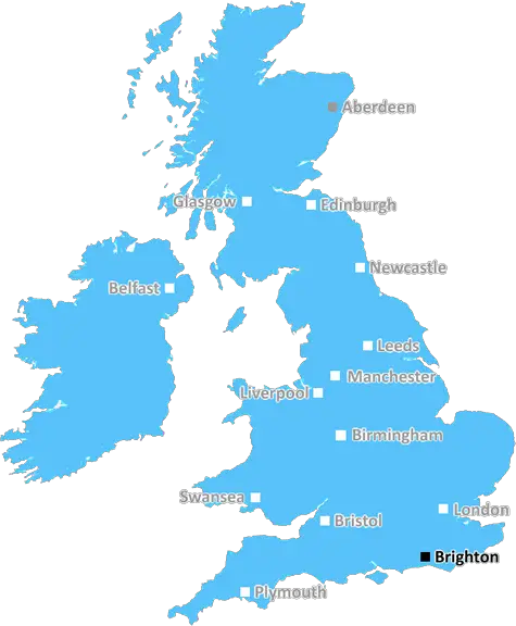
Brighton (BN18)
The BN18 postcode area is located in the Brighton postcode town region, within the county of West Sussex, and contains a total of 651 individual postcodes.
There are 38 electoral wards in the BN18 postcode area, including Arundel, Brighton, Eastbourne, Hailsham, Hassocks, Henfield, Hove, Lancing, Lewes, Littlehampton, Newhaven, Peacehaven, Pevensey, Polegate, Seaford, Shoreham-By-Sea, Steyning, Worthing which come under the local authority of the Arun Council.
Combining the whole postcode region, 28% of people in BN18 are classed as having an AB social grade, (i.e. 'white-collar' middle-upper class), compared to 27% across the UK.
This does not mean that the people of BN18 are wealthier - or higher class - than average, but it can be an indication that the area may be prospering and desirable to live in.
BN18 is a postcode district located in the city of Brighton and Hove in the south of England. It covers the west of the city and includes Shoreham-by-Sea, Southwick and Portslade. Its population is primarily white, but also includes significant Black and Asian minorities.
BN18 serves as an important transport hub in the city, with Brighton station within its boundaries, along with the A259,A27 and the A2038. It is also home to large employers such as Harbour Lights, Park Resorts, Stagecoach, Southern Water and the South Downs National Park Authority.
The areas around BN18 are mainly residential, with residents taking advantage of the many green spaces in the area and nearby access to the beach. Portslade Academy, Southwick Community College and a selection of primary and secondary schools are located within the postcode district. There are also plenty of shops and restaurants in the area and Portslade Village provides a lively atmosphere on the weekends.
BN18 is a popular destination for both locals and visitors, as it offers plenty of attractions. Shoreham Beach is just minutes away, and residents can take advantage of the other local beaches such as Saltdean and Rottingdean. Breeze Brighton is a family theme park located in the district, and Gulliver's Land is a short drive away. Visitors can also explore the adjacent South Downs National Park or take part in a variety of leisure activities.
For those looking for a quiet evening out, there are plenty of pubs, bars and restaurants to choose from. Some pubs offer traditional events such as quizzes and comedy nights, while the numerous local eateries cater for all tastes. For those wishing to explore further afield, there are regular bus and rail services available, with direct access to Brighton and London.
Whether residents or visitors, BN18 has something to offer everyone. With its many attractions, transport links and opportunities for leisure and entertainment, it is no surprise that this area of Brighton and Hove remains so popular.

Demographics
West Sussex

BN18 is located in the county of West Sussex, in England.
West Sussex has a total population of 843,800, making it the 28th largest county in the UK.
West Sussex has a total area of 770 square miles, and a population density of 423 people per square kilometre. For comparison, Greater London has a density of 5,618 people/km2.
| Outward Code | BN18 |
| Postal Town | Brighton |
| MSOA Name | Arun 001 |
| LSOA Name | Arun 001A |
| County | West Sussex |
| Region | West Sussex |
| Country | England |
| Local Authority | Arun |
| Area Classification | Urban with City and Town |
BN18 Electoral Wards
The postal region of BN18, includes the local towns, villages, electoral wards and stations of:
Dig even deeper into the BN18 postcode by clicking on a postcode below:
Click on an outward postal code below for more information about the area. Each 'outward' postcode give you a comprehensive list of all postcodes within the outward code area (BN) and estimated address.
Click on an 'outward' code for more information. For example, the outward postcode page 'EC2M' will give you an alphabetical list covering all postcodes located in the region, from 'EC2M 1BB' through to 'EC2M 7YA'.
Chris H
Wednesday, April 10, 2024
We don't have any views of BN18 right now. If you live in BN18 or have visited it, please help us to help others by telling others what you think of this neighbourhood.
Add your view of BN18
People need your local expertise. If you live in BN18 or have first-hand knowledge of the neighbourhood, please consider sharing your views. It's completely anonymous - all we ask is for your initials.
Please tell us what you like about the BN18 postcode area, what you don't like, and what it's like to live or work here.
| LOCAL AMENITIES | |
| FAMILY FRIENDLY | |
| PARKING | |
| GREEN SPACES |
Local News Sussex
Artist to release charity song following diagnosis
Lukas Villemann-Brabant is living with cardiomyopathy and a pacemaker despite being 25 years old.
BBC NewsHardest Geezer eyes next challenge after Africa run
Russ Cook says it is "hard to contemplate the whole thing" after completing the mammoth challenge.
BBC NewsBusinessman launches fully recyclable crisp packet
Tom Lock, from East Grinstead, says the crisp packet is the first fully recyclable crisp packet.
BBC NewsArsenal beat Brighton to move top of Premier League
Arsenal maintained their pursuit of a first Premier League title for 20 years as they moved top of the table with an impressive away victory over Brighton.
BBC NewsFlood warnings and travel delays as high tides hit
Exceptionally high tides combined with strong winds cause problems in parts of the UK.
BBC NewsWrexham edge closer to promotion with Crawley win
Wrexham move a step closer to securing promotion to League One with an impressive victory over Crawley Town.
BBC NewsChalk cliff collapses on to beach in East Sussex
The cliff fall between Saltdean and Telscombe comes after the authorities warned people to stay safe.
BBC NewsSexual harassment of NHS staff widespread - survey
A study was carried out of more than 12,200 health workers.
BBC NewsFrom the Postcode Area blog

Deciphering Crime Rates - a Deep Dive Into UK Postcode Analysis
Ever wondered about the crime rate in your UK postcode? You're not alone. We've dug deep into the data, uncovering trends and patterns that'll make your head spin.

Death of the High Street?
The BBC reports that despite councils' attempts to kurb them, the UK's high streets have seen a huge growth in fast food outlets. Could this mark the death knell for the Great British high street, and what can we do about it to halt its decline?

Discrimination by Postcode
You really couldn't make it up, could you? Some of the country's most vulnerable people are missing out on their weekly £25 Cold Weather Payment, just because the system that's in operation is discriminating against them because payments are based on postcode, rather than geographic location.

The Redesign is Underway
Well, the current website was absolutely in dire need of a good redesign - from the ground up. So I set out to pull it all apart and get it up and running again to become the most comprehensive guide to every postcode in the UK. And it's been a long, tough job from start to finish - and quite possibly the biggest project I've ever undertaken.
SOCIAL GRADES
According to census records, 28% of people here have a social grade of AB (highest), compared to the national average of 27%.